
Battlefields & battle sites · Mid Wales
Penparc
In or near Aberporth.
Penparc in Wales Mid, United Kingdom.

Roger W Haworth — CC BY-SA 2.0 via Wikimedia Commons licence

Plan your visit
- Typical visit
- 1 h–2 h
- Free entry
- Dog-friendly
About
Penparc is a place of interest in Wales Mid, United Kingdom — drawn from open-data sources for visitor reference. See the linked Wikipedia article for the full description.
Photo gallery
Heritage listing
http://cadwpublic-api.azurewebsites.net/reports/listedbuilding/FullReport?lang=en&id=13109
From Cadw under OGL v3.
From the Wikipedia article
Penparc (also known as Penyparc) is a village in Ceredigion, Wales, on the A487 road 3 miles (4.8 km) northeast of Cardigan. The surrounding land is principally used for cattle grazing although the significant glacial sand deposits are also commercially used as a source of sand and gravel. To the east of the village, near a prominent conical hill, is the site of the Battle of Crug Mawr, fought in 1136.
Excerpt from Wikipedia under CC BY-SA 4.0. See the source article linked in Sources below.
- Coordinates
- 52.1019, -4.6125
- District
- Ceredigion
- Parish
- Y Ferwig
- Postcode
- SA43 1SE
- Parliamentary constituency
- Ceredigion Preseli
Sources
Other places nearby

Brongwyn Touring and Camping Park
Campsites · 0.7 km

Banc-y-Warren
Other places · 0.9 km

Crugllwyn Camp
Vineyards · 1.0 km

Banc y Mwldan
Other places · 1.5 km

Cardigan Caravan and Camping Site
Caravan parks · 1.9 km

Treforgan
Farms (open to visitors) · 2.3 km

Tynewydd
Other places · 2.3 km

Pen-rhiw
Other places · 2.3 km

Tremain
Villages · 2.4 km

Mount Pleasant
Mountains & hills · 2.4 km
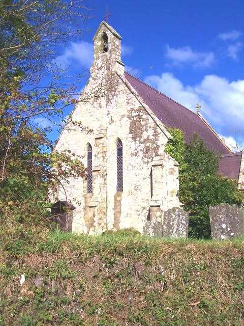
St Michael's Church, Tremain
Historic churches · 2.4 km
Church Of St Cynllo, Llangoedmor
Historic churches · 2.6 km
Nearby
📷 5Campsites · Mid Wales
Brongwyn Touring and Camping Park
Brongwyn Touring and Camping Park — a campsite in wales mid.
📷 4Vineyards · Mid Wales
Crugllwyn Camp
Crugllwyn Camp — a UK vineyard in wales mid, producing English or Welsh wine from cool-climate grape varieties.
📷 2📷 5Caravan parks · Mid Wales
Cardigan Caravan and Camping Site
Cardigan Caravan and Camping Site — a caravan park in wales mid.
📷 3Where to eat & stay near Penparc
Places to stay
📷 5Campsites · Mid Wales
Brongwyn Touring and Camping Park
Brongwyn Touring and Camping Park — a campsite in wales mid.
📷 5Caravan parks · Mid Wales
Cardigan Caravan and Camping Site
Cardigan Caravan and Camping Site — a caravan park in wales mid.
 📷 5
📷 5 📷 2
📷 2 📷 5
📷 5 📷 5
📷 5Places to eat & drink
 📷 3
📷 3Historic pubs · Mid Wales
Bar 45
Bar 45 — Historic pub — listed building or notable heritage status.
 📷 5
📷 5Historic pubs · Mid Wales
The Grosvenor
The Grosvenor — Historic pub — listed building or notable heritage status.
 📷 5
📷 5Restaurants · Mid Wales
Fusion Bar and Restaurant
Fusion Bar and Restaurant — a restaurant in wales mid.
 📷 5
📷 5 📷 4
📷 4Historic pubs · Mid Wales
Cardiff Arms
Cardiff Arms — Historic pub — listed building or notable heritage status.
 📷 3
📷 3Historic pubs · Mid Wales
The Pendre Inn
The Pendre Inn — Historic pub — listed building or notable heritage status.
More places in this region
 📷 3
📷 3 📷 3
📷 3Battlefields & battle sites · Mid Wales
Presteigne Forest
Presteigne Forest in Wales Mid, United Kingdom.
 📷 3
📷 3Battlefields & battle sites · Mid Wales
Glyn Cothi Forest
Glyn Cothi Forest in Wales Mid, United Kingdom.
 📷 4
📷 4Frequently asked questions
- Where is Penparc?
- Penparc is in Mid Wales, United Kingdom (postcode SA43 1SE), in the parish of Y Ferwig.
- What is Penparc?
- Penparc in Wales Mid, United Kingdom.
- How do I get to Penparc?
- Drivers can use postcode SA43 1SE.
- Is Penparc a listed building?
- Penparc is officially recognised as II listed.
- Is Penparc free to visit?
- Yes, Penparc is free to enter.
- How do I get to Penparc?
- Drivers can navigate to postcode SA43 1SE. It sits within the Ceredigion Preseli parliamentary constituency.