
Natural landmarks · Northern Ireland
Pearse Óg GAC
In or near Armagh.
Pearse Óg GAC in Northern Ireland, United Kingdom.

P Flannagan — CC BY-SA 2.0 via Wikimedia Commons licence

Plan your visit
- Typical visit
- 1 h–2 h
- Free entry
- Dog-friendly
About
Pearse Óg GAC is a place of interest in Northern Ireland, United Kingdom — drawn from open-data sources for visitor reference. See the linked Wikipedia article for the full description.
Photo gallery
From the Wikipedia article
Pearse Óg Gaelic Athletic Club (Irish: Na Piarsaigh Óga) is a Gaelic Athletic Association club in County Armagh, Northern Ireland. 'Na Piarsaigh Óga', which translates as 'the Young Pearses', takes its name from the Irish revolutionaries Pádraic and Willie Pearse. The club's crest includes a sword in flames, a symbol associated with Pádraic Pearse since his editorship of the nationalist newspaper An Claidheamh Soluis, surrounded by the green and gold club colours and a skyline of Armagh city.
Excerpt from Wikipedia under CC BY-SA 4.0. See the source article linked in Sources below.
Background
History
The club was formed in 1950 as a result of the popular street leagues that were running at the time. The founder members met in Dougan's Loft, Navan Street, Armagh. They included Charlie McQuade, Felix McStravick, Sam Johnson, Gene McStravick, Eugene McKenna, Gerry Cush and the legendary Ulster footballer Big Jim McCullagh, who became the Pearse Ógs' inaugural chairman. The club's name was suggested by Seamy Trainor. Their home ground for many years was the Athletic Grounds at Drumarg in the west of the city. Pearse Óg won their first Armagh Senior Football Championship title in 1985 defeating local rivals Armagh Harps in the final. The backbone of this team was formed by players who had…
Sourced from Wikipedia under CC BY-SA 4.0.
- Coordinates
- 54.3521, -6.6775
- Postcode
- BT60 4BX
- Parliamentary constituency
- Newry and Armagh
- Established
- 1950
Sources
- wikidata: Q7158299 (CC0)
- wikipedia: Pearse Óg GAC (CC BY-SA 4.0)
Other places nearby

St Catherine's College Armagh
Historic churches · 0.9 km

St Patrick's Cathedral
Cathedrals · 1.1 km

Armagh Harps GFC
Natural landmarks · 1.3 km

Patrick McGee
Memorials & monuments · 1.4 km
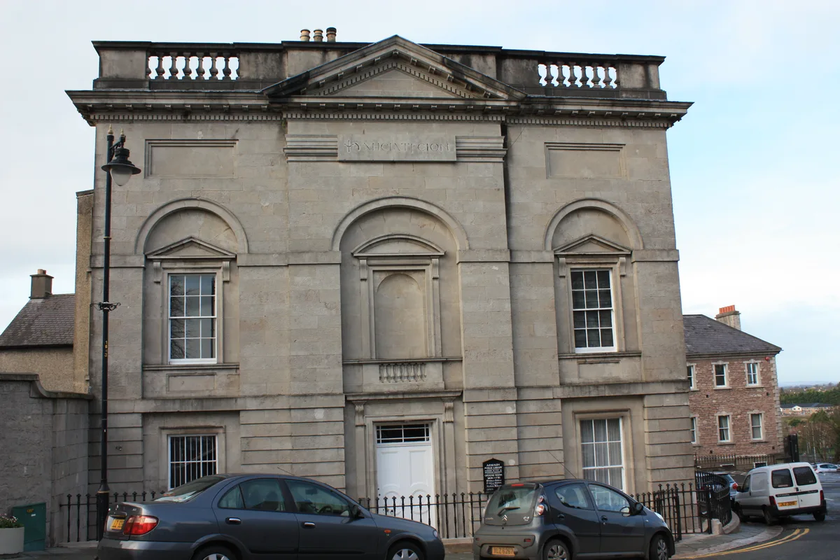
Armagh Robinson Library
Museums · 1.4 km

No 5 Vicars' Hill
Museums · 1.4 km

Armagh railway station
Natural landmarks · 1.4 km

Irish Street Halt railway station
Natural landmarks · 1.4 km

Athletic Grounds
Stadiums · 1.4 km

Tandragee Idol
Public art & sculpture · 1.4 km

St Patrick's Cathedral, Armagh
Cathedrals · 1.5 km
Armagh City and District Council
Natural landmarks · 1.5 km
Nearby
📷 3Historic churches · Northern Ireland
St Catherine's College Armagh
St Catherine's College Armagh in Northern Ireland, United Kingdom.
Flagship📷 5Cathedrals · Northern Ireland
St Patrick's Cathedral
St Patrick's Cathedral in Northern Ireland, United Kingdom.
📷 3Natural landmarks · Northern Ireland
Armagh Harps GFC
Armagh Harps GFC in Northern Ireland, United Kingdom.
📷 3Memorials & monuments · Northern Ireland
Patrick McGee
Patrick McGee — a memorial in northern-ireland, United Kingdom.
📷 3Museums · Northern Ireland
Armagh Robinson Library
Armagh Robinson Library — library building in Armagh, County Armagh, Northern Ireland.
📷 3Museums · Northern Ireland
No 5 Vicars' Hill
No 5 Vicars' Hill — a museum in northern-ireland, United Kingdom.
Where to eat & stay near Pearse Óg GAC
Places to stay
 📷 5
📷 5 📷 5
📷 5 📷 4
📷 4Caravan parks · Northern Ireland
Clare Glen Caravan Park
Clare Glen Caravan Park — a caravan park in northern ireland.
 📷 5
📷 5Caravan parks · Northern Ireland
Dungannon Park Caravan & Camping
Dungannon Park Caravan & Camping — a caravan park in northern ireland.
 📷 5
📷 5Caravan parks · Northern Ireland
Dungannon Park Caravan & Camping
Dungannon Park Caravan & Camping — a caravan park in northern ireland.
Places to eat & drink
 📷 5
📷 5More natural landmarks in this region
 Flagship📷 4
Natural landmarks · Northern Ireland
Lough Erne
Lough Erne — lake in County Fermanagh, Northern Ireland, UK.
 Flagship📷 4
Natural landmarks · Northern Ireland
Lough Neagh
Lough Neagh — large lake in Northern Ireland.
 📷 3
📷 3Natural landmarks · Northern Ireland
Ballysaggart Lough
Ballysaggart Lough — lake in the United Kingdom.
 📷 5
📷 5Natural landmarks · Northern Ireland
Belmore Mountain
Belmore Mountain — mountain in the United Kingdom.
Frequently asked questions
- Where is Pearse Óg GAC?
- Pearse Óg GAC is in Northern Ireland, United Kingdom (postcode BT60 4BX).
- What is Pearse Óg GAC?
- Pearse Óg GAC in Northern Ireland, United Kingdom.
- How do I get to Pearse Óg GAC?
- Drivers can use postcode BT60 4BX.
- When was Pearse Óg GAC built?
- Built or established in 1950.
- Is Pearse Óg GAC free to visit?
- Yes, Pearse Óg GAC is free to enter.
- How do I get to Pearse Óg GAC?
- Drivers can navigate to postcode BT60 4BX. It sits within the Newry and Armagh parliamentary constituency.