Historic houses · Central Scotland
Path House (Pathhead Medical Centre), 3-9 Nether Street, Kirkcaldy
In or near Pathhead.
Path House (Pathhead Medical Centre), 3-9 Nether Street, Kirkcaldy in Scotland Islands, United Kingdom.

Graeme Yuill — CC BY-SA 2.0 via Wikimedia Commons licence
Plan your visit
- Typical visit
- 1 h–2 h
- Nearest railway station
- Kirkcaldy · 1.5 km
- Family-friendly
- Limited wheelchair access
About
Path House (Pathhead Medical Centre), 3-9 Nether Street, Kirkcaldy is a place of interest in Scotland Islands, United Kingdom — drawn from open-data sources for visitor reference. See the linked Wikipedia article for the full description.
Photo gallery
See it from the streetimagery from 2019
Imagery © Mapillary contributors, CC BY-SA 4.0
From the Wikipedia article
Path House, formerly known as Dunnikier House, is a manor house in the Scottish town of Kirkcaldy in the Fife Council Area. It was listed by Historic Environment Scotland in 1971 as a Category A listed building.
Excerpt from Wikipedia under CC BY-SA 4.0. See the source article linked in Sources below.
Background
History
The mansion, located on Nether Street (A921) near Kirkcaldy Harbour, was built in 1692 by John Watson after his marriage to Euphan Orrock, as confirmed by the monograms "IW" and "EO" displayed at various locations on the house. After just a few years, it was transferred to the Oswald family who remodelled it in the early 18th century, when the rear wings may have been added. As the town of Kirkcaldy spread ever nearer to the mansion, the Oswalds decided in the 1790s to build and move to a new house, also called Dunnikier House, further away from the town. In 1891, the old house was renovated and converted into the rectory of the local parish church. In 1979 the house was acquired by the…
Description
The three-story building, plastered with harl between natural stone borders, originally had an L-shaped floor plan. The front facade is largely symmetrical with a frieze below a simple cornice. In the interior corner of the south-facing main façade is an engaged round stair tower with a conical roof and weather vane. Next to the tower is the main entrance. Monograms decorate the dormer windows gableheads. The roofs are made of grey slate.
Sourced from Wikipedia under CC BY-SA 4.0.
- Coordinates
- 56.1195, -3.1477
- District
- Fife
- Postcode
- KY1 2PG
- Parliamentary constituency
- Cowdenbeath and Kirkcaldy
- Nearest railway station
- Kirkcaldy — 1.5 km
Sources
- wikidata: Q17572161 (CC0)
- wikipedia: Path House, Kirkcaldy (CC BY-SA 4.0)
Other places nearby
Pathhead Evangelical Union Congregational Church, Pathhead Court, Kirkcaldy
Historic churches · 0.1 km

Pathhead
Towns & cities · 0.2 km

Feuars Arms, 66-68 Commercial Street, Kirkcaldy
Historic pubs · 0.2 km

East Bridge, East Bridge Flour Mills, The Path, Kirkcaldy
Historic bridges · 0.3 km
Ravenscraig Castle
Castles · 0.4 km

Pathhead Sands
Beaches · 0.4 km

461 and 463 High Street, Kirkcaldy
Historic pubs · 0.5 km

Pathhead Parish Church, Church Street, Kirkcaldy
Historic churches · 0.5 km

Melville Brodie Engineering Memorial
Memorials & monuments · 0.5 km
Kirkcaldy Harbour
Marinas · 0.6 km

Sinclairtown railway station
Heritage railway stations · 0.6 km

The Royal Scot, 395-399 High Street, Kirkcaldy
Historic pubs · 0.6 km
Nearby
📷 5Historic churches · Central Scotland
Pathhead Evangelical Union Congregational Church, Pathhead Court, Kirkcaldy
Pathhead Evangelical Union Congregational Church, Pathhead Court, Kirkcaldy — category C listed building-listed church in scotland-central, United Kingdom.
📷 5📷 5Historic pubs · Central Scotland
Feuars Arms, 66-68 Commercial Street, Kirkcaldy
Feuars Arms, 66-68 Commercial Street, Kirkcaldy in Scotland Central, United Kingdom.
📷 5Historic bridges · Central Scotland
East Bridge, East Bridge Flour Mills, The Path, Kirkcaldy
East Bridge, East Bridge Flour Mills, The Path, Kirkcaldy — category B listed building-listed bridge in scotland-central, United Kingdom.
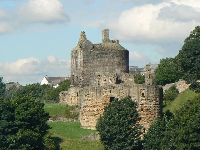
📷 3Castles · Central Scotland
Ravenscraig Castle
Ravenscraig Castle — castle in Fife, Scotland, UK.
📷 3Where to eat & stay near Path House (Pathhead Medical Centre), 3-9 Nether Street, Kirkcaldy
Places to stay
 📷 7
📷 7 📷 5
📷 5Hotels · Central Scotland
Oswald House Hotel
Oswald House Hotel — a hotel in scotland central.
 📷 5
📷 5Caravan parks · Central Scotland
North Lodge Holiday Park
North Lodge Holiday Park — a caravan park in scotland central.
 📷 5
📷 5Caravan parks · Central Scotland
Kinghorn Harbour Holiday Park
Kinghorn Harbour Holiday Park — a caravan park in scotland central.
 📷 5
📷 5Caravan parks · Central Scotland
Sandhills Caravan Park
Sandhills Caravan Park — a caravan park in scotland central.
 📷 5
📷 5Caravan parks · Central Scotland
Pettycur Bay Holiday Park
Pettycur Bay Holiday Park — a caravan park in scotland central.
Places to eat & drink
📷 5Historic pubs · Central Scotland
Feuars Arms, 66-68 Commercial Street, Kirkcaldy
Feuars Arms, 66-68 Commercial Street, Kirkcaldy in Scotland Central, United Kingdom.
📷 7Historic pubs · Central Scotland
461 and 463 High Street, Kirkcaldy
461 and 463 High Street, Kirkcaldy in Scotland Central, United Kingdom.
📷 7Historic pubs · Central Scotland
The Royal Scot, 395-399 High Street, Kirkcaldy
The Royal Scot, 395-399 High Street, Kirkcaldy in Scotland Central, United Kingdom.
 📷 5
📷 5Historic pubs · Central Scotland
The Robert Nairn
The Robert Nairn in Scotland Central, United Kingdom.
 📷 7
📷 7Historic pubs · Central Scotland
Belvedere Hotel, West Wemyss
Belvedere Hotel, West Wemyss in Scotland Central, United Kingdom.
 📷 5
📷 5Historic pubs · Central Scotland
Coaltown of Balgonie
Coaltown of Balgonie in Scotland Islands, United Kingdom.
More historic houses in this region

 📷 4
📷 4Historic houses · Central Scotland
Nisbet House
Nisbet House in England North East, United Kingdom.
 📷 5
📷 5Historic houses · Central Scotland
Buxley
Buxley in England North East, United Kingdom.
 📷 4
📷 4Frequently asked questions
- Where is Path House (Pathhead Medical Centre), 3-9 Nether Street, Kirkcaldy?
- Path House (Pathhead Medical Centre), 3-9 Nether Street, Kirkcaldy is in the Scottish Highlands, United Kingdom (postcode KY1 2PG).
- What is Path House (Pathhead Medical Centre), 3-9 Nether Street, Kirkcaldy?
- Path House (Pathhead Medical Centre), 3-9 Nether Street, Kirkcaldy in Scotland Islands, United Kingdom.
- How do I get to Path House (Pathhead Medical Centre), 3-9 Nether Street, Kirkcaldy?
- The nearest railway station is Kirkcaldy, about 1.5 km away. Drivers can use postcode KY1 2PG.
- How do I get to Path House (Pathhead Medical Centre), 3-9 Nether Street, Kirkcaldy?
- The nearest railway station is Kirkcaldy, about 1.5 km away. Drivers can navigate to postcode KY1 2PG.