
Stadiums · Mid Wales
Park Avenue
Also known as: Coedlan y Parc
Park Avenue — stadium in Aberystwyth, Wales.

Wikimedia Commons contributors — see linked file page for photographer and licence licence

Plan your visit
- Typical visit
- 1.5 h–3 h
- Nearest railway station
- Vale of Rheidol · 0.2 km
About
Park Avenue is a stadium in the United Kingdom. Records date its origin to 1907. Owned by Ceredigion County Council. Wikidata describes it as: "stadium in Aberystwyth, Wales". Coordinates: 52.4104°, -4.0807°.
Photo gallery
From the Wikipedia article
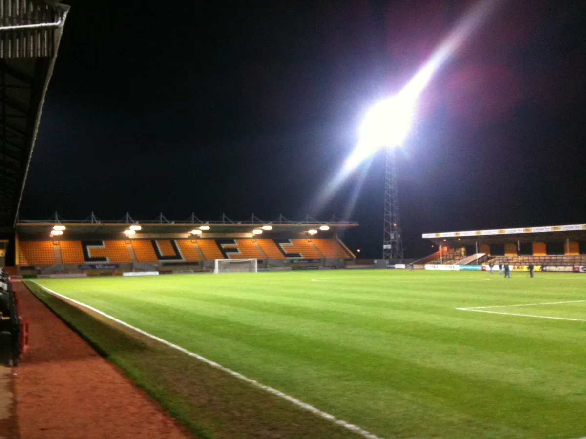
Park Avenue (Welsh: Coedlan y Parc) currently called Aberystwyth University Stadium for sponsorship purposes, is a football stadium in Aberystwyth, Wales and has served as the home of Cymru Premier side Aberystwyth Town since 1907. The stadium capacity is 5,000 with 1,500 seats. It is a 4G artificial turf pitch. In May 2021, the ground was designated UEFA Category 2 status after successful inspection by Standards Officer Scott Struthers. The ground is adjacent to the River Rheidol and close to the shore of Cardigan Bay. The ground has a bar, named after John Charles, who played in the Wales national football team.
Excerpt from Wikipedia under CC BY-SA 4.0. See the source article linked in Sources below.
Background
History
The ground has hosted the final of the Welsh League Cup on eleven occasions. The club renamed the hospitality room the 'Lolfa Emyr James' (Emyr James Suite) after a board member who died in August 2018. George Best played for the Northern Ireland Youth Team here four days before his seventeenth birthday on 18 May 1963.
Architecture
The ground has five areas: the Railway End, named after the former Carmarthen to Aberystwyth Line; the Dias Stand after a former Green Legend; the Rhun Owens Stand after a former secretary; the Shed End and the Narks Corner.
Sourced from Wikipedia under CC BY-SA 4.0.
- Coordinates
- 52.4104, -4.0807
- District
- Ceredigion
- Parish
- Aberystwyth
- Postcode
- SY23 1PG
- Parliamentary constituency
- Ceredigion Preseli
- Phone
- +44 1970 625 819
- Established
- 1907
- Nearest railway station
- Vale of Rheidol — 0.2 km
Sources
- wikidata: Q7137610 (CC0)
- wikipedia: Park Avenue, Aberystwyth (CC BY-SA 4.0)
- commons: Park Avenue - geograph-285516.jpg (CC BY-SA 4.0)
Other places nearby
Loading nearby places…
Nearby
 📷 3
📷 3Other places · Mid Wales
Aberystwyth power station
Aberystwyth power station in Wales Mid, United Kingdom.
 📷 5
📷 5Historic bridges · Mid Wales
Trefechan Bridge
Trefechan Bridge — Grade II listed building-listed bridge in wales-mid, United Kingdom.
 📷 3
📷 3Other places · Mid Wales
Aberystwyth Rheidol
Aberystwyth Rheidol in Wales Mid, United Kingdom.
 📷 5
📷 5Caravan parks · Mid Wales
Aberystwyth Holiday Village
Aberystwyth Holiday Village — a caravan park in wales mid.
📷 3Public art & sculpture · Mid Wales
War Memorial at Tabernacle Chapel,Powell St.
War Memorial at Tabernacle Chapel,Powell St. in Wales Mid, United Kingdom.
 📷 5
📷 5Literary houses · Mid Wales
Rheidol Castle
Rheidol Castle — a literary house museum in wales mid.
Other places from this era
 📷 5
📷 5Stadiums · London
Abbey Stadium
Abbey Stadium — homeground for Cambridge United F.C.
.jpg?width=1200) 📷 5
📷 5Stadiums · London
Bobby Moore statue
Bobby Moore statue — Public artwork (statue).
 📷 5
📷 5Stadiums · London
Brentford Community Stadium
Brentford Community Stadium — stadium in London, England.
 📷 5
📷 5Stadiums · London
Gallagher Stadium
Gallagher Stadium — Football stadium in Kent, England.
More places in this region
 📷 3
📷 3Stadiums · Mid Wales
Latham Park
Latham Park — Stadium in Newtown, Wales.
 📷 3
📷 3Stadiums · Mid Wales
Recreation Ground
Recreation Ground — stadium in Caersws, Wales, UK.
 📷 4
📷 4Stadiums · Mid Wales
Penparcau F.C.
Penparcau F.C. in Wales Mid, United Kingdom.
 📷 3
📷 3Stadiums · Mid Wales
Bow Street F.C.
Bow Street F.C. in Wales Mid, United Kingdom.
Frequently asked questions
- Where is Park Avenue?
- Park Avenue is in Mid Wales, United Kingdom (postcode SY23 1PG), in the parish of Aberystwyth.
- What is Park Avenue?
- Park Avenue — stadium in Aberystwyth, Wales.
- How do I get to Park Avenue?
- The nearest railway station is Vale of Rheidol, about 0.2 km away. Drivers can use postcode SY23 1PG.
- When was Park Avenue built?
- Built or established in 1907.
- Who owns Park Avenue?
- Park Avenue is owned by Ceredigion County Council.
- How do I get to Park Avenue?
- The nearest railway station is Vale of Rheidol, about 0.2 km away. Drivers can navigate to postcode SY23 1PG.