
Historic churches · North Wales
Pant Glas
In or near Dolbenmaen.
Pant Glas (Welsh for 'green hollow'; as in other Celtic languages, "glas" may mean both 'green' and 'blue') is a hamlet on the A487 road in Gwynedd, Wales, in the community of Clynnog. Historically in

Eric Jones — CC BY-SA 2.0 via Wikimedia Commons licence

Plan your visit
- Typical visit
- 30 min–1 h
- Nearest railway station
- Criccieth · 9.6 km
- Free entry
Getting there & planning your visit
To visit Pant Glas, the nearest railway station is Criccieth, located 9.6 km away. The postcode for the church is LL51 9DJ, which can be used for sat-nav directions. Entry to the church is free.
About
Pant Glas (Welsh for 'green hollow'; as in other Celtic languages, "glas" may mean both 'green' and 'blue') is a hamlet on the A487 road in Gwynedd, Wales, in the community of Clynnog. Historically in Caernarfonshire, it is located approximately 10 miles (16 km) south of Caernarfon, 9 miles (14 km) north-west of Porthmadog, and 10 miles (16 km) north-east of Pwllheli. Nearby is the former Pant Glas railway station on the closed Carnarvonshire Railway. The station closed in January 1957. The railway closed in 1964 and has since been replaced with the Lôn Eifion cycle track. Also nearby is the Arfon transmitting station, the tallest structure in Wales. Welsh opera singer Sir Bryn Terfel was brought up at Fferm Nant Cyll Ucha, located just outside the hamlet. In February 2005, the speed limit for the A487 in Pant Glas was reduced from 50 mph (80 km/h) to 40 mph (64 km/h).
Photo gallery
Heritage listing
http://cadwpublic-api.azurewebsites.net/reports/listedbuilding/FullReport?lang=en&id=25709
From Cadw under OGL v3.
From the Wikipedia article
Pant Glas (Welsh for 'green hollow'; as in other Celtic languages, "glas" may mean both 'green' and 'blue') is a hamlet on the A487 road in Gwynedd, Wales, in the community of Clynnog. Historically in Caernarfonshire, it is located approximately 10 miles (16 km) south of Caernarfon, 9 miles (14 km) north-west of Porthmadog, and 10 miles (16 km) north-east of Pwllheli. Nearby is the former Pant Glas railway station on the closed Carnarvonshire Railway. The station closed in January 1957. The railway closed in 1964 and has since been replaced with the Lôn Eifion cycle track. Also nearby is the Arfon transmitting station, the tallest structure in Wales. Welsh opera singer Sir Bryn Terfel was brought up at Fferm Nant Cyll Ucha, located just outside the hamlet. In February 2005, the speed limit for the A487 in Pant Glas was reduced from 50 mph (80 km/h) to 40 mph (64 km/h).
Excerpt from Wikipedia under CC BY-SA 4.0. See the source article linked in Sources below.
- Coordinates
- 53.0010, -4.2780
- District
- Gwynedd
- Parish
- Clynnog
- Postcode
- LL51 9DJ
- Parliamentary constituency
- Dwyfor Meirionnydd
- Nearest railway station
- Criccieth — 9.6 km
Sources
- wikipedia: Pant Glas (CC BY-SA 4.0)
Other places nearby

Pant Glas Roman Marching Camp
Archaeological sites · 0.6 km

Y Foel
Mountains & hills · 0.9 km

Gwarchodfa Natur Genedlaethol Cors Gyfelog
Forests & woodlands · 1.2 km

Bwlch-derwin
Historic churches · 1.4 km

Derwin Bach Roman Marching Camp
Archaeological sites · 2.0 km

Pen Llystyn Roman Fort
Archaeological sites · 2.5 km

Pen Llystyn Roman Fort
Archaeological sites · 2.5 km

Mynydd Cennin
Mountains & hills · 2.7 km

Nantlle Valley
Historic churches · 2.7 km
Mynydd Cennin
Mountains & hills · 2.7 km
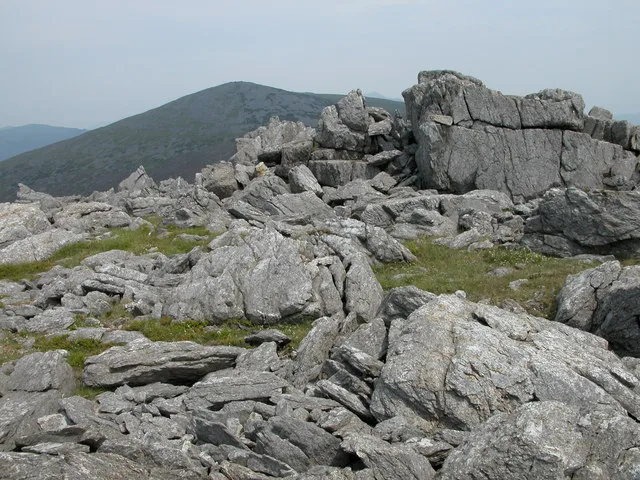
Mynydd Graig Goch
Mountains & hills · 2.8 km
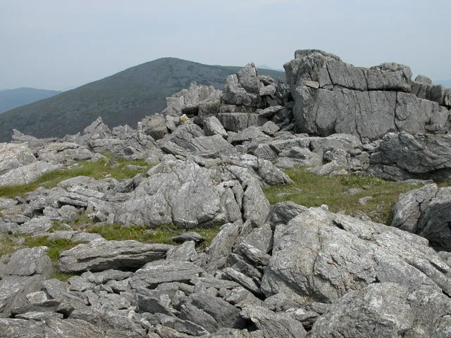
Graig Goch
Natural landmarks · 2.8 km
Nearby
📷 3Archaeological sites · North Wales
Pant Glas Roman Marching Camp
Pant Glas Roman Marching Camp — a archaeological in wales-north, United Kingdom.
📷 5📷 3Forests & woodlands · North Wales
Gwarchodfa Natur Genedlaethol Cors Gyfelog
Gwarchodfa Natur Genedlaethol Cors Gyfelog is a forest or woodland in the United Kingdom.
📷 5Historic churches · North Wales
Bwlch-derwin
Bwlch-derwin is a village in the community of Dolbenmaen, in the county of Gwynedd, Wales. Historically in Caernarfonshire, the village is situated within Snowdonia.
📷 3Archaeological sites · North Wales
Derwin Bach Roman Marching Camp
Derwin Bach Roman Marching Camp — a archaeological in wales-north, United Kingdom.
📷 3Archaeological sites · North Wales
Pen Llystyn Roman Fort
Pen Llystyn Roman Fort — a archaeological in wales-north, United Kingdom.
Where to eat & stay near Pant Glas
Places to stay
 📷 5
📷 5 📷 5
📷 5Campsites · North Wales
Ty’n Llan Campsite
Ty’n Llan Campsite — a campsite in wales north.
 📷 5
📷 5Caravan parks · North Wales
Llyn Y Gele Caravan Park
Llyn Y Gele Caravan Park — a caravan park in wales north.
📷 5Caravan parks · North Wales
West Point Beach Resort
West Point Beach Resort — a caravan park in wales north.
 📷 5
📷 5Caravan parks · North Wales
Tyddyn Cethin Caravan Park
Tyddyn Cethin Caravan Park — a caravan park in wales north.
 📷 5
📷 5Campsites · North Wales
Aberafon Campsite
Aberafon Campsite — a campsite in wales north.
Places to eat & drink
 📷 5
📷 5 📷 5
📷 5Restaurants · North Wales
Dylan's Restaurant
Dylan's Restaurant — a restaurant in wales north. Cuisine: burger;cake;coffee shop;fish;italian;italian pizza;pasta;pizza;seafood.
 📷 5
📷 5 📷 5
📷 5 📷 5
📷 5 📷 5
📷 5More places in this region
 📷 3
📷 3Historic churches · North Wales
All Saints Church
All Saints Church — Anglican church in Deganwy, Wales.
 📷 3
📷 3Historic churches · North Wales
All Saints Church, Great Saughall
All Saints Church, Great Saughall — grade II listed church in Saughall, Cheshire West and Chester, Cheshire, England, UK.
 📷 3
📷 3Historic churches · North Wales
All Saints Church, Higher Kinnerton
All Saints Church, Higher Kinnerton — church in United Kingdom.
 📷 3
📷 3Historic churches · North Wales
All Saints' Church, Gresford
All Saints' Church, Gresford — church in Gresford, north Wales.
Frequently asked questions
- Where is Pant Glas?
- Pant Glas is in North Wales, United Kingdom (postcode LL51 9DJ), in the parish of Clynnog.
- What is Pant Glas?
- Pant Glas (Welsh for 'green hollow'; as in other Celtic languages, "glas" may mean both 'green' and 'blue') is a hamlet on the A487 road in Gwynedd, Wales, in the community of Clynnog. Historically in
- How do I get to Pant Glas?
- The nearest railway station is Criccieth, about 9.6 km away. Drivers can use postcode LL51 9DJ.
- Is Pant Glas a listed building?
- Pant Glas is officially recognised as II listed.
- Is Pant Glas free to visit?
- Yes, Pant Glas is free to enter.
- How do I get to Pant Glas?
- Drivers can navigate to postcode LL51 9DJ. It sits within the Dwyfor Meirionnydd parliamentary constituency.