
Canals · West Midlands
Oxford Canal
In or near Exhall.
Oxford Canal — canal in the United Kingdom.

Wikimedia Commons contributors — see linked file page for photographer and licence licence

Plan your visit
- Typical visit
- 1 h–2 h
- Nearest railway station
- Coventry Arena · 1.9 km
- Free entry
- Dog-friendly
Getting there & planning your visit
To visit the Oxford Canal, the nearest railway station is Coventry Arena, located 1.9 km away. Entry to the canal is free, and you can use the postcode CV2 1QL for sat-nav directions.
About
Oxford Canal is a canal in the United Kingdom. Wikidata describes it as: "canal in the United Kingdom". Coordinates: 52.4500°, -1.4667°.
Photo gallery
From the Wikipedia article
The Oxford Canal is a 78-mile (126 km) narrowboat canal in southern central England linking the City of Oxford with the Coventry Canal at Hawkesbury (just north of Coventry and south of Bedworth) via Banbury and Rugby. Completed in 1790, it connects to the River Thames at Oxford, and links with the Grand Union Canal, which it is combined with for 5 miles (8 km) between to the villages of Braunston and Napton-on-the-Hill. The canal is usually divided into the North Oxford Canal (north of Napton, via Rugby to Hawkesbury Junction near Coventry) and the South Oxford Canal, south of Napton to Banbury and Oxford. The canal was for about 15 years the main canal artery of trade between the Midlands and London, via its connection to the Thames, until the Grand Union Canal (then called the Grand Junction Canal) took most of the London-bound traffic following its opening in 1805. The North Oxford Canal (which had been straightened in the 1830s) remained an important artery of trade carrying coal and other commodities until the 1960s; the more rural South Oxford Canal however became something of a backwater, especially following the opening of the Grand Junction Canal, and it faced closure proposals in the 1950s. Since the end of regular commercial goods carriage on the canal in the 1960s, it has gained a new use as a leisure resource, and become used primarily for narrowboat pleasure boating. The Oxford Canal traverses Oxfordshire, Northamptonshire and east Warwickshire through broad, shallow valleys and lightly rolling hills; the canal's route northeast and then northwest forms part of the Warwickshire ring.
Excerpt from Wikipedia under CC BY-SA 4.0. See the source article linked in Sources below.
Background
Architecture
The Oxford Canal was constructed in several stages over a period of more than twenty years. | repeal_date = 14 May 1829 | amendments = | repealing_legislation = Oxford Canal Navigation Act 1829 | related_legislation = | status = Repealed | original_text = https://books.google.co.uk/books?id=VaI3AAAAMAAJ&pg=PA274 | collapsed = yes }} In 1769 the (9 Geo. 3. c. 70) authorising the Oxford Canal was passed, having been promoted in Parliament by Sir Roger Newdigate MP, who chaired the canal company. The intention was to link the industrial English Midlands to London via the River Thames. Construction began shortly after near Coventry. The principal motivation for the canal was the transport of…
Description
]] The canal begins in Warwickshire near Hawkesbury Village at Hawkesbury Junction, also known as Sutton Stop, where it connects with the Coventry Canal, a little over 4 miles (or about 7 km) from the centre of Coventry and 5 mi from Nuneaton. Within a mile were the late 18th- and 19th-century coal field/pit and colliery of the small town of Bedworth. From Hawkesbury, it runs southeast through the Warwickshire countryside for 15 mi to Rugby. The route between Coventry and Rugby is level, with no locks, apart from the stop lock at the junction. Parts of this section were straightened by raising and waterproofing in the 1820s; the remains of a more circuitous route (which kept to the chosen…
Sourced from Wikipedia under CC BY-SA 4.0.
- Coordinates
- 52.4500, -1.4667
- District
- Coventry
- Parish
- Coventry, unparished area
- Postcode
- CV2 1QL
- Parliamentary constituency
- Coventry East
- Established
- 1790
- Nearest railway station
- Coventry Arena — 1.9 km
Sources
- wikidata: Q238725 (CC0)
- wikipedia: Oxford Canal (CC BY-SA 4.0)
- commons: Oxford Canal at Hillmorton.jpg (CC BY-SA 4.0)
Other places nearby

Greyhound Inn
Historic pubs · 0.8 km

Site of Alexandra Colliery
Archaeological sites · 1.5 km

Foleshill
Villages · 1.6 km

Site of end of Branch Line linking to Site of Alexandra Colliery & Craven Colliery via mineral lines
Archaeological sites · 1.6 km

Gurdwara Dhan Dhan Baba Vadbhag Singh Ji
Historic churches · 1.8 km
Gurdwara Dukh Nirwaran Sahib
Historic churches · 1.9 km

Sky Blues Wall of Fame
Public art & sculpture · 1.9 km

Exhall
Villages · 1.9 km
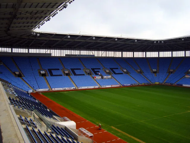
Ricoh Arena
Stadiums · 2.0 km

Henley College, Coventry
Natural landmarks · 2.0 km

Oxford Canal Canal Bridge No 11
Historic bridges · 2.0 km

Jimmy Hill
Public art & sculpture · 2.0 km
Nearby
📷 4Historic pubs · West Midlands
Greyhound Inn
Greyhound Inn — Historic pub — listed building or notable heritage status.
📷 3Archaeological sites · West Midlands
Site of Alexandra Colliery
Site of Alexandra Colliery — an archaeological site in West Midlands, United Kingdom.
📷 5📷 3Archaeological sites · West Midlands
Site of end of Branch Line linking to Site of Alexandra Colliery & Craven Colliery via mineral lines
Site of end of Branch Line linking to Site of Alexandra Colliery & Craven Colliery via mineral lines — an archaeological site in West Midlands, United Kingdom.
📷 5Historic churches · West Midlands
Gurdwara Dhan Dhan Baba Vadbhag Singh Ji
Gurdwara Dhan Dhan Baba Vadbhag Singh Ji — a church in West Midlands, United Kingdom.
📷 5Historic churches · West Midlands
Gurdwara Dukh Nirwaran Sahib
Gurdwara Dukh Nirwaran Sahib — a church in West Midlands, United Kingdom.
Where to eat & stay near Oxford Canal
Places to stay
 📷 5
📷 5Hotels · West Midlands
DoubleTree by Hilton Coventry Building Society Arena
DoubleTree by Hilton Coventry Building Society Arena — a hotel in england west midlands. 4-star. Brand: DoubleTree.
 📷 5
📷 5Hotels · West Midlands
DoubleTree by Hilton Hotel Coventry
DoubleTree by Hilton Hotel Coventry — a hotel in england west midlands.
 📷 5
📷 5 📷 5
📷 5 📷 6
📷 6Hotels · West Midlands
Telegraph Hotel
Telegraph Hotel — a hotel in england west midlands.
 📷 5
📷 5Hotels · West Midlands
Premier Inn
Premier Inn — a hotel in england west midlands.
Places to eat & drink
📷 4Historic pubs · West Midlands
Greyhound Inn
Greyhound Inn — Historic pub — listed building or notable heritage status.
 📷 3
📷 3Historic pubs · West Midlands
The Pilot Hotel
The Pilot Hotel — Historic pub — listed building or notable heritage status.
 📷 5
📷 5Historic pubs · West Midlands
The Biggin Hall
The Biggin Hall — Historic pub — listed building or notable heritage status.
 📷 3
📷 3Historic pubs · West Midlands
The Whitefriars
The Whitefriars — Historic pub — listed building or notable heritage status.
 📷 5
📷 5Historic pubs · West Midlands
The Golden Cross Inn
The Golden Cross Inn — Historic pub — listed building or notable heritage status.
 📷 5
📷 5Historic pubs · West Midlands
The Castle Grounds
The Castle Grounds — Historic pub — listed building or notable heritage status.
More places in this region
 📷 5
📷 5 📷 3
📷 3 📷 4
📷 4 📷 3
📷 3Frequently asked questions
- Where is Oxford Canal?
- Oxford Canal is in the West Midlands, United Kingdom (postcode CV2 1QL), in the parish of Coventry, unparished area.
- What is Oxford Canal?
- Oxford Canal — canal in the United Kingdom.
- How do I get to Oxford Canal?
- The nearest railway station is Coventry Arena, about 1.9 km away. The nearest town is Exhall. Drivers can use postcode CV2 1QL.
- When was Oxford Canal built?
- Built or established in 1790.
- Is Oxford Canal free to visit?
- Yes, Oxford Canal is free to enter.
- How do I get to Oxford Canal?
- The nearest railway station is Coventry Arena, about 1.9 km away. Drivers can navigate to postcode CV2 1QL.