
Other places · North East England
Oxbridge
In or near Newtown.
Oxbridge in England North East, United Kingdom.

Adrian Dust — CC BY-SA 2.0 via Wikimedia Commons licence

Plan your visit
- Typical visit
- 1 h–2 h
- Nearest railway station
- Stockton · 1.2 km
Getting there & planning your visit
To visit Oxbridge, the nearest railway station is Stockton, which is 1.2 km away. The postcode for sat-nav is TS18 4DP. Entry details are not provided.
About
Oxbridge is a place of interest in England North East, United Kingdom — drawn from open-data sources for visitor reference. See the linked Wikipedia article for the full description.
Photo gallery
From the Wikipedia article
Oxbridge is an area of Stockton-on-Tees within the borough of Stockton-on-Tees and the ceremonial county of County Durham, England. It is situated to the south-west of the town centre. In recent times, the area has been known for its high crime rate. In a 2019 article wrote by TeessideLive, Oxbridge was marked as a "hot spot" for residential burglaries, drug dealing, crime and anti-social behaviour.
Excerpt from Wikipedia under CC BY-SA 4.0. See the source article linked in Sources below.
- Coordinates
- 54.5615, -1.3305
- District
- Stockton-on-Tees
- Parish
- Stockton-on-Tees, unparished area
- Postcode
- TS18 4DP
- Parliamentary constituency
- Stockton North
- Nearest railway station
- Stockton — 1.2 km
Sources
- wikidata: Q7115147 (CC0)
- wikipedia: Oxbridge, Stockton-on-Tees (CC BY-SA 4.0)
Other places nearby

Oxbridge Cemetery
Cemeteries · 0.3 km
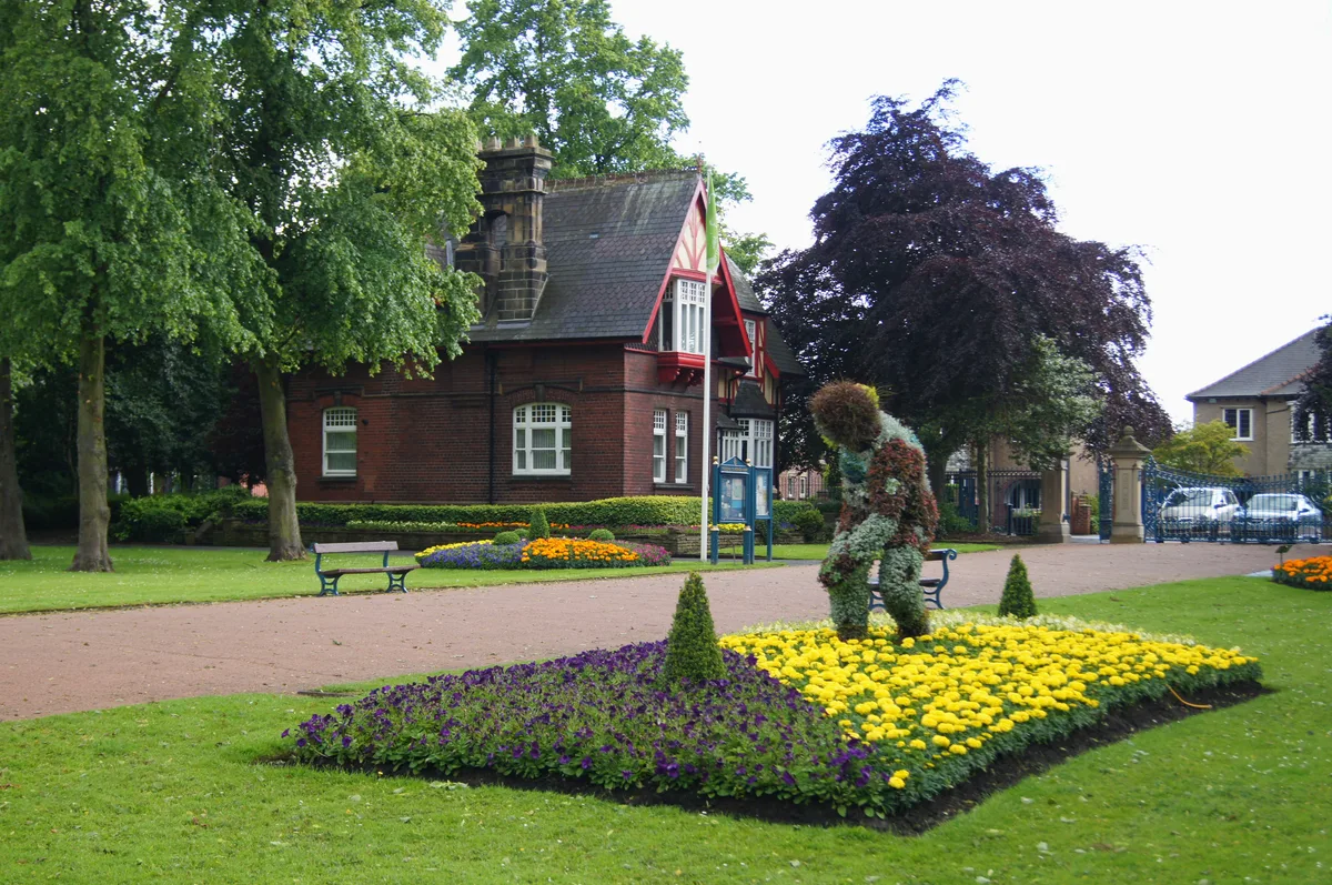
Ropner Park
Country parks · 0.5 km

Fish Swalloing Bird
Public art & sculpture · 0.5 km
Grangefield Road
Natural landmarks · 0.6 km

War memorial cross outside St Peter's Church
Memorials & monuments · 0.7 km
St Peter's Church, Stockton-on-Tees
Historic churches · 0.7 km

The Grangefield Ground
Stadiums · 0.7 km

Farooq E Azam Mosque and Islamic Centre
Historic churches · 0.8 km
Jamia Masjid Usman-e-Ghani
Historic churches · 0.8 km

Cannon Stockton-on-Tees
Theatres · 0.9 km

Hartburn
Other places · 0.9 km

The Grangefield Academy
Other places · 0.9 km
Nearby
📷 4Cemeteries · North East England
Oxbridge Cemetery
Oxbridge Cemetery is a cemetery in the United Kingdom.
📷 4Country parks · North East England
Ropner Park
Ropner Park — public park in Stockton-on-Tees, England.
📷 3Public art & sculpture · North East England
Fish Swalloing Bird
Fish Swalloing Bird — a public art in North East England, United Kingdom.
📷 3Natural landmarks · North East England
Grangefield Road
Grangefield Road in England North East, United Kingdom.
📷 3Memorials & monuments · North East England
War memorial cross outside St Peter's Church
War memorial cross outside St Peter's Church — Grade II listed building-listed memorial in england-north-east, United Kingdom.
📷 4Historic churches · North East England
St Peter's Church, Stockton-on-Tees
St Peter's Church, Stockton-on-Tees in England North East, United Kingdom.
Where to eat & stay near Oxbridge
Places to stay
 📷 5
Hostels · North East England
Bridge House Hostel
Bridge House Hostel — a hostel in england north east.
📷 5Hostels · North East England
Bridge House Hostel
Bridge House Hostel — a hostel in england north east.
 📷 5
Hotels · North East England
Hampton by Hilton Stockton on Tees
Hampton by Hilton Stockton on Tees — a hotel in england north east. 3-star. Brand: Hampton.
 📷 5
Caravan parks · North East England
White Water Park Caravan Club Site
White Water Park Caravan Club Site — a caravan park in england north east.
 📷 5
Caravan parks · North East England
Elton Home Park Residential
Elton Home Park Residential — a caravan park in england north east.
 📷 5
Hotels · North East England
Baltimore Hotel
Baltimore Hotel — a hotel in england north east.
Places to eat & drink
 📷 5
Historic pubs · North East England
The Ketton Ox Public House
The Ketton Ox Public House in England North East, United Kingdom.
 📷 5
Restaurants · North East England
Borrelli Delicatessen
Borrelli Delicatessen — a restaurant in england north east.
 📷 5
Restaurants · North East England
Soul Curry
Soul Curry — a restaurant in england north east.
 📷 6
Historic pubs · North East England
The Zetland
The Zetland in England North East, United Kingdom.
 📷 5
Historic pubs · North East England
The Stainton Public House
The Stainton Public House in England North East, United Kingdom.
 📷 5
Historic pubs · North East England
1 Bridgewater, Levenbank
1 Bridgewater, Levenbank in England North East, United Kingdom.
More places in this region
 📷 5
Other places · North East England
Appleby Horse Fair
The Appleby Horse Fair, previously known as Appleby New Fair, is an annual gathering of Romani people (Gypsies) and Travellers in Appleby-in-Westmorland in Cumbria, England. The horse fair is held eac
 📷 5
Other places · North East England
Crosby Garrett
Crosby Garrett in England North East, United Kingdom.
 📷 5
Other places · North East England
Ravenstonedale
Ravenstonedale in England North East, United Kingdom.
 📷 5
Frequently asked questions
- Where is Oxbridge?
- Oxbridge is in North-East England, United Kingdom (postcode TS18 4DP), in the parish of Stockton-on-Tees, unparished area.
- What is Oxbridge?
- Oxbridge in England North East, United Kingdom.
- How do I get to Oxbridge?
- The nearest railway station is Stockton, about 1.2 km away. The nearest town is Newtown. Drivers can use postcode TS18 4DP.
- How do I get to Oxbridge?
- The nearest railway station is Stockton, about 1.2 km away. Drivers can navigate to postcode TS18 4DP.