
Historic bridges · North East England
Ovingham Bridges
In or near Prudhoe.
Ovingham Bridges in England North East, United Kingdom.

Andrew Curtis — CC BY-SA 2.0 via Wikimedia Commons licence

Plan your visit
- Typical visit
- 15 min–30 min
- Nearest railway station
- Prudhoe · 0.2 km
- Free entry
- Dog-friendly
- Wheelchair accessible
Getting there & planning your visit
Ovingham Bridges is located in Northumberland, with the nearest railway station being Prudhoe, just 0.2 km away. Entry is free, and the site is wheelchair accessible. The postcode for sat-nav is NE42 6NR.
About
Ovingham Bridges is a place of interest in England North East, United Kingdom — drawn from open-data sources for visitor reference. See the linked Wikipedia article for the full description.
Photo gallery
Protected designations
- Area of Outstanding Natural Beauty: North Pennines
Designations sourced from Natural England open data under OGL v3.
From the Wikipedia article
Ovingham Bridges are a pair of side-by-side vehicle and pedestrian bridges across the River Tyne linking Ovingham and Prudhoe in Northumberland, England. Following a lengthy refurbishment programme by Northumberland County Council, Ovingham Bridge re-opened to vehicles on 5 September 2016. The vehicle bridge is a single track of reduced width for cars and light vans only. There is no footpath; pedestrians use the separate footbridge that runs alongside and with the same deck level. The centre piers are set wider, allowing the deck to spread and two vehicles can pass, although this is rare. No traffic controls are installed; drivers observe the far end and wait or enter the bridge using a set of unwritten rules that usually function well.
Excerpt from Wikipedia under CC BY-SA 4.0. See the source article linked in Sources below.
Background
History
It was built in 1883 by the Ovingham Bridge Company and replaced the earlier ferry. The steel tubes are marked Dorman Long Middlesbrough, the firm that designed and built the Sydney Harbour Bridge and the Tyne Bridge. It was originally opened and operated as a toll bridge until 1945. The toll house has long since been demolished. It was located on the downstream side at the southern end of the bridge. In 1974 a footbridge was erected alongside, immediately downstream of the main bridge. In 2009 both bridges underwent a strengthening programme as they had been closed during the January floods of 2005. Gabions were installed around the base of the pilings to prevent scour, and the river…
Sourced from Wikipedia under CC BY-SA 4.0.
- Coordinates
- 54.9670, -1.8670
- District
- Northumberland
- Parish
- Ovingham
- Postcode
- NE42 6NR
- Parliamentary constituency
- Hexham
- Nearest railway station
- Prudhoe — 0.2 km
- Opening
- {{start date|1883|12|20|df=yes}}
Sources
- wikidata: Q7114171 (CC0)
- wikipedia: Ovingham Bridge (CC BY-SA 4.0)
Other places nearby
Ovingham road bridge
Historic bridges · 0.0 km

Ovingham War Memorial
Memorials & monuments · 0.1 km

Church of St Mary
Historic churches · 0.2 km

Ovingham
Historic bridges · 0.2 km

Prudhoe railway station
Heritage railway stations · 0.2 km

Ovingham
Villages · 0.4 km
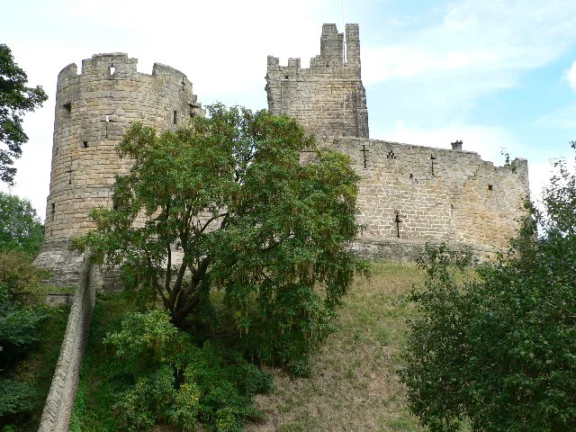
Prudhoe Castle
Castles · 0.6 km

A695 road
Other places · 1.0 km

John Wesley 1757
Memorials & monuments · 1.2 km

High Hermitage Caravan Park
Campsites · 1.3 km

Prudhoe
Towns & cities · 1.3 km
High Hermitage Caravan Park
Caravan parks · 1.3 km
Nearby
📷 3Historic bridges · North East England
Ovingham road bridge
Ovingham road bridge in England North East, United Kingdom.
📷 3Memorials & monuments · North East England
Ovingham War Memorial
Ovingham War Memorial — Grade II listed building-listed memorial in scotland-lowlands, United Kingdom.
📷 3Historic churches · North East England
Church of St Mary
Church of St Mary — church in Ovingham, Northumberland, England, UK.
📷 5Historic bridges · North East England
Ovingham
Ovingham in England North East, United Kingdom.
📷 4Heritage railway stations · North East England
Prudhoe railway station
Prudhoe railway station in England North East, United Kingdom.
📷 5Where to eat & stay near Ovingham Bridges
Places to stay
📷 5Campsites · North East England
High Hermitage Caravan Park
High Hermitage Caravan Park — a campsite in scotland lowlands.
📷 5Caravan parks · North East England
High Hermitage Caravan Park
High Hermitage Caravan Park — a caravan park in scotland lowlands.
 📷 5
📷 5 📷 5
📷 5Campsites · North East England
Wellhouse Farm Camping site
Wellhouse Farm Camping site — a campsite in scotland lowlands.
 📷 5
📷 5B&Bs · North East England
Duke Of Wellington Inn
Duke Of Wellington Inn — a bed-and-breakfast in scotland lowlands.
📷 5Caravan parks · North East England
Wellhouse Farm Caravan Park
Wellhouse Farm Caravan Park — a caravan park in scotland lowlands.
Places to eat & drink
 📷 5
📷 5Historic pubs · North East England
The Crown And Anchor
The Crown And Anchor in Scotland Lowlands, United Kingdom.
 📷 4
📷 4 📷 5
📷 5Historic pubs · North East England
Wellington Inn
Wellington Inn in Scotland Lowlands, United Kingdom.
 📷 5
📷 5 📷 5
📷 5 📷 7
📷 7Historic pubs · North East England
The Vicars Pele
The Vicars Pele in Scotland Lowlands, United Kingdom.
More bridges in this region
 📷 3
📷 3Historic bridges · North East England
Bridge About 30 Metres South Of The Manor House
Bridge About 30 Metres South Of The Manor House — Grade II listed building-listed bridge in england-yorkshire, United Kingdom.
 📷 3
📷 3Historic bridges · North East England
Old Bridge Over Nor Beck, On East Side Of Road
Old Bridge Over Nor Beck, On East Side Of Road — Grade II listed building-listed bridge in england-yorkshire, United Kingdom.
 📷 3
📷 3Historic bridges · North East England
Barnard Castle Bridge
Barnard Castle Bridge is a historic bridge in the United Kingdom.
 📷 3
📷 3Historic bridges · North East England
Blandswath Bridge
Blandswath Bridge is a historic bridge in the United Kingdom.
Frequently asked questions
- Where is Ovingham Bridges?
- Ovingham Bridges is in North-East England, United Kingdom (postcode NE42 6NR), in the parish of Ovingham.
- What is Ovingham Bridges?
- Ovingham Bridges in England North East, United Kingdom.
- How do I get to Ovingham Bridges?
- The nearest railway station is Prudhoe, about 0.2 km away. Drivers can use postcode NE42 6NR.
- Who owns Ovingham Bridges?
- Ovingham Bridges is owned by Northumberland County Council.
- Is Ovingham Bridges a protected site?
- Yes — Ovingham Bridges is part of the North Pennines National Landscape (AONB).
- Is Ovingham Bridges free to visit?
- Yes, Ovingham Bridges is free to enter.
- How do I get to Ovingham Bridges?
- The nearest railway station is Prudhoe, about 0.2 km away. Drivers can navigate to postcode NE42 6NR.