
Islands · Scottish Islands
Outer Hebrides
Also known as: Ynysoedd Allanol Heledd, Na hOileáin Siar, Na h-Eileanan Siar
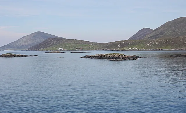
Outer Hebrides in Scotland Islands, United Kingdom.

Frederick Pollock — CC BY-SA 2.0 via Wikimedia Commons licence

Plan your visit
- Typical visit
- 4 h–12 h
- Free entry
- Dog-friendly
About
Outer Hebrides is a place of interest in Scotland Islands, United Kingdom — drawn from open-data sources for visitor reference. See the linked Wikipedia article for the full description.
Photo gallery
From the Wikipedia article
The Outer Hebrides or Western Isles, sometimes known as the Long Isle or Long Island, is an island chain off the west coast of mainland Scotland. It is the longest archipelago in the British Isles. The islands form part of the archipelago of the Hebrides, separated from the Scottish mainland and from the Inner Hebrides by the waters of the Minch, the Little Minch, and the Sea of the Hebrides. The Outer Hebrides are considered to be the traditional heartland of the Gaelic language. The islands form one of the 32 council areas of Scotland, which since 1998 has used only the Gaelic form of its name, including in English language contexts. The council area is called Na h-Eileanan an Iar ('the Western Isles') and its council is Comhairle nan Eilean Siar ('Council of the Western Isles'). Most of the islands have a bedrock formed from ancient metamorphic rocks, and the climate is mild and oceanic. The 19 inhabited islands had an estimated population of 26,020 in 2024, and there are more than 50 substantial uninhabited islands. The distance from Barra Head to the Butt of Lewis is roughly 210 kilometres (130 mi). There are various important prehistoric structures, many of which pre-date the first written references to the islands by Roman and Greek authors. The Western Isles became part of the Norse kingdom of the Suðreyjar, which lasted for over 400 years, until sovereignty over the Outer Hebrides was transferred to Scotland by the Treaty of Perth in 1266. Control of the islands was then held by clan chiefs, principal amongst whom were the MacLeods, MacDonalds, and the MacNeils. The Highland Clearances of the 19th century had a devastating effect on many communities, and it is only in recent years that population levels have ceased to decline. Much of the land is now under local control, and commercial activity is based on tourism, crofting, fishing, and weaving. Sea transport is crucial for those who live and work in the Outer Hebrides, and a variety of ferry services…
Excerpt from Wikipedia under CC BY-SA 4.0. See the source article linked in Sources below.
Background
History
In Scotland, the Celtic Iron Age way of life, often troubled but never extinguished by Rome, re-asserted itself when the legions abandoned any permanent occupation in 211 AD. Hanson (2003) writes: "For many years it has been almost axiomatic in studies of the period that the Roman conquest must have had some major medium or long-term impact on Scotland. On present evidence that cannot be substantiated either in terms of environment, economy, or, indeed, society. The impact appears to have been very limited. The general picture remains one of broad continuity, not of disruption ... The Roman presence in Scotland was little more than a series of brief interludes within a longer continuum of…
Sourced from Wikipedia under CC BY-SA 4.0.
- Coordinates
- 57.7600, -7.0200
- District
- Na h-Eileanan Siar
- Postcode
- HS5 3UB
- Parliamentary constituency
- Na h-Eileanan an Iar
Sources
- wikidata: Q80967 (CC0)
- wikipedia: Outer Hebrides (CC BY-SA 4.0)
Other places nearby
Leverburgh
Other places · 0.0 km

Dùn Innisgall
Archaeological sites · 0.5 km

Beinn an Tòib
Mountains & hills · 0.7 km

Loch Steisevat
Lakes · 0.8 km

Leverburgh Lifeboat Station
Islands · 0.9 km

Obbe
Villages · 1.2 km
The Obbe
Mountains & hills · 1.3 km

Water Tower, Leverburgh, Harris
Memorials & monuments · 1.8 km

The Obbe
Natural landmarks · 1.9 km

Shranndabhal
Mountains & hills · 2.4 km

Harris, Strond, Dun Boraigeo
Vineyards · 2.4 km
Sranndabhal
Mountains & hills · 2.4 km
Nearby
📷 4📷 3Archaeological sites · Scottish Islands
Dùn Innisgall
Dùn Innisgall — a archaeological in scotland-highlands, United Kingdom.
📷 5Mountains & hills · Scottish Islands
Beinn an Tòib
Beinn an Tòib — mountain in scotland highlands. Elevation: 103 m.
📷 5📷 4Islands · Scottish Islands
Leverburgh Lifeboat Station
Leverburgh Lifeboat Station in Scotland Islands, United Kingdom.
📷 5Where to eat & stay near Outer Hebrides
Places to stay
 📷 5
📷 5Hostels · Scottish Islands
Berneray Hostel
Berneray Hostel — a hostel in scotland highlands.
 📷 5
📷 5Campsites · Scottish Islands
West Harris Trust Camping Spot
West Harris Trust Camping Spot — a campsite in scotland highlands.
 📷 5
📷 5Hostels · Scottish Islands
John's Bunkhouse
John's Bunkhouse — a hostel in scotland highlands.
 📷 5
📷 5Campsites · Scottish Islands
Traigh Horgabost Campsite
Traigh Horgabost Campsite — a campsite in scotland highlands.
 📷 5
📷 5Campsites · Scottish Islands
Lickisto Blackhouse Camping
Lickisto Blackhouse Camping — a campsite in scotland highlands.
 📷 5
📷 5Campsites · Scottish Islands
Clachan Sands Camping Area
Clachan Sands Camping Area — a campsite in scotland highlands.
Places to eat & drink
 📷 5
📷 5Historic pubs · Scottish Islands
Rodel Hotel, Harris
Rodel Hotel, Harris in Scotland Highlands, United Kingdom.
More places in this region
 📷 5
📷 5Islands · Scottish Islands
Bac Beag
Bac Beag — Scottish island, part of the Treshnish Isles in the Inner Hebrides.
 📷 5
📷 5Islands · Scottish Islands
Bac Mòr
Bac Mòr — island in Argyll and Bute, Scotland, UK, one of the Treshnish Isles.
 Flagship📷 3
Islands · Scottish Islands
Baleshare
Baleshare — flat tidal island in the Outer Hebrides, Scotland, UK.
 Flagship📷 5
Islands · Scottish Islands
Barra
Barra — island in Outer Hebrides, Scotland, UK.
Frequently asked questions
- Where is Outer Hebrides?
- Outer Hebrides is in the Scottish Islands, United Kingdom (postcode HS5 3UB).
- What is Outer Hebrides?
- Outer Hebrides in Scotland Islands, United Kingdom.
- How do I get to Outer Hebrides?
- Drivers can use postcode HS5 3UB.
- Is Outer Hebrides free to visit?
- Yes, Outer Hebrides is free to enter.
- How do I get to Outer Hebrides?
- Drivers can navigate to postcode HS5 3UB. It sits within the Na h-Eileanan an Iar parliamentary constituency.