
Museums · South West England
Ottery St Mary
In or near Gittisham.
Ottery St Mary, known as "Ottery", is a town and civil parish in the East Devon district of Devon, England, on the River Otter, about 10 miles (16 km) east of Exeter on the B3174. At the 2001 census,

Lewis Clarke — CC BY-SA 2.0 via Wikimedia Commons licence

Plan your visit
- Typical visit
- 1.5 h–3 h
- Best time of year
- Year-round
- Nearest railway station
- Feniton · 3.9 km
- Family-friendly
- Limited wheelchair access
About
Ottery St Mary, known as "Ottery", is a town and civil parish in the East Devon district of Devon, England, on the River Otter, about 10 miles (16 km) east of Exeter on the B3174. At the 2001 census, the parish, which includes the villages of Metcombe, Fairmile, Alfington, Tipton St John, Wiggaton, and (until 2017) West Hill, had a population of 7,692. The population of the urban area alone at the 2011 census was 4,898. In 2021 the parish had a population of 7,986. There are two electoral wards in Ottery (Rural and Town). The total population of both wards, including the adjacent civil parish of Aylesbeare, at the 2011 census was 9,022. Ottery is home to a number of independent, local businesses which are situated on Mill Street, Silver Street and Yonder Street. An area known as 'The Square' is at the centre of the town. Ottery is a hub for local trade providing goods and services for residents and visitors alike.
Photo gallery
See it from the streetimagery from 2022
Imagery © Mapillary contributors, CC BY-SA 4.0
Protected designations
- Area of Outstanding Natural Beauty: East Devon
Designations sourced from Natural England open data under OGL v3.
From the Wikipedia article
Ottery St Mary, known as "Ottery", is a town and civil parish in the East Devon district of Devon, England, on the River Otter, about 10 miles (16 km) east of Exeter on the B3174. At the 2001 census, the parish, which includes the villages of Metcombe, Fairmile, Alfington, Tipton St John, Wiggaton, and (until 2017) West Hill, had a population of 7,692. The population of the urban area alone at the 2011 census was 4,898. In 2021 the parish had a population of 7,986. There are two electoral wards in Ottery (Rural and Town). The total population of both wards, including the adjacent civil parish of Aylesbeare, at the 2011 census was 9,022. Ottery is home to a number of independent, local businesses which are situated on Mill Street, Silver Street and Yonder Street. An area known as 'The Square' is at the centre of the town. Ottery is a hub for local trade providing goods and services for residents and visitors alike.
Excerpt from Wikipedia under CC BY-SA 4.0. See the source article linked in Sources below.
Background
History
Archaeological excavations in 2014, in advance of a housing development at Island Farm, uncovered a medieval longhouse dating to AD.1250–1350. Ottery's notable buildings include the Tumbling Weir and St Mary's church. The town is the site of The King's School, formerly a grammar school but now a comprehensive school, founded in 1545 by Henry VIII, and of Ottery St Mary Primary School. The Old Town Hall now accommodates the local heritage museum. The Chanter's House is a Grade II listed building. The Listing summary states: "Dates from the days of the College but little trace of antiquity remains, mainly enclosed by large brick outer additions by Butterfield including a 3rd storey, extending…
Sourced from Wikipedia under CC BY-SA 4.0.
- Coordinates
- 50.7520, -3.2790
- County
- Devon
- District
- East Devon
- Parish
- Ottery St. Mary
- Postcode
- EX11 1DB
- Parliamentary constituency
- Honiton and Sidmouth
- Nearest railway station
- Feniton — 3.9 km
- Official site
- ottery-st-mary.parish.uk
Sources
- wikipedia: Ottery St Mary (CC BY-SA 4.0)
Other places nearby
Victoria Monument marking 60th year of her reign
Memorials & monuments · 0.0 km
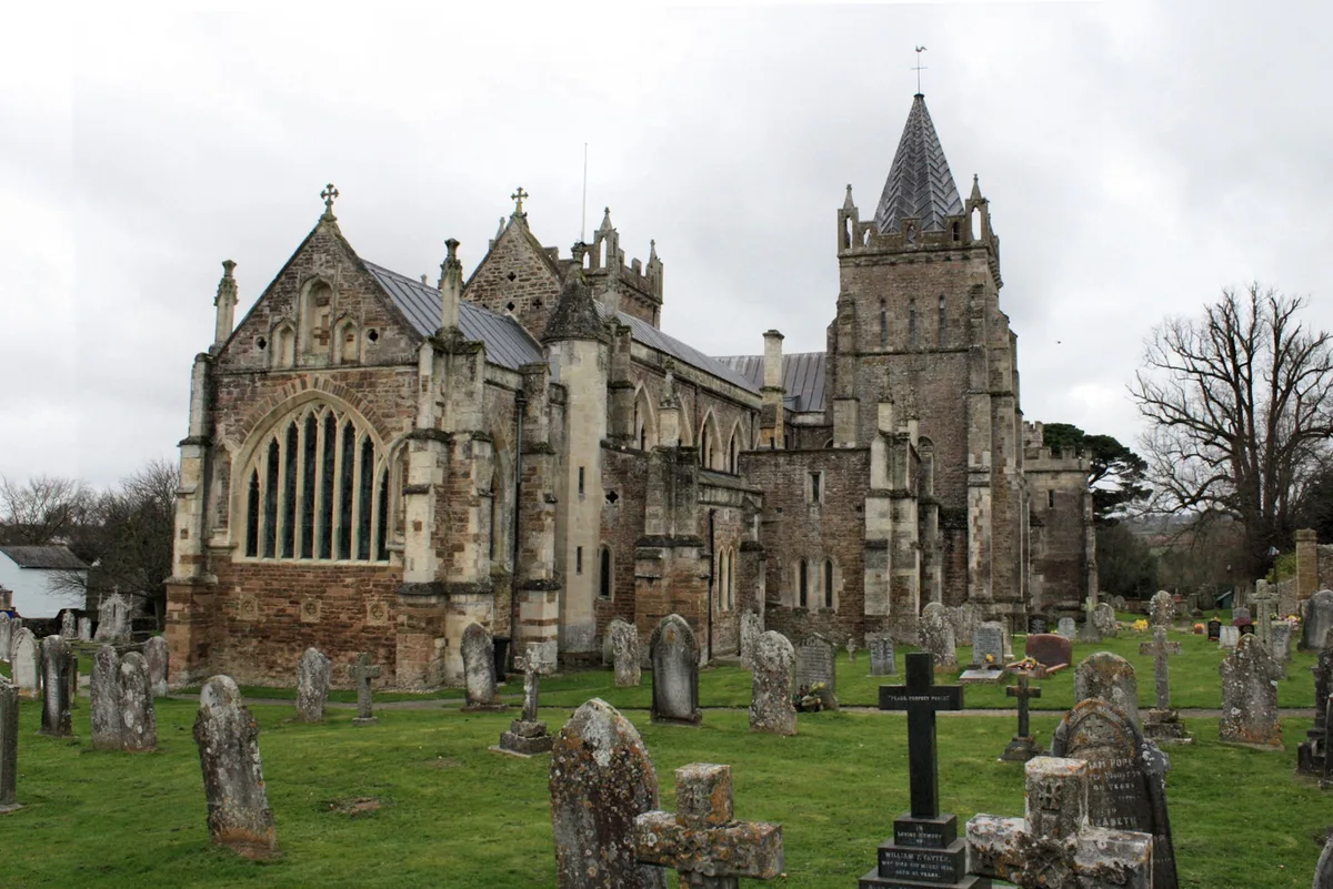
St Mary's Church, Ottery St Mary
Abbeys & priories · 0.1 km

St Mary's Church, Ottery St Mary
Cathedrals · 0.1 km

The Priory
Memorials & monuments · 0.1 km
.jpg?width=1200)
The Chanter's House
Historic houses · 0.2 km

Tumbling Weir
Natural landmarks · 0.4 km

St Saviours Bridge
Historic bridges · 0.6 km

Cadhay Bridge
Historic bridges · 0.8 km

Ottery St Mary
Villages · 0.9 km

Pixies' Parlour
Caves · 1.1 km

Cadhay Gardens
Gardens · 1.2 km
Cadhay
Historic houses · 1.3 km
Nearby
📷 3Memorials & monuments · South West England
Victoria Monument marking 60th year of her reign
Victoria Monument marking 60th year of her reign is a memorial in the United Kingdom.
📷 5Abbeys & priories · South West England
St Mary's Church, Ottery St Mary
St Mary's Church, Ottery St Mary — Grade I listed church in Ottery St Mary, Devon, England, UK.
📷 5Cathedrals · South West England
St Mary's Church, Ottery St Mary
St Mary's Church, Ottery St Mary is a cathedral in the United Kingdom.
📷 3Memorials & monuments · South West England
The Priory
The Priory is a memorial in the United Kingdom.
📷 3Historic houses · South West England
The Chanter's House
The Chanter's House — house in Ottery St Mary, East Devon, England, UK.
📷 3Natural landmarks · South West England
Tumbling Weir
Tumbling Weir — a other in england-south-west, United Kingdom.
Where to eat & stay near Ottery St Mary
Places to stay
 📷 5
📷 5 📷 5
📷 5Campsites · South West England
Yurt Village
Yurt Village — a campsite in england south west.
 📷 5
📷 5Campsites · South West England
Bowhayes Farm Sanctuary - Camping & Glamping
Bowhayes Farm Sanctuary - Camping & Glamping — a campsite in england south west.
 📷 5
📷 5 📷 5
📷 5Campsites · South West England
Pithead Campsite
Pithead Campsite — a campsite in england south west.
 📷 5
📷 5Places to eat & drink
 📷 5
📷 5 📷 7
📷 7Historic pubs · South West England
White Lion Inn
White Lion Inn in England South West, United Kingdom.
 📷 7
📷 7Historic pubs · South West England
Three Tuns Inn
Three Tuns Inn in England South West, United Kingdom.
 📷 5
📷 5Historic pubs · South West England
The Star Inn (JD Wetherspoon)
The Star Inn (JD Wetherspoon) in England South West, United Kingdom.
 📷 5
📷 5 📷 5
📷 5Historic pubs · South West England
The Anchor Inn
The Anchor Inn in England South West, United Kingdom.
More museums in this region
 📷 5
📷 5Museums · South West England
Alexander Keiller Museum
Alexander Keiller Museum — museum in South West England, United Kingdom.
 📷 5
📷 5Museums · South West England
American Museum and Gardens
American Museum and Gardens — culture and arts museum near Bath, England, United Kingdom.
 📷 5
📷 5Museums · South West England
Atwell-Wilson Motor Museum
Atwell-Wilson Motor Museum — museum in Calne, England, UK.
 📷 5
📷 5Museums · South West England
Bath Abbey Heritage Vaults
Bath Abbey Heritage Vaults — museum in Bath Abbey, Bath, England, UK.
Frequently asked questions
- Where is Ottery St Mary?
- Ottery St Mary is in Devon, South-West England, United Kingdom (postcode EX11 1DB), in the parish of Ottery St. Mary.
- What is Ottery St Mary?
- Ottery St Mary, known as "Ottery", is a town and civil parish in the East Devon district of Devon, England, on the River Otter, about 10 miles (16 km) east of Exeter on the B3174. At the 2001 census,
- How do I get to Ottery St Mary?
- The nearest railway station is Feniton, about 3.9 km away. The nearest town is Gittisham. Drivers can use postcode EX11 1DB.
- Is Ottery St Mary a protected site?
- Yes — Ottery St Mary is part of the East Devon National Landscape (AONB).
- How do I get to Ottery St Mary?
- The nearest railway station is Feniton, about 3.9 km away. Drivers can navigate to postcode EX11 1DB.