
Forts · North East England
Otterburn Battlefield
In or near Otterburn.
Otterburn Battlefield is a fort in the United Kingdom.

Wikimedia Commons contributors — see linked file page for photographer and licence licence

Plan your visit
- Typical visit
- 45 min–1.5 h
About
Otterburn Battlefield is a historic fort or fortified site in the United Kingdom. Coordinates: 55.2374°, -2.1947°. This entry is part of The Great Britain Guide, a free, ad-free, open-data tourist directory.
Photo gallery
From the Wikipedia article
The Battle of Otterburn, also known as the Battle of Chevy Chase, took place according to Scottish sources on 5 August 1388, or 19 August according to English sources, as part of the continuing border skirmishes between the Scots and English. The Scottish nobles James, 2nd Earl of Douglas and John Dunbar, Earl of Moray led their army toward Durham while Archibald Douglas, 3rd Earl of Douglas at the time Lord of Galloway, and Robert Stewart, Duke of Albany, at the time Earl of Fife, coordinated a simultaneous attack on Carlisle Castle. It was timed to take advantage of divisions on the English side between Ralph Neville, 1st Earl of Westmorland and Henry Percy, 1st Earl of Northumberland who had just taken over defence of the border and partly in revenge for King Richard II's invasion of Scotland three years previously.
Excerpt from Wikipedia under CC BY-SA 4.0. See the source article linked in Sources below.
- Coordinates
- 55.2374, -2.1947
- District
- Northumberland
- Parish
- Otterburn
- Postcode
- NE19 1JF
- Parliamentary constituency
- Hexham
Sources
- osm: n1325250251 (ODbL)
- wikipedia: Battle of Otterburn (CC BY-SA 4.0)
- commons: Otterburn Battle.jpg (CC BY-SA 4.0)
Other places nearby

Percy's Cross
Memorials & monuments · 0.0 km

Otterburn
Towns & cities · 0.9 km

Otterburn Hall
Castles · 0.9 km
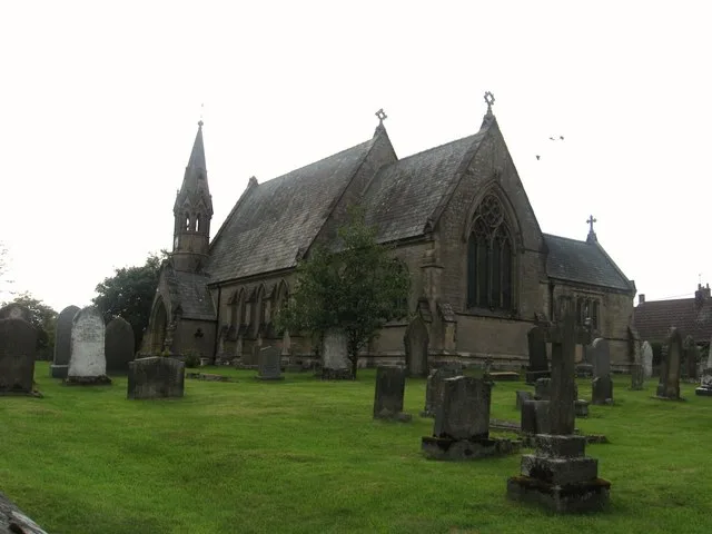
St John the Evangelist's Church, Otterburn
Historic churches · 1.0 km

Redesdale
National parks · 1.1 km

William de Percy
Hotels · 1.1 km

Otterburn Tower
Castles · 1.2 km

Otterburn Mill
Mills · 1.4 km

Romano-British Farmstead
Archaeological sites · 1.4 km

Dargues Roman camp
Archaeological sites · 1.6 km

Fawdon Hill defended settlement, 900m north-west of Closehead
Vineyards · 1.9 km

Blakehope Roman Fort
Archaeological sites · 2.0 km
Nearby
📷 3Memorials & monuments · North East England
Percy's Cross
Percy's Cross is a memorial in the United Kingdom.
📷 5Towns & cities · North East England
Otterburn
Otterburn — village and civil parish in Northumberland, England, UK.
📷 4Castles · North East England
Otterburn Hall
Otterburn Hall in England North East, United Kingdom.
📷 3Historic churches · North East England
St John the Evangelist's Church, Otterburn
St John the Evangelist's Church, Otterburn — church in Otterburn, Northumberland, England, UK.
📷 4📷 5Hotels · North East England
William de Percy
William de Percy — a hotel in scotland lowlands.
Where to eat & stay near Otterburn Battlefield
Places to stay
📷 5Hotels · North East England
William de Percy
William de Percy — a hotel in scotland lowlands.
 📷 5
📷 5 📷 5
📷 5 📷 7
📷 7 📷 5
📷 5Campsites · North East England
Demesne Farm Campsite & Granary Cottage
Demesne Farm Campsite & Granary Cottage — a campsite in scotland lowlands.
 📷 5
📷 5Hostels · North East England
Tarset Tor bunkhouse
Tarset Tor bunkhouse — a hostel in scotland lowlands.
Places to eat & drink
 📷 5
📷 5Historic pubs · North East England
The Redesdale Arms
The Redesdale Arms in Scotland Lowlands, United Kingdom.
 📷 7
📷 7More forts in this region
 📷 4
📷 4 📷 4
📷 4 📷 4
📷 4Forts · North East England
Richmond Barracks, North Yorkshire
Richmond Barracks, North Yorkshire in England North East, United Kingdom.
 📷 3
📷 3Forts · North East England
Albemarle Barracks, England
Albemarle Barracks, England in England North East, United Kingdom.
Frequently asked questions
- Where is Otterburn Battlefield?
- Otterburn Battlefield is in the Scottish Lowlands, United Kingdom (postcode NE19 1JF), in the parish of Otterburn.
- What is Otterburn Battlefield?
- Otterburn Battlefield is a fort in the United Kingdom.
- How do I get to Otterburn Battlefield?
- Drivers can use postcode NE19 1JF.
- How do I get to Otterburn Battlefield?
- Drivers can navigate to postcode NE19 1JF. It sits within the Hexham parliamentary constituency.