Lighthouses · East of England
Orford Ness
In or near Snape.
Orford Ness is a cuspate foreland shingle spit on the Suffolk coast in Great Britain, linked to the mainland at Aldeburgh and stretching along the coast to Orford and down to North Weir Point, opposit

Dave Thompson — CC BY-SA 2.0 via Wikimedia Commons licence
Plan your visit
- Typical visit
- 30 min–1 h
- Free entry
- Family-friendly
- Dog-friendly
Getting there & planning your visit
To visit Orford Ness, the nearest postcode is IP12 2NY. Entry is free.
About
Orford Ness is a cuspate foreland shingle spit on the Suffolk coast in Great Britain, linked to the mainland at Aldeburgh and stretching along the coast to Orford and down to North Weir Point, opposite Shingle Street. It is divided from the mainland by the River Alde, and was formed by longshore drift along the coast. The material of the spit comes from places further north, such as Dunwich. Near the middle point of its length, at the foreland point or "Ness", once stood Orfordness Lighthouse, demolished in summer 2020 owing to the encroaching sea. In the name of the lighthouse (and the radio transmitting station – see below), "Orfordness" is written as one word.
Photo gallery
Protected designations
- Site of Special Scientific Interest: Alde-Ore Estuary SSSI
- National Nature Reserve: ORFORDNESS-HAVERGATE
- Area of Outstanding Natural Beauty: Suffolk Coast & Heaths
- Ramsar wetland: Alde-Ore Estuary
Designations sourced from Natural England open data under OGL v3.
From the Wikipedia article
Orford Ness is a cuspate foreland shingle spit on the Suffolk coast in Great Britain, linked to the mainland at Aldeburgh and stretching along the coast to Orford and down to North Weir Point, opposite Shingle Street. It is divided from the mainland by the River Alde, and was formed by longshore drift along the coast. The material of the spit comes from places further north, such as Dunwich. Near the middle point of its length, at the foreland point or "Ness", once stood Orfordness Lighthouse, demolished in summer 2020 owing to the encroaching sea. In the name of the lighthouse (and the radio transmitting station – see below), "Orfordness" is written as one word.
Excerpt from Wikipedia under CC BY-SA 4.0. See the source article linked in Sources below.
Background
History
The peninsula was formerly administered by the Ministry of Defence, which conducted secret military tests during both world wars and the Cold War. The site was selected as the location for the Orfordness Beacon, one of the earliest experiments in long-range radio navigation. The Beacon was set up in 1929 and used in the pre-war era. In the 1930s Orford Ness was the site of the first purpose-built experiments on the defence system that would later be known as radar. Having proved the technology on Orford Ness, Robert Watson-Watt and his team moved to nearby Bawdsey Manor and developed the Chain Home radar system in time for its vital role in the Battle of Britain. The Atomic Weapons Research…
Description
Orford Ness is an internationally important site for nature conservation. It contains a significant portion of the European reserve of vegetated shingle habitat, which is internationally scarce, highly fragile, and very easily damaged. Together with Havergate Island the site is a designated National Nature Reserve and forms part of: the Alde-Ore Estuary Site of Special Scientific Interest (SSSI); the Alde, Ore & Butley Estuaries and the Orfordness-Shingle Street Special Area of Conservation (SAC); the Alde-Ore Estuary Special Protection Area (SPA); the Alde-Ore Estuary Ramsar Site site; the Suffolk Coasts and Heaths Area of Outstanding Natural Beauty (AONB); and the Suffolk Heritage Coast.…
Sourced from Wikipedia under CC BY-SA 4.0.
- Coordinates
- 52.0814, 1.5586
- County
- Suffolk
- District
- East Suffolk
- Parish
- Orford
- Postcode
- IP12 2NY
- Parliamentary constituency
- Suffolk Coastal
- Official site
- snape-pc.gov.uk
Sources
- wikipedia: Orford Ness (CC BY-SA 4.0)
Other places nearby

Orford Ness National Nature Reserve (National Trust)
Wildlife reserves · 0.6 km
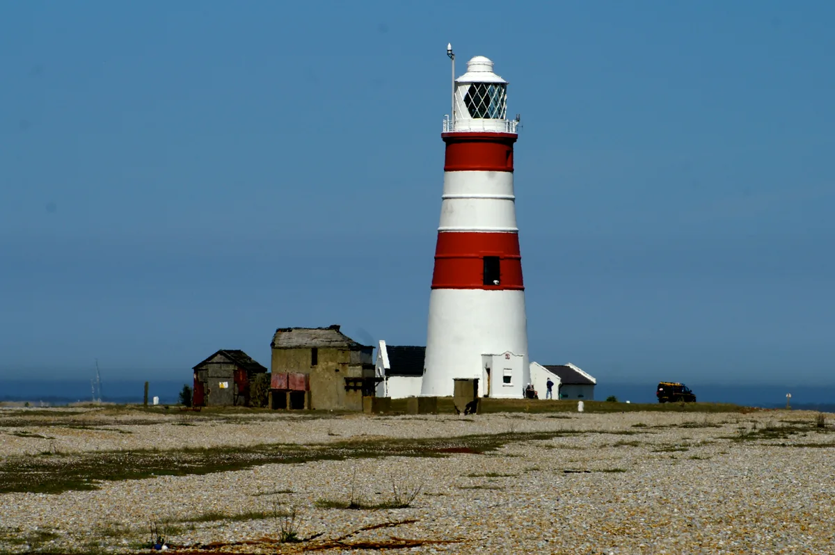
Orfordness Lighthouse
Lighthouses · 1.1 km
Hollesley Bay
Mountains & hills · 1.7 km

The Jolly Sailor Public House
Historic pubs · 1.8 km

Orford War Memorial
Memorials & monuments · 2.2 km

St Bartholomews Church
Historic churches · 2.2 km

Orford, Suffolk
Museums · 2.3 km

Crown and Castle
Hotels · 2.3 km

Orford
Villages · 2.3 km
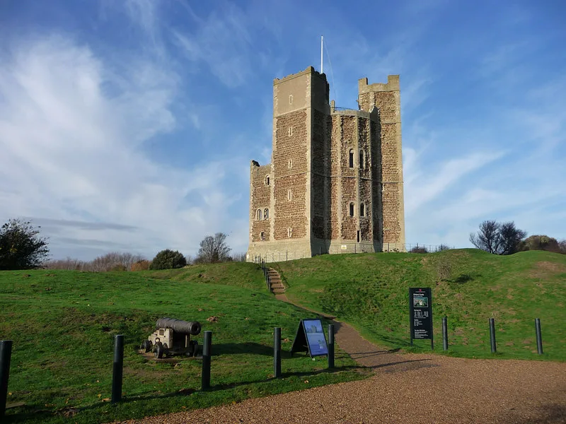
Orford Castle
Castles · 2.4 km

Orford Museum
Museums · 2.4 km

Orford Village Sign
Public art & sculpture · 2.5 km
Nearby
📷 3Wildlife reserves · East of England
Orford Ness National Nature Reserve (National Trust)
Orford Ness National Nature Reserve (National Trust) — a wildlife reserve in england-east, United Kingdom.
📷 5Lighthouses · East of England
Orfordness Lighthouse
Orfordness Lighthouse — demolished lighthouse in Orford, East Suffolk, England, UK.
📷 3Mountains & hills · East of England
Hollesley Bay
Hollesley Bay — bay on the coast of Suffolk, England.
📷 7Historic pubs · East of England
The Jolly Sailor Public House
The Jolly Sailor Public House in England East, United Kingdom.
📷 3Memorials & monuments · East of England
Orford War Memorial
Orford War Memorial — Grade II listed building-listed memorial in england-east, United Kingdom.
📷 5Historic churches · East of England
St Bartholomews Church
St Bartholomews Church — church in Orford, Suffolk, England, UK.
Where to eat & stay near Orford Ness
Places to stay
📷 7Hotels · East of England
Crown and Castle
Crown and Castle — a hotel in england east.
 📷 5
📷 5 📷 5
📷 5 📷 7
📷 7 📷 5
📷 5Caravan parks · East of England
Church Farm Holiday Park
Church Farm Holiday Park — a caravan park in england east.
 📷 5
📷 5Caravan parks · East of England
Run Cottage Caravan Park
Run Cottage Caravan Park — a caravan park in england east.
Places to eat & drink
📷 7Historic pubs · East of England
The Jolly Sailor Public House
The Jolly Sailor Public House in England East, United Kingdom.
 📷 7
📷 7Historic pubs · East of England
The Parrot And Punchbowl Public House
The Parrot And Punchbowl Public House in England East, United Kingdom.
 📷 7
📷 7Historic pubs · East of England
The Lion, Little Glemham
The Lion, Little Glemham in England East, United Kingdom.
 📷 7
📷 7Historic pubs · East of England
George and Dragon, Farnham
George and Dragon, Farnham in England East, United Kingdom.
 📷 5
📷 5 📷 5
📷 5Historic pubs · East of England
The Horse and Groom
The Horse and Groom in England East, United Kingdom.
More lighthouses in this region
 📷 5
📷 5Lighthouses · East of England
Mucking Flat Lighthouse (historical)
Mucking Flat Lighthouse (historical) — a lighthouse in england london.
Lighthouses · East of England
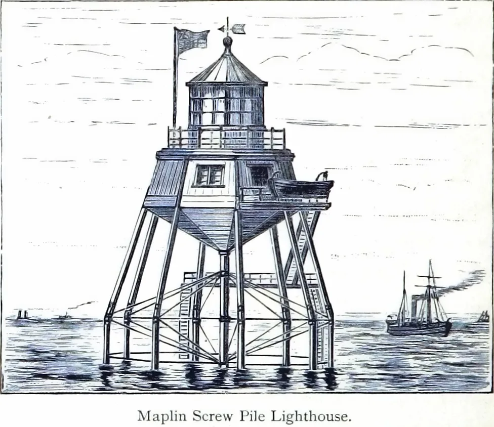
Maplin Lighthouse
Maplin Lighthouse — lighthouse at the mouth of the Thames on Maplin Sands, Essex, England.
 📷 3
📷 3Lighthouses · East of England
Chapman Lighthouse (historical)
Chapman Lighthouse (historical) — a lighthouse in england south east.
 📷 5
📷 5Lighthouses · East of England
Southend Pier Lighthouse (historical)
Southend Pier Lighthouse (historical) — a lighthouse in england south east.
Frequently asked questions
- Where is Orford Ness?
- Orford Ness is in Suffolk, East of England, United Kingdom (postcode IP12 2NY), in the parish of Orford.
- What is Orford Ness?
- Orford Ness is a cuspate foreland shingle spit on the Suffolk coast in Great Britain, linked to the mainland at Aldeburgh and stretching along the coast to Orford and down to North Weir Point, opposit
- How do I get to Orford Ness?
- Drivers can use postcode IP12 2NY.
- Who owns Orford Ness?
- Orford Ness is owned by Ministry of Defence, Atomic Weapons Research Establishment, National Trust for Places of Historic Interest or Natural Beauty.
- Is Orford Ness a protected site?
- Yes — Orford Ness is part of the Alde-Ore Estuary SSSI Site of Special Scientific Interest and the ORFORDNESS-HAVERGATE National Nature Reserve.
- Is Orford Ness free to visit?
- Yes, Orford Ness is free to enter.
- How do I get to Orford Ness?
- Drivers can navigate to postcode IP12 2NY. It sits within the Suffolk Coastal parliamentary constituency.