
Manor houses · Yorkshire & the Humber
Oldstead Hall
In or near Coxwold.
Oldstead Hall — a manor in Yorkshire & the Humber, United Kingdom.

Martin Dawes — CC BY-SA 2.0 via Wikimedia Commons licence

Plan your visit
- Typical visit
- 1 h–2 h
- Limited wheelchair access
About
Oldstead Hall is a manor located in Yorkshire & the Humber, United Kingdom. Sourced from OpenStreetMap (ODbL licence); see local listings for visitor information, opening hours and admission details.
Photo gallery
Protected designations
- Area of Outstanding Natural Beauty: Howardian Hills
Designations sourced from Natural England open data under OGL v3.
Place summary
Oldstead Hall is a manor located in Yorkshire. It is noted for its historical significance and architectural features typical of the region.
AI-generated from the structured facts on this page (operator, designation, listing, era). Not a substitute for visiting.
- Coordinates
- 54.2156, -1.1856
- District
- North Yorkshire
- Parish
- Oldstead
- Postcode
- YO61 4BL
- Parliamentary constituency
- Thirsk and Malton
Sources
- osm: node/4597083620 (ODbL)
Other places nearby

Oak Hill
Mountains & hills · 0.5 km

Mount Snever Observatory
Memorials & monuments · 0.5 km

Church Farm Camping
Campsites · 1.4 km

Kilburn Hill
Mountains & hills · 1.6 km

Brink Hill
Mountains & hills · 1.9 km

Church of St Mary
Historic churches · 1.9 km

War Memorial Set in Wall Approximately 7 Metres to South of Churchyard South Gateway
Memorials & monuments · 2.0 km

Mouseman Visitor Centre
Natural landmarks · 2.0 km

Promontory fort at Roulston Scar
Vineyards · 2.1 km

The Abbey Inn
Historic pubs · 2.1 km

Butter Hill Caravan Park
Caravan parks · 2.2 km
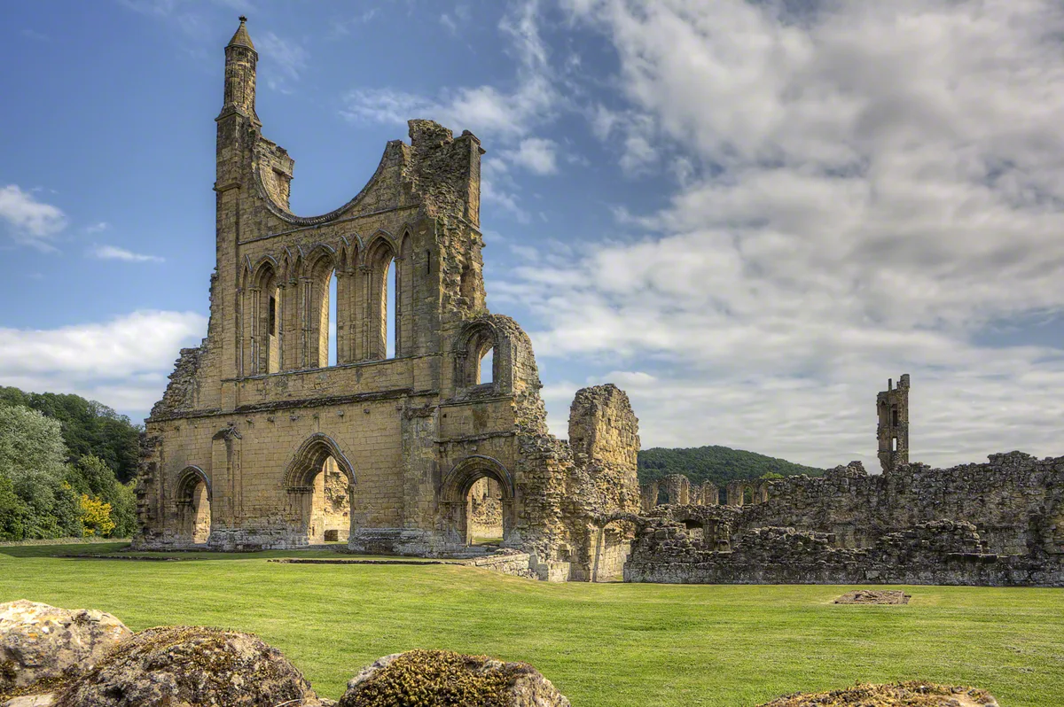
Byland Abbey
Abbeys & priories · 2.4 km
Nearby
📷 5Mountains & hills · Yorkshire & the Humber
Oak Hill
Oak Hill — a hill or mountain in england yorkshire.
📷 5Memorials & monuments · Yorkshire & the Humber
Mount Snever Observatory
Mount Snever Observatory is a memorial in the United Kingdom.
📷 5Campsites · Yorkshire & the Humber
Church Farm Camping
Church Farm Camping — a campsite in england yorkshire.
📷 5Mountains & hills · Yorkshire & the Humber
Kilburn Hill
Kilburn Hill — a hill or mountain in england yorkshire.
📷 5Mountains & hills · Yorkshire & the Humber
Brink Hill
Brink Hill — mountain in england yorkshire. Elevation: 122 m.
📷 4Historic churches · Yorkshire & the Humber
Church of St Mary
Church of St Mary — church in Kilburn, North Yorkshire, England, UK.
Where to eat & stay near Oldstead Hall
Places to stay
📷 5Campsites · Yorkshire & the Humber
Church Farm Camping
Church Farm Camping — a campsite in england yorkshire.
📷 5Caravan parks · Yorkshire & the Humber
Butter Hill Caravan Park
Butter Hill Caravan Park — a caravan park in england yorkshire.
 📷 5
 📷 3
Caravan parks · Yorkshire & the Humber
Brenk House Farm Caravan Park
Brenk House Farm Caravan Park — a caravan park in england yorkshire.
 📷 5
B&Bs · Yorkshire & the Humber
Newburgh House B&B
Newburgh House B&B — a bed-and-breakfast in england yorkshire.
 📷 5
Campsites · Yorkshire & the Humber
Bungdale Head Farm
Bungdale Head Farm — a campsite in england yorkshire.
Places to eat & drink
📷 5Historic pubs · Yorkshire & the Humber
The Abbey Inn
The Abbey Inn in England Yorkshire, United Kingdom.
 📷 5
Restaurants · Yorkshire & the Humber
The Stapylton Arms
The Stapylton Arms — a restaurant in england yorkshire.
 📷 5
Historic pubs · Yorkshire & the Humber
Fauconberg Arms Inn
Fauconberg Arms Inn in England Yorkshire, United Kingdom.
 📷 7
Historic pubs · Yorkshire & the Humber
The Black Swan And Railings To Front
The Black Swan And Railings To Front in England Yorkshire, United Kingdom.
 📷 5
Historic pubs · Yorkshire & the Humber
Crown And Anchor Public House
Crown And Anchor Public House in England Yorkshire, United Kingdom.
 📷 7
Historic pubs · Yorkshire & the Humber
The Golden Fleece Hotel
The Golden Fleece Hotel in England Yorkshire, United Kingdom.
More places in this region
 📷 3
Manor houses · Yorkshire & the Humber
Manor of the Archbishop of York
Manor of the Archbishop of York — a manor in Yorkshire & the Humber, United Kingdom.
 📷 3
Manor houses · Yorkshire & the Humber
Rigg Hall
Rigg Hall — a manor in Yorkshire & the Humber, United Kingdom.
 📷 3
Manor houses · Yorkshire & the Humber
Thimbleby Hall
Thimbleby Hall — a manor in Yorkshire & the Humber, United Kingdom.
 📷 3
Manor houses · Yorkshire & the Humber
Ravensthorpe Manor
Ravensthorpe Manor — a manor in Yorkshire & the Humber, United Kingdom.
Frequently asked questions
- Where is Oldstead Hall?
- Oldstead Hall is in Yorkshire, United Kingdom (postcode YO61 4BL), in the parish of Oldstead.
- What is Oldstead Hall?
- Oldstead Hall — a manor in Yorkshire & the Humber, United Kingdom.
- How do I get to Oldstead Hall?
- The nearest town is Coxwold. Drivers can use postcode YO61 4BL.
- Is Oldstead Hall a protected site?
- Yes — Oldstead Hall is part of the Howardian Hills National Landscape (AONB).
- How do I get to Oldstead Hall?
- Drivers can navigate to postcode YO61 4BL. It sits within the Thirsk and Malton parliamentary constituency.