
Historic houses · South East England
Oare House
In or near Pewsey.
Oare House — Grade I listed building in Oare, Wiltshire, England, UK.

Wikimedia Commons contributors — see linked file page for photographer and licence licence

Plan your visit
- Typical visit
- 1 h–2 h
- Nearest railway station
- Pewsey · 2.7 km
- Family-friendly
- Limited wheelchair access
Getting there & planning your visit
To visit Oare House, the nearest railway station is Pewsey, located 2.7 km away. The postcode for sat-nav is SN8 4JH. Accessibility is limited for wheelchair users.
About
Oare House is a historic house in the United Kingdom — typically a country seat, manor, or town house with notable architecture or history. Heritage designation: Grade I listed building. Wikidata describes it as: "Grade I listed building in Oare, Wiltshire, England, UK". Coordinates: 51.3660°, -1.7773°.
Photo gallery
Protected designations
- Site of Special Scientific Interest: Pewsey Downs SSSI
- Area of Outstanding Natural Beauty: Cotswolds
- Area of Outstanding Natural Beauty: North Wessex Downs
Designations sourced from Natural England open data under OGL v3.
From the Wikipedia article
Oare House is a Grade I listed country house in Oare, Wiltshire, England. The house was built in 1740 for a London wine merchant, Henry Deacon. It was largely remodelled in the early 1920s by the architect Clough Williams-Ellis, for Sir Geoffrey Fry, 1st Baronet, private secretary to Bonar Law and Stanley Baldwin. Its gardens, which include a summerhouse also designed by Williams-Ellis, are listed Grade II on the Register of Historic Parks and Gardens. To the west of the gardens stands the Oare Pavilion, completed in 2003 and the only British building designed by I. M. Pei. In 1965 Oare House was purchased by Sir Alick Downer, the Australian High Commissioner, who used it to entertain high ranking figures in English and Australian society. It is currently owned by Sir Henry Keswick.
Excerpt from Wikipedia under CC BY-SA 4.0. See the source article linked in Sources below.
- Coordinates
- 51.3660, -1.7773
- District
- Wiltshire
- Parish
- Wilcot, Huish and Oare
- Postcode
- SN8 4JH
- Parliamentary constituency
- East Wiltshire
- Nearest railway station
- Pewsey — 2.7 km
- Official site
- ngs.org.uk
Sources
- wikidata: Q17529367 (CC0)
- wikipedia: Oare House (CC BY-SA 4.0)
- commons: Oare House.JPG (CC BY-SA 4.0)
Other places nearby

Oare
Villages · 0.2 km

Huish Down
Mountains & hills · 0.9 km

Giant's Grave
Mountains & hills · 1.0 km
Giant's Grave (Martinsell Hill)
Vineyards · 1.1 km

Pains Bridge At Su 164611
Historic bridges · 2.0 km

Martinsell Hill Camp
Vineyards · 2.0 km

Wilcot
Villages · 2.3 km
.jpg?width=1200)
Wilcot War Memorial
Memorials & monuments · 2.3 km

Wilcot War Memorial and railings
Memorials & monuments · 2.3 km

Draycott Hill
Mountains & hills · 2.3 km
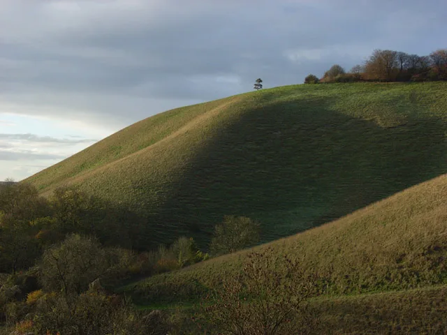
Martinsell Hill
Mountains & hills · 2.4 km

Martinsell viewpoint
Viewpoints · 2.4 km
Nearby
📷 5📷 5Mountains & hills · South East England
Huish Down
Huish Down — mountain in england south east. Elevation: 261 m.
📷 5Mountains & hills · South East England
Giant's Grave
Giant's Grave — mountain in england south east. Elevation: 250 m.
📷 5Vineyards · South East England
Giant's Grave (Martinsell Hill)
Giant's Grave (Martinsell Hill) — a UK vineyard in england south east, producing English or Welsh wine from cool-climate grape varieties.
📷 5Historic bridges · South East England
Pains Bridge At Su 164611
Pains Bridge At Su 164611 — Grade II listed building-listed bridge in england-south-east, United Kingdom.
📷 5Vineyards · South East England
Martinsell Hill Camp
Martinsell Hill Camp — a UK vineyard in england south east, producing English or Welsh wine from cool-climate grape varieties.
Where to eat & stay near Oare House
Places to stay
 📷 5
📷 5Campsites · South East England
Totteridge Farm
Totteridge Farm — a campsite in england south east.
 📷 5
📷 5Campsites · South East England
The Bruce Arms Campsite
The Bruce Arms Campsite — a campsite in england south east.
 📷 5
📷 5Campsites · South East England
The Woodbridge Camp SIte
The Woodbridge Camp SIte — a campsite in england south east.
 📷 5
📷 5 📷 7
📷 7Hotels · South East England
Castle & Ball Hotel
Castle & Ball Hotel — a hotel in england south east.
 📷 7
📷 7Places to eat & drink
 📷 7
📷 7Cafés · South East England
St Peter's and St Paul's
St Peter's and St Paul's — a café in england south east.
 📷 7
📷 7 📷 7
📷 7Historic pubs · South West England
The Queens Head Inn
The Queens Head Inn in England South West, United Kingdom.
 📷 5
📷 5 📷 7
📷 7Historic pubs · South West England
Black Swan Hotel
Black Swan Hotel in England South West, United Kingdom.
 📷 7
📷 7Historic pubs · South East England
The Pelican Public House
The Pelican Public House in England South East, United Kingdom.
More historic houses in this region
 📷 5
📷 5Historic houses · South East England
12 and 14 High Street, Rochester
12 and 14 High Street, Rochester — building in Rochester, Kent, England, UK.
 📷 5
📷 5Historic houses · South East England
Berkeley House
Berkeley House — house in Rochester, Kent, England, UK.
.jpg?width=1200) 📷 5
📷 5Historic houses · South East England
Betchworth House
Betchworth House — house in Betchworth, Mole Valley, England, UK.
 📷 5
📷 5Historic houses · South East England
Bookham Grove
Bookham Grove — building in Mole Valley, Surrey, England, UK.
Frequently asked questions
- Where is Oare House?
- Oare House is in South-East England, United Kingdom (postcode SN8 4JH), in the parish of Wilcot, Huish and Oare.
- What is Oare House?
- Oare House — Grade I listed building in Oare, Wiltshire, England, UK.
- How do I get to Oare House?
- The nearest railway station is Pewsey, about 2.7 km away. The nearest town is Pewsey. Drivers can use postcode SN8 4JH.
- Who owns Oare House?
- Oare House is owned by | landlord =.
- Is Oare House a listed building?
- Oare House is officially recognised as Grade I listed building listed.
- Is Oare House a protected site?
- Yes — Oare House is part of the Pewsey Downs SSSI Site of Special Scientific Interest and the Cotswolds National Landscape (AONB).
- How do I get to Oare House?
- The nearest railway station is Pewsey, about 2.7 km away. Drivers can navigate to postcode SN8 4JH.