Abbeys & priories · North East England
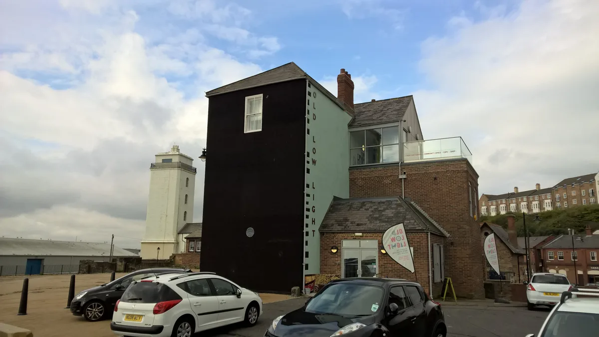
North Shields Fish Quay
In or near South Shields.
North Shields Fish Quay in England North East, United Kingdom.

Les Hull — CC BY-SA 2.0 via Wikimedia Commons licence
Plan your visit
- Typical visit
- 45 min–1.5 h
- Nearest railway station
- Tynemouth · 0.9 km
- Paid entry
- Family-friendly
- Limited wheelchair access
Getting there & planning your visit
To visit North Shields Fish Quay, the nearest railway station is Tynemouth, located 0.9 km away. The postcode for navigation is NE30 1JA. Accessibility is limited for wheelchair users.
About
North Shields Fish Quay is a place of interest in England North East, United Kingdom — drawn from open-data sources for visitor reference. See the linked Wikipedia article for the full description.
Photo gallery
Official information
The Old Low Light is a heritage centre located at North Shields Fish Quay, dedicated to sharing the local history and stories of the area. Visitors can explore exhibitions and events that highlight the town's seafaring past and its community. The centre also plays a role in preserving the historic building, which was once a guiding light for ships entering the Tyne.
From the Wikipedia article
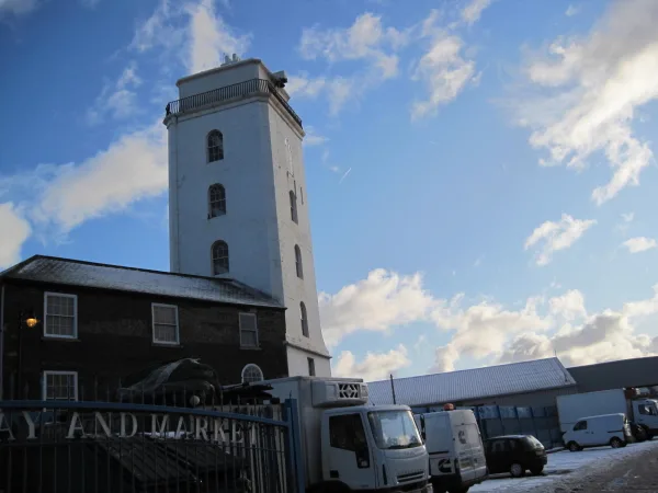
North Shields Fish Quay is a fishing port located close to the mouth of the River Tyne, in North Shields, Tyne and Wear, North East England, 8 miles (13 km) east of the city of Newcastle upon Tyne. The quay was established in 1225 as shielings village (seasonal huts used by hunters or fishermen) around the Pow Burn; the town of North Shields, where it takes its name from the shielings. The quay was originally located to serve the nearby Tynemouth Castle and Priory. The original site is largely derelict industrial land currently being redeveloped, which belonged to the original Tyne Brand canning company. The Pow Burn runs from nearby Northumberland Park and disappears underground at Tynemouth Road and the Metro urban transport line, eventually flowing into the Tyne. The development of North Shields was restricted due to the neighbouring port, Newcastle upon Tyne, which was the region's leading port at the time. Its trade guilds resented trade outside of the city, so that coal mined in North Shields within 300 ft (91.4 m) of the river had to be transported on land 8 miles to Newcastle to be loaded onto boats. In the 18th and 19th centuries, the North Shields Fish Quay High Light and Low Light lighthouses, which now are defunct, provided a line of sight for vessels entering from the river mouth. Before the north and south piers were built, many ships foundered on the rocks known as the Black Middens, which lie to the east of the quay and can be seen at low tide. The site has an original Old High Light and Old Low Light as well as High Light and Low Light, called so because they were positioned low (at river level on the quay) and high (on the bank top some 150 ft higher (46 m)). The present quay was built in 1870 to accommodate the increase in fishing boats after the introduction of steam trawlers. It is the largest English port for prawns. Its proximity to the Dogger Bank has led fishing boats from Whitby and elsewhere on the north east coast to relocate there.…
Excerpt from Wikipedia under CC BY-SA 4.0. See the source article linked in Sources below.
- Coordinates
- 55.0090, -1.4330
- District
- North Tyneside
- Parish
- North Tyneside, unparished area
- Postcode
- NE30 1JA
- Parliamentary constituency
- Tynemouth
- Phone
- +44 191 257 4506
- Nearest railway station
- Tynemouth — 0.9 km
- Official site
- oldlowlight.co.uk
Sources
- wikidata: Q7056633 (CC0)
- wikipedia: North Shields Fish Quay (CC BY-SA 4.0)
Other places nearby

Tynemouth Lifeboat Station
Harbours & ports · 0.0 km
Fish Quay Old Low Light
Lighthouses · 0.1 km

Old Lowlight Heritage Centre
Museums · 0.1 km
Old Low Light
Memorials & monuments · 0.1 km

Clifford's Fort
Memorials & monuments · 0.1 km
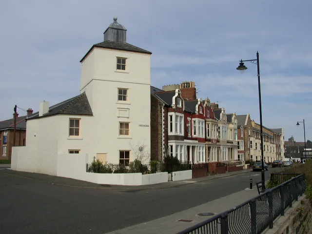
Fish Quay Low Light
Lighthouses · 0.1 km
%2C_Fish_Quay%2C_North_Shields_-_geograph.org.uk_-_7191955.jpg?width=1200)
Fiddlers Green
Heritage railway stations · 0.1 km

Dolphin Mooring Post
Heritage railway stations · 0.2 km

Buoy
Heritage railway stations · 0.2 km

Buoys
Public art & sculpture · 0.2 km
Fish Quay Old High Light
Lighthouses · 0.2 km
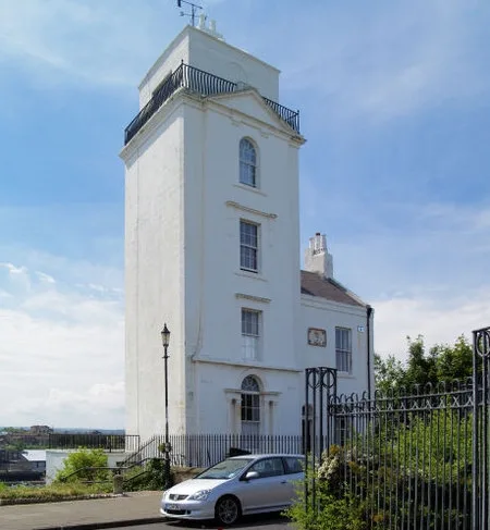
Fish Quay New Lighthouses
Lighthouses · 0.3 km
Nearby
📷 4Harbours & ports · North East England
Tynemouth Lifeboat Station
Tynemouth Lifeboat Station in England North East, United Kingdom.
📷 3Lighthouses · North East England
Fish Quay Old Low Light
Fish Quay Old Low Light — lighthouse in Tyne and Wear, England.
📷 3Museums · North East England
Old Lowlight Heritage Centre
Old Lowlight Heritage Centre — a museum in scotland-lowlands, United Kingdom.
📷 3Memorials & monuments · North East England
Old Low Light
Old Low Light — a memorial in scotland-lowlands, United Kingdom.
📷 4Memorials & monuments · North East England
Clifford's Fort
Clifford's Fort in England North East, United Kingdom.
📷 3Lighthouses · North East England
Fish Quay Low Light
Fish Quay Low Light — lighthouse in Tyne and Wear, England.
Where to eat & stay near North Shields Fish Quay
Places to stay
 📷 5
📷 5B&Bs · North East England
The Clifton
The Clifton — a bed-and-breakfast in scotland lowlands.
📷 5B&Bs · North East England
Forest Guest House
Forest Guest House — a bed-and-breakfast in scotland lowlands.
 📷 5
📷 5Hotels · North East England
The Grand Hotel
The Grand Hotel — a hotel in scotland lowlands.
 📷 5
📷 5Caravan parks · North East England
Sandhaven Caravan Site
Sandhaven Caravan Site — a caravan park in scotland lowlands.
 📷 5
📷 5B&Bs · North East England
York House Hotel
York House Hotel — a bed-and-breakfast in scotland lowlands.
 📷 5
📷 5Caravan parks · North East England
Lizard Lane Caravan Park
Lizard Lane Caravan Park — a caravan park in scotland lowlands.
Places to eat & drink
 📷 5
📷 5Historic pubs · North East England
The Kirkpatrick
The Kirkpatrick in England North East, United Kingdom.
 📷 5
📷 5Historic pubs · North East England
The Scotia Public House
The Scotia Public House in England North East, United Kingdom.
 📷 5
📷 5Cafés · North East England
Caffè Nero
Caffè Nero — a café in scotland lowlands. Cuisine: coffee shop. Brand: Caffè Nero.
 📷 5
📷 5Historic pubs · North East England
Marsden Grotto
Marsden Grotto in England North East, United Kingdom.
 📷 5
📷 5Historic pubs · North East England
The Albert Public House
The Albert Public House in England North East, United Kingdom.
 📷 3
📷 3Historic pubs · North East England
The Kings Arms
The Kings Arms — Historic pub — listed building or notable heritage status.
More abbeys in this region
 📷 5
📷 5Abbeys & priories · North East England
Egglestone Abbey
Egglestone Abbey is a abbey in the United Kingdom.
 📷 5
📷 5 📷 4
📷 4Abbeys & priories · North East England
St Cuthbert's Way
St Cuthbert's Way in England North East, United Kingdom.
 Flagship📷 3
Abbeys & priories · North East England
The Abbey, Skirwith
The Abbey, Skirwith in England North East, United Kingdom.
Frequently asked questions
- Where is North Shields Fish Quay?
- North Shields Fish Quay is in North-East England, United Kingdom (postcode NE30 1JA), in the parish of North Tyneside, unparished area.
- What is North Shields Fish Quay?
- North Shields Fish Quay in England North East, United Kingdom.
- How do I get to North Shields Fish Quay?
- The nearest railway station is Tynemouth, about 0.9 km away. Drivers can use postcode NE30 1JA.
- How do I get to North Shields Fish Quay?
- The nearest railway station is Tynemouth, about 0.9 km away. Drivers can navigate to postcode NE30 1JA.