
Historic churches · East Midlands
North Scarle
In or near South Clifton.
North Scarle is a village and civil parish in the North Kesteven district of Lincolnshire, England. The population of the civil parish at the 2011 census was 640. The village is situated close to th

Alan Murray-Rust — CC BY-SA 2.0 via Wikimedia Commons licence
_-_geograph.org.uk_-_3054994.jpg)
Plan your visit
- Typical visit
- 30 min–1 h
- Nearest railway station
- Swinderby · 3.2 km
- Free entry
Getting there & planning your visit
To visit North Scarle, the nearest railway station is Swinderby, located 3.2 km away. The postcode for navigation is LN6 9EF, and entry to the church is free.
About
North Scarle is a village and civil parish in the North Kesteven district of Lincolnshire, England. The population of the civil parish at the 2011 census was 640. The village is situated close to the River Trent, about 8 miles (13 km) south-west from the city and county town of Lincoln, and on the county boundary with Nottinghamshire. The parish church is dedicated to All Saints and is a Grade I listed building dating from the 12th century, although it was destroyed by fire in 1342 and rebuilt directly after. In 1898 it was extensively restored and a north aisle was built by Sir Ninian Comper. The 19th-century clergyman and Australian police commander Henry Inman was rector of All Saints for 36 years and is interred in the churchyard. Village amenities include a village hall, post office, heritage centre, The White Hart public house, a Methodist hall, a sports and social club and playing fields, and a Primary School. There is also a miniature railway.
Photo gallery
From the Wikipedia article
North Scarle is a village and civil parish in the North Kesteven district of Lincolnshire, England. The population of the civil parish at the 2011 census was 640. The village is situated close to the River Trent, about 8 miles (13 km) south-west from the city and county town of Lincoln, and on the county boundary with Nottinghamshire. The parish church is dedicated to All Saints and is a Grade I listed building dating from the 12th century, although it was destroyed by fire in 1342 and rebuilt directly after. In 1898 it was extensively restored and a north aisle was built by Sir Ninian Comper. The 19th-century clergyman and Australian police commander Henry Inman was rector of All Saints for 36 years and is interred in the churchyard. Village amenities include a village hall, post office, heritage centre, The White Hart public house, a Methodist hall, a sports and social club and playing fields, and a Primary School. There is also a miniature railway.
Excerpt from Wikipedia under CC BY-SA 4.0. See the source article linked in Sources below.
- Coordinates
- 53.1935, -0.7297
- County
- Lincolnshire
- District
- North Kesteven
- Parish
- North Scarle
- Postcode
- LN6 9EF
- Parliamentary constituency
- Sleaford and North Hykeham
- Nearest railway station
- Swinderby — 3.2 km
Sources
- wikipedia: North Scarle (CC BY-SA 4.0)
Other places nearby

Lowfields
Caravan parks · 1.4 km

St Cecilia's Church, Girton
Historic churches · 2.6 km
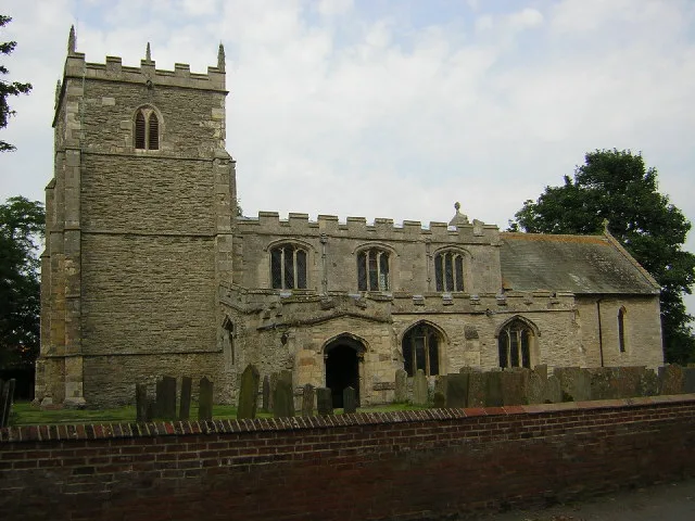
St Helena's Church, South Scarle
Historic churches · 2.6 km

Eagle
Villages · 2.7 km

War Memorial Arch
Memorials & monuments · 2.7 km

South Scarle
Villages · 3.0 km
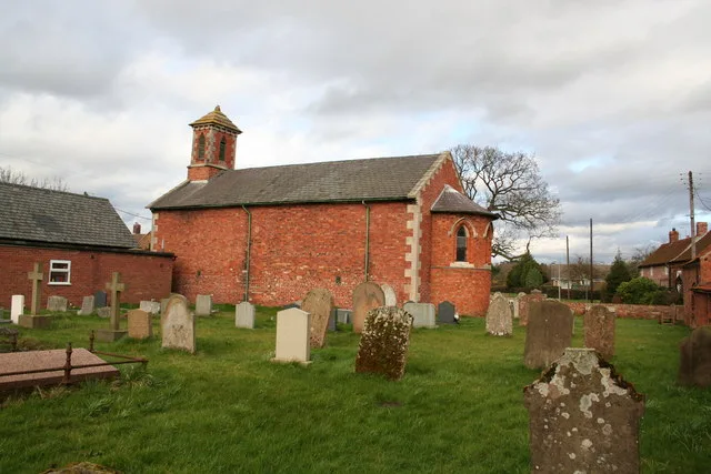
Holy Trinity Church, Besthorpe
Historic churches · 3.3 km

Tunman Wood
Wildlife reserves · 4.2 km

Swinderby
Historic churches · 4.4 km

South Clifton
Towns & cities · 4.4 km
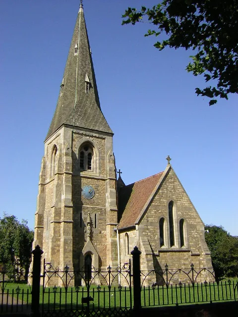
All Saints' Church, Harby
Historic churches · 4.5 km

Harby-with-Swinethorpe War Memorial
Memorials & monuments · 4.5 km
Nearby
📷 5📷 5Historic churches · East Midlands
St Cecilia's Church, Girton
St Cecilia's Church, Girton — Grade II listed building-listed church in england-east-midlands, United Kingdom.
📷 5Historic churches · East Midlands
St Helena's Church, South Scarle
St Helena's Church, South Scarle — church in Newark and Sherwood, Nottinghamshire, England, UK.
📷 5📷 3Memorials & monuments · East Midlands
War Memorial Arch
War Memorial Arch — Grade II listed building-listed memorial in england-east-midlands, United Kingdom.
📷 5Where to eat & stay near North Scarle
Places to stay
📷 5 📷 5
📷 5Campsites · East Midlands
Marnham Lake Fishing and Camping
Marnham Lake Fishing and Camping — a campsite in england east midlands.
 📷 5
📷 5Campsites · East Midlands
Brownlow Arms Camp Site
Brownlow Arms Camp Site — a campsite in england east midlands.
 📷 5
📷 5Caravan parks · East Midlands
Marnham Meadows Holiday Park and Fishing Lake
Marnham Meadows Holiday Park and Fishing Lake — a caravan park in england east midlands.
📷 5Caravan parks · East Midlands
Trentside Caravan Park
Trentside Caravan Park — a caravan park in england east midlands.
 📷 3
📷 3Caravan parks · East Midlands
Cathedral View Holiday Park
Cathedral View Holiday Park — a caravan park in england east midlands.
Places to eat & drink
 📷 5
📷 5 📷 5
📷 5Historic pubs · East Midlands
The Newcastle Arms
The Newcastle Arms in England East Midlands, United Kingdom.
 📷 5
📷 5Cafés · East Midlands
Little Lincoln Cafe
Little Lincoln Cafe — a café in england east midlands.
 📷 5
📷 5Cafés · East Midlands
Madame Waffle
Madame Waffle — a café in england east midlands.
 📷 5
📷 5Historic pubs · East Midlands
268, High Street
268, High Street in England East Midlands, United Kingdom.
 📷 5
📷 5Restaurants · East Midlands
Cafe Zoot
Cafe Zoot — a restaurant in england east midlands.
More places in this region
 📷 5
📷 5Historic churches · East Midlands
All Saints' Church, Stamford
All Saints' Church, Stamford — church in Stamford, Lincolnshire, England, UK.
 📷 5
📷 5Historic churches · East Midlands
Church of All Saints
Church of All Saints — church in Little Casterton, Rutland, United Kingdom.
 📷 5
📷 5Historic churches · East Midlands
Church of All Saints
Church of All Saints — church in Fenland, UK.
 📷 5
📷 5Historic churches · East Midlands
Church of St Leonard
Church of St Leonard — church in Fenland, UK.
Frequently asked questions
- Where is North Scarle?
- North Scarle is in Lincolnshire, the East Midlands, United Kingdom (postcode LN6 9EF), in the parish of North Scarle.
- What is North Scarle?
- North Scarle is a village and civil parish in the North Kesteven district of Lincolnshire, England. The population of the civil parish at the 2011 census was 640. The village is situated close to th
- How do I get to North Scarle?
- The nearest railway station is Swinderby, about 3.2 km away. Drivers can use postcode LN6 9EF.
- Is North Scarle free to visit?
- Yes, North Scarle is free to enter.
- How do I get to North Scarle?
- The nearest railway station is Swinderby, about 3.2 km away. Drivers can navigate to postcode LN6 9EF.