
Public art & sculpture · London
North Downs
In or near Great Bookham.
North Downs — a public art in england-london, United Kingdom.

Mike Pennington — CC BY-SA 2.0 via Wikimedia Commons licence

Plan your visit
- Typical visit
- 1 h–2 h
- Nearest railway station
- Leatherhead · 1.9 km
- Free entry
- Dog-friendly
Getting there & planning your visit
To visit North Downs, the nearest railway station is Leatherhead, located 1.9 km away. The postcode for your sat-nav is KT22 9BS, and entry is free.
About
North Downs is a public art located in england-london, United Kingdom. Sourced from OpenStreetMap (ODbL licence); see local listings for visitor information, opening hours and admission details.
Photo gallery
See it from the streetimagery from 2018
Imagery © Mapillary contributors, CC BY-SA 4.0
Protected designations
- Area of Outstanding Natural Beauty: Surrey Hills
Designations sourced from Natural England open data under OGL v3.
From the Wikipedia article
The North Downs are a ridge of chalk hills and an area of downland in south-east England, that stretch from Farnham in Surrey to the White Cliffs of Dover in Kent. Much of the North Downs comprises two Areas of Outstanding Natural Beauty (AONBs): the Surrey Hills and the Kent Downs. The North Downs Way National Trail runs along the North Downs from Farnham to Dover. They form the northern boundary of the Weald, which is correspondingly bounded to the south by the South Downs. The highest point in the North Downs is Botley Hill, Surrey (270 metres (890 ft) above sea level). The County Top of Kent is Betsom's Hill (251 m (823 ft) above sea level), which is less than 1 km from Westerham Heights, Bromley, the highest point in Greater London at an elevation of 245 m (804 ft).
Excerpt from Wikipedia under CC BY-SA 4.0. See the source article linked in Sources below.
Background
History
Worked flints and human and animal remains dating from the Lower Paleolithic, about 400,000 years ago, were discovered at Barnfield Pit near Swanscombe; this provides the earliest evidence of human occupation in the North Downs. It is suggested that human activity at that time coincided with intermittent warm phases during the last glacial period and that continuous occupation of the Downs did not occur until warming after the glaciation. Flint axes have also been found on river terraces at Farnham, on Walton and Banstead Heaths and on the crest of the escarpment above Folkestone. There is considerable evidence of Mesolithic activity in the Surrey Downs through the discovery of…
Sourced from Wikipedia under CC BY-SA 4.0.
- Coordinates
- 51.2832, -0.3434
- County
- Surrey
- District
- Mole Valley
- Parish
- Mole Valley, unparished area
- Postcode
- KT22 9BS
- Parliamentary constituency
- Dorking and Horley
- Nearest railway station
- Leatherhead — 1.9 km
Sources
- osm: node/1627652986 (ODbL)
- wikipedia: North Downs (CC BY-SA 4.0)
Other places nearby
Bockett's Farm Park
Parks · 0.1 km

50 years of Peace
Memorials & monuments · 0.5 km
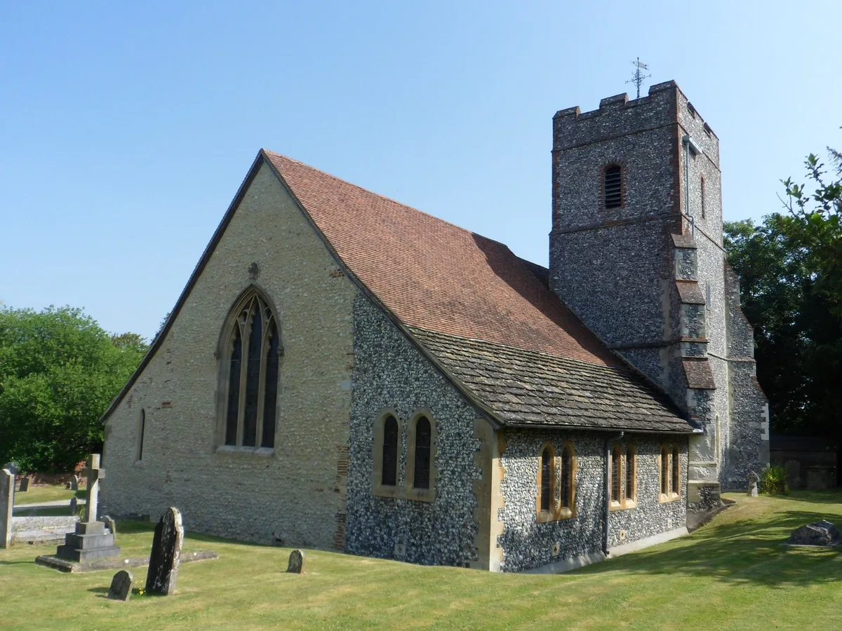
Church of St. Mary, Fetcham
Historic churches · 0.9 km

Fetcham Park House
Historic houses · 0.9 km

Coster Monument Approximately 3 Metres West Of North West Corner Of Church Of St Mary
Memorials & monuments · 0.9 km

London viewpoint
Viewpoints · 1.0 km
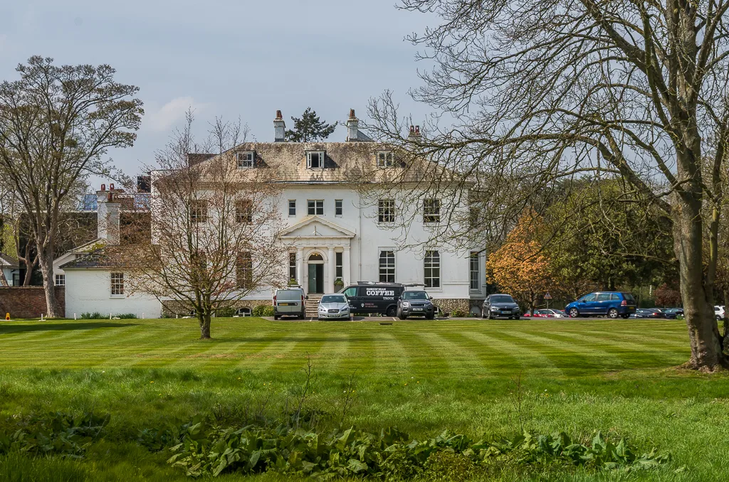
Thorncroft Manor
Stately homes · 1.2 km

Surrey Society of Model Engineers
Natural landmarks · 1.2 km

Bockets Farm to Crabtree Lane (BW 23)
Mountain bike trails · 1.4 km

Norbury Park House
Manor houses · 1.4 km

Norbury Park
Parks · 1.4 km

Downside Manor
Manor houses · 1.4 km
Nearby
📷 5Parks · London
Bockett's Farm Park
Bockett's Farm Park — a other in england-london, United Kingdom.
📷 5Memorials & monuments · London
50 years of Peace
50 years of Peace — a memorial in england-london, United Kingdom.
📷 5Historic churches · London
Church of St. Mary, Fetcham
Church of St. Mary, Fetcham — church in Mole Valley, UK.
📷 5Historic houses · London
Fetcham Park House
Fetcham Park House — house in Mole Valley, Surrey, England, UK.
📷 5Memorials & monuments · London
Coster Monument Approximately 3 Metres West Of North West Corner Of Church Of St Mary
Coster Monument Approximately 3 Metres West Of North West Corner Of Church Of St Mary — Grade II listed building-listed memorial in england-london, United Kingdom.
📷 5Viewpoints · South East England
London viewpoint
London viewpoint is a viewpoint in the United Kingdom.
Where to eat & stay near North Downs
Places to stay
 📷 5
📷 5 📷 7
📷 7Hotels · London
Woodlands Park Hotel
Woodlands Park Hotel — a hotel in england london.
 📷 5
📷 5Caravan parks · South East England
Conifer Park Caravan Site
Conifer Park Caravan Site — a caravan park in england london.
 📷 5
📷 5Campsites · South East England
Ranmore Common Campsite
Ranmore Common Campsite — a campsite in england london.
 📷 5
📷 5Campsites · London
Polyapes Scout Camp
Polyapes Scout Camp — a campsite in england london.
 📷 5
📷 5Campsites · South East England
Dorking Scouts Camp Site
Dorking Scouts Camp Site — a campsite in england london.
Places to eat & drink
 📷 5
📷 5 📷 5
📷 5Historic pubs · South East England
The Windsor Castle Public House
The Windsor Castle Public House in England South East, United Kingdom.
 📷 5
📷 5Historic pubs · London
The Leg Of Mutton And Cauliflower Public House
The Leg Of Mutton And Cauliflower Public House in England London, United Kingdom.
 📷 7
📷 7 📷 7
📷 7Historic pubs · South East England
Duke Of Wellington Public House
Duke Of Wellington Public House in England South East, United Kingdom.
 📷 5
📷 5Historic pubs · London
The Cricketers Public House
The Cricketers Public House in England London, United Kingdom.
More places in this region
 📷 5
📷 5Public art & sculpture · London
33
33 — Public artwork (architecture) by Studio Weave.
 📷 5
📷 5Public art & sculpture · London
A Conversation with Oscar Wilde
A Conversation with Oscar Wilde — Public artwork (sculpture).
 📷 5
📷 5Public art & sculpture · London
A Sculpture for Mary Wollstonecraft
A Sculpture for Mary Wollstonecraft — Public artwork (sculpture) by Maggi Hambling.
 📷 5
📷 5Public art & sculpture · London
A Slice of Reality
A Slice of Reality — Public artwork (installation) by Richard Wilson.
Frequently asked questions
- Where is North Downs?
- North Downs is in Surrey, London, United Kingdom (postcode KT22 9BS), in the parish of Mole Valley, unparished area.
- What is North Downs?
- North Downs — a public art in england-london, United Kingdom.
- How do I get to North Downs?
- The nearest railway station is Leatherhead, about 1.9 km away. Drivers can use postcode KT22 9BS.
- Is North Downs a protected site?
- Yes — North Downs is part of the Surrey Hills National Landscape (AONB).
- Is North Downs free to visit?
- Yes, North Downs is free to enter.
- How do I get to North Downs?
- The nearest railway station is Leatherhead, about 1.9 km away. Drivers can navigate to postcode KT22 9BS.