
Museums · East of England
Norfolk
In or near Swanton Morley.
Norfolk ( NOR-fək, -fuuk) is a ceremonial county in England, located in the East of England and East Anglia. It borders Lincolnshire and The Wash to the north-west, the North Sea to the north and eas

habiloid — CC BY-SA 2.0 via Wikimedia Commons licence
%2C_Dereham_-_geograph.org.uk_-_7704035.jpg)
Plan your visit
- Typical visit
- 1.5 h–3 h
- Best time of year
- Year-round
- Nearest railway station
- Dereham · 0.7 km
- Family-friendly
- Limited wheelchair access
Getting there & planning your visit
To visit the Norfolk museum, the nearest railway station is Dereham, which is 0.7 km away. The postcode for navigation is NR20 3TR. Please note that wheelchair accessibility is limited.
About
Norfolk ( NOR-fək, -fuuk) is a ceremonial county in England, located in the East of England and East Anglia. It borders Lincolnshire and The Wash to the north-west, the North Sea to the north and east, Cambridgeshire to the west, and Suffolk to the south. The largest settlement is the city of Norwich. The county has an area of 2,074 mi2 (5,370 km2) and had an estimated population of 940,359 in 2024. It is predominantly rural. Norwich is in the centre-east of the county, and its other principal settlements include Great Yarmouth on the east coast, Thetford in the south, and King's Lynn in the north-west. For local government purposes Norfolk is a non-metropolitan county with seven districts. The centre of Norfolk is gently undulating lowland. To the east are the northern half of the Broads, a network of rivers and lakes which extend into Suffolk and have a similar status to a national park. The west of the county contains part of the Fens, and to the south is part of Thetford Forest. The geology of the county includes clay and chalk deposits, which make its coast susceptible to erosion; the northern coast has been designated a national landscape. There is evidence of Prehistoric settlement in Norfolk. In the Roman era the region was home to the Iceni, whose leader Boudica led a major revolt in AD60. The Angles settled the area in the 5th century, after which it became part of the Kingdom of East Anglia. During the later Middle Ages the county was prosperous and heavily involv
Photo gallery
See it from the streetimagery from 2024
Imagery © Mapillary contributors, CC BY-SA 4.0
Protected designations
- Site of Special Scientific Interest: River Wensum SSSI
Designations sourced from Natural England open data under OGL v3.
From the Wikipedia article
Norfolk ( NOR-fək, -fuuk) is a ceremonial county in England, located in the East of England and East Anglia. It borders Lincolnshire and The Wash to the north-west, the North Sea to the north and east, Cambridgeshire to the west, and Suffolk to the south. The largest settlement is the city of Norwich. The county has an area of 2,074 mi2 (5,370 km2) and had an estimated population of 940,359 in 2024. It is predominantly rural. Norwich is in the centre-east of the county, and its other principal settlements include Great Yarmouth on the east coast, Thetford in the south, and King's Lynn in the north-west. For local government purposes Norfolk is a non-metropolitan county with seven districts. The centre of Norfolk is gently undulating lowland. To the east are the northern half of the Broads, a network of rivers and lakes which extend into Suffolk and have a similar status to a national park. The west of the county contains part of the Fens, and to the south is part of Thetford Forest. The geology of the county includes clay and chalk deposits, which make its coast susceptible to erosion; the northern coast has been designated a national landscape. There is evidence of Prehistoric settlement in Norfolk. In the Roman era the region was home to the Iceni, whose leader Boudica led a major revolt in AD60. The Angles settled the area in the 5th century, after which it became part of the Kingdom of East Anglia. During the later Middle Ages the county was prosperous and heavily involved in the wool trade; this allowed the construction of many large churches. In 1549 Norfolk was the scene of Kett's Rebellion, which unsuccessfully protested the enclosure of land. The county was not heavily industrialised during the Industrial Revolution, and Norwich lost its status as one of England's largest cities. The contemporary economy is largely based on agriculture and tourism.
Excerpt from Wikipedia under CC BY-SA 4.0. See the source article linked in Sources below.
Background
History
The area that was to become Norfolk was settled in pre-Roman times (there were Palaeolithic settlers as early as 950,000 years ago), with camps along the higher land in the west, where flints could be quarried. A Brittonic tribe, the Iceni, emerged in the 1st century BC. The Iceni revolted against the Roman invasion in AD 47, and again in 60 led by Boudica. The crushing of the second rebellion opened the area to the Romans. During the Roman era roads and ports were constructed throughout the area and farming was widespread. Situated on the east coast, the homelands of the Iceni were vulnerable to attacks from continental Europe and other parts of Britain, and forts were built to defend…
Description
The Pavilion Theatre is a 510-seater venue on the end of Cromer Pier, best known for hosting the 'end-of-the-pier' show, the Seaside Special. The theatre also presents comedy, music, dance, opera, musicals and community shows. The Britannia Pier Theatre (Great Yarmouth) mainly hosts popular comedy acts such as the Chuckle Brothers and Jim Davidson. The theatre has 1,200 seats and is one of the largest in Norfolk. The Theatre Royal in Norwich has been on its present site for over 250 years, having been authorised by the Norwich Theatre Act 1768 (8 Geo. 3. c. 28). The 1,300-seat theatre, the largest in the city, hosts a mix of national touring productions including musicals, dance, drama,…
Visiting
Norfolk is a popular tourist destination and has several major holiday attractions. There are many seaside resorts, including some of the finest British beaches, such as those at Great Yarmouth, Cromer and Holkham. Norfolk contains the Broads and other areas of outstanding natural beauty and many areas of the coast are wild bird sanctuaries and reserves with some areas designated as protected landscapes such as the Norfolk Coast AONB. <gallery widths="200px" heights="150px"> File:ElmHill.jpg| File:Mundesleybeachnorth.jpg| File:WroxhamBridge.jpg| File:Peddars Way - Holkham Bay.jpg| </gallery> Charles III's residence at Sandringham House in Sandringham provides a year-round tourist attraction…
Sourced from Wikipedia under CC BY-SA 4.0.
- Coordinates
- 52.6725, 0.9500
- County
- Norfolk
- District
- Breckland
- Parish
- Dereham
- Postcode
- NR20 3TR
- Parliamentary constituency
- Mid Norfolk
- Nearest railway station
- Dereham — 0.7 km
- Official site
- norfolk.gov.uk
Sources
- wikipedia: Norfolk (CC BY-SA 4.0)
Other places nearby

Lord Admiral Nelson
Public art & sculpture · 0.4 km

Mid-Norfolk Railway Museum Room
Museums · 0.7 km

Memorial Hall
Theatres · 0.9 km

King's Head Hotel
Hotels · 1.0 km

Dereham Windmill
Windmills · 1.0 km

Dereham Village Sign
Public art & sculpture · 1.1 km
Puzzlescape
Escape rooms · 1.1 km
Dereham
Museums · 1.2 km
Hollywood Cinema
Theatres · 1.2 km

Cowper Congregational Church
Memorials & monuments · 1.2 km
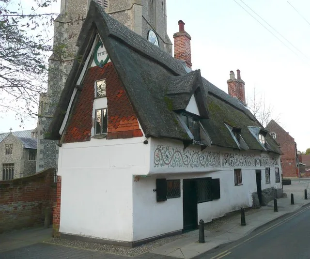
Bishop Bonner's Cottage Museum
Museums · 1.2 km

Bishop Bonner's Cottage
Archaeological sites · 1.2 km
Nearby
📷 3Public art & sculpture · East of England
Lord Admiral Nelson
Lord Admiral Nelson — a public art in england-east, United Kingdom.
📷 3Museums · East of England
Mid-Norfolk Railway Museum Room
Mid-Norfolk Railway Museum Room — a museum in england-east, United Kingdom.
📷 3📷 7Hotels · East of England
King's Head Hotel
King's Head Hotel — a hotel in england east.
📷 3Windmills · East of England
Dereham Windmill
Dereham Windmill is a windmill in the United Kingdom.
📷 3Public art & sculpture · East of England
Dereham Village Sign
Dereham Village Sign — a public art in england-east, United Kingdom.
Where to eat & stay near Norfolk
Places to stay
📷 7Hotels · East of England
King's Head Hotel
King's Head Hotel — a hotel in england east.
 📷 7
📷 7Hotels · East of England
The Romany Rye
The Romany Rye — a hotel in england east.
 📷 5
📷 5 📷 5
📷 5Caravan parks · East of England
Swallow Lodge
Swallow Lodge — a caravan park in england east midlands.
 📷 3
📷 3Campsites · East of England
Park Farm Camping
Park Farm Camping — a campsite in england east midlands.
 📷 5
📷 5Places to eat & drink
 📷 5
📷 5Historic pubs · East of England
Green Dragon Public House
Green Dragon Public House in England East, United Kingdom.
 📷 5
📷 5 📷 5
📷 5Historic pubs · East of England
Griffin Hotel, Attleborough
Griffin Hotel, Attleborough in England East, United Kingdom.
 📷 5
📷 5Restaurants · East of England
Swaffham Kebab & Pizza House
Swaffham Kebab & Pizza House — a restaurant in england east.
 📷 5
📷 5Historic pubs · East of England
The Rampant Horse Inn
The Rampant Horse Inn in England East, United Kingdom.
 📷 5
📷 5More museums in this region
 📷 5
📷 5Museums · East of England
American Air Museum
American Air Museum — museum at Imperial War Museum Duxford, Cambridgeshire, England, UK.
 📷 5
📷 5Museums · East of England
Ashwell Village Museum
Ashwell Village Museum — historic building museum in Ashwell, Hertfordshire, England, United Kingdom.
 📷 5
📷 5Museums · East of England
Barleylands Farm Museum
Barleylands Farm Museum — Farm museum in Billericay, England.
 📷 5
📷 5Museums · East of England
Cromwell Museum
Cromwell Museum — museum in Huntingdon, England, United Kingdom.
Frequently asked questions
- Where is Norfolk?
- Norfolk is in Norfolk, East of England, United Kingdom (postcode NR20 3TR), in the parish of Dereham.
- What is Norfolk?
- Norfolk ( NOR-fək, -fuuk) is a ceremonial county in England, located in the East of England and East Anglia. It borders Lincolnshire and The Wash to the north-west, the North Sea to the north and eas
- How do I get to Norfolk?
- The nearest railway station is Dereham, about 0.7 km away. Drivers can use postcode NR20 3TR.
- Is Norfolk a protected site?
- Yes — Norfolk is part of the River Wensum SSSI Site of Special Scientific Interest.
- How do I get to Norfolk?
- The nearest railway station is Dereham, about 0.7 km away. Drivers can navigate to postcode NR20 3TR.