
Memorials & monuments · North East England
Newcastle town wall
Also known as: Balla baile Newcastle
In or near Newcastle upon Tyne.
Newcastle town wall in England North East, United Kingdom.

Mike Quinn — CC BY-SA 2.0 via Wikimedia Commons licence
_-_geograph.org.uk_-_4508147.jpg)
Plan your visit
- Typical visit
- 15 min–45 min
- Nearest railway station
- St James · 0.3 km
- Free entry
- Dog-friendly
Getting there & planning your visit
Newcastle town wall is located in Newcastle upon Tyne, postcode NE4 5SR. The nearest railway station is St James, which is 0.3 km away. Entry to the site is free.
About
Newcastle town wall is a place of interest in England North East, United Kingdom — drawn from open-data sources for visitor reference. See the linked Wikipedia article for the full description.
Photo gallery
See it from the streetimagery from 2019
Imagery © Mapillary contributors, CC BY-SA 4.0
From the Wikipedia article
The Newcastle town wall is a medieval defensive wall, and Scheduled Ancient Monument, in Newcastle upon Tyne, northern England. It was built during the 13th and 14th centuries, and helped protect the town from attack and occupation during times of conflict. It was approximately 3 kilometres (2 mi) long, at least 2 metres (6.5 ft) thick, up to 7.6 metres (25 ft) high, and had six main gates: Close Gate, West Gate, New Gate, Pilgrim Gate, Pandon Gate and Sand Gate. It also had seventeen towers, as well as several smaller turrets and postern gates. The town wall was kept in good repair whilst there was a threat of invasion from Scottish armies, and the town was successfully defended on at least two occasions; but with the decline of the border wars between England and Scotland, the wall was allowed to deteriorate. During the English Civil War, the Scots were able to breach the wall using mines and artillery. By the mid-18th century the wall had become obsolete and, as the town was redeveloped, large sections were demolished leaving only parts standing. The most substantial remains are the West Walls, on the western side of the city.
Excerpt from Wikipedia under CC BY-SA 4.0. See the source article linked in Sources below.
Background
Architecture
The town wall was constructed during the 13th and 14th centuries to repel Scottish invaders. Newcastle is about 100 km from the River Tweed, which then marked the border between England and Scotland. At that time there was a power struggle between England and Scotland, that eventually led to the Wars of Scottish Independence. The Scottish kings were always ready to take advantage of any weakness in English rule to invade the North of England. An example of this is David I of Scotland, who took advantage of the civil war between Stephen and Matilda to invade Northumberland in three successive years—1136–8. In the Treaty of Durham (1139), David's son Henry was given the earldom of…
Sourced from Wikipedia under CC BY-SA 4.0.
- Coordinates
- 54.9717, -1.6214
- District
- Newcastle upon Tyne
- Parish
- Newcastle upon Tyne, unparished area
- Postcode
- NE4 5SR
- Parliamentary constituency
- Newcastle upon Tyne Central and West
- Nearest railway station
- St James — 0.3 km
- Official site
- www.newcastle.gov.uk
Sources
- wikidata: Q7017551 (CC0)
- wikipedia: Newcastle town wall (CC BY-SA 4.0)
Other places nearby

Herber Tower
Memorials & monuments · 0.0 km

Hadrian's Tower
Other places · 0.1 km

Durham Tower
Memorials & monuments · 0.1 km
Morden Tower
Memorials & monuments · 0.1 km

Chinatown
Other places · 0.1 km

Blackfriars Friary
Archaeological sites · 0.1 km

Tyne Theatre and Opera House
Open-air theatres · 0.1 km
The Town Wall
Memorials & monuments · 0.1 km

Blackfriars Church
Historic houses · 0.1 km

Ever Changing
Other places · 0.1 km

BlackFriars, Newcastle-upon-Tyne
Abbeys & priories · 0.1 km
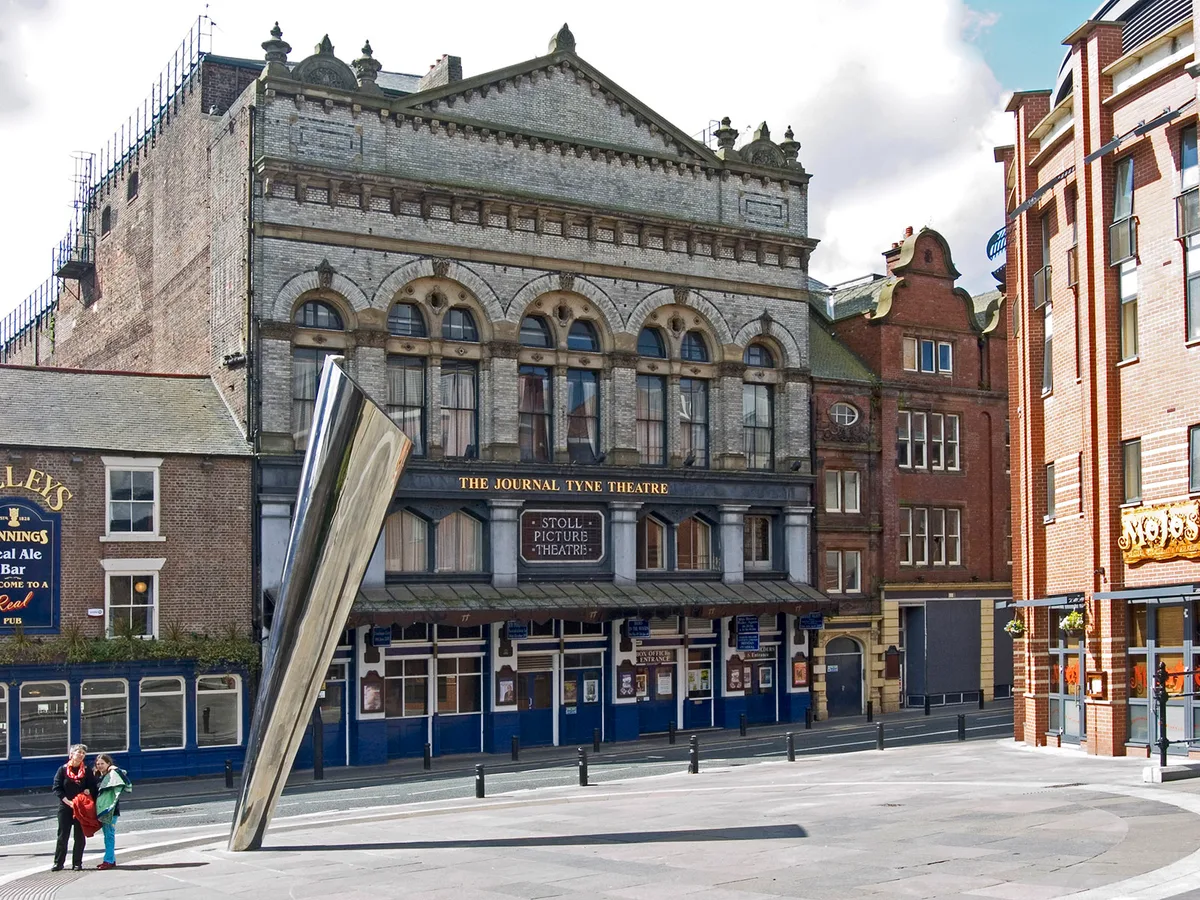
Tyne Theatre and Opera House
Theatres · 0.1 km
Nearby
📷 3Memorials & monuments · North East England
Herber Tower
Herber Tower — a memorial in scotland-lowlands, United Kingdom.
📷 4Other places · North East England
Hadrian's Tower
Hadrian's Tower in England North East, United Kingdom.
📷 5Memorials & monuments · North East England
Durham Tower
Durham Tower — a memorial in scotland-lowlands, United Kingdom.
📷 4Memorials & monuments · North East England
Morden Tower
Morden Tower in England North East, United Kingdom.
📷 5Other places · North East England
Chinatown
Chinatown in England North East, United Kingdom.
📷 5Archaeological sites · North East England
Blackfriars Friary
Blackfriars Friary — a archaeological site in scotland lowlands.
Where to eat & stay near Newcastle town wall
Places to stay
 📷 5
📷 5Hotels · North East England
Maldron Hotel Newcastle
Maldron Hotel Newcastle — a hotel in scotland lowlands. 4-star. Brand: Maldron Hotels.
 📷 5
📷 5Hostels · North East England
Albatross Hostel
Albatross Hostel — a hostel in scotland lowlands.
 📷 5
📷 5Hotels · North East England
The County Hotel
The County Hotel — a hotel in scotland lowlands.
 📷 5
📷 5Hostels · North East England
Heroes Bunkz
Heroes Bunkz — a hostel in scotland lowlands.
 📷 5
📷 5Hotels · North East England
Hampton by Hilton Newcastle
Hampton by Hilton Newcastle — a hotel in scotland lowlands. 3.5-star. Brand: Hampton.
Places to eat & drink
 📷 5
📷 5Historic pubs · North East England
Liberty House
Liberty House in Scotland Lowlands, United Kingdom.
 📷 5
📷 5Historic pubs · North East England
The Cordwainers' Public House
The Cordwainers' Public House in Scotland Lowlands, United Kingdom.
 📷 5
📷 5Historic pubs · North East England
Theatre Royal Lounge And Restaurant; The Royal Public House
Theatre Royal Lounge And Restaurant; The Royal Public House in Scotland Lowlands, United Kingdom.
 📷 5
📷 5 📷 5
📷 5Historic pubs · North East England
The Balmoral Public House
The Balmoral Public House in Scotland Lowlands, United Kingdom.
 📷 5
📷 5Restaurants · North East England
Cilantro
Cilantro — a restaurant in scotland lowlands.
More memorials in this region
 📷 3
📷 3Memorials & monuments · North East England
Hurworth and Neasham War Memorial
Hurworth and Neasham War Memorial — Grade II listed building-listed memorial in england-yorkshire, United Kingdom.
 📷 3
📷 3Memorials & monuments · North East England
Fryingpan Stone
Fryingpan Stone — a memorial in england-yorkshire, United Kingdom.
 📷 3
📷 3Memorials & monuments · North East England
Yoak Stone
Yoak Stone — a memorial in england-yorkshire, United Kingdom.
 📷 3
📷 3Memorials & monuments · North East England
Pump Cottage 1680
Pump Cottage 1680 — a memorial in england-yorkshire, United Kingdom.
Frequently asked questions
- Where is Newcastle town wall?
- Newcastle town wall is in North-East England, United Kingdom (postcode NE4 5SR), in the parish of Newcastle upon Tyne, unparished area.
- What is Newcastle town wall?
- Newcastle town wall in England North East, United Kingdom.
- How do I get to Newcastle town wall?
- The nearest railway station is St James, about 0.3 km away. Drivers can use postcode NE4 5SR.
- Is Newcastle town wall free to visit?
- Yes, Newcastle town wall is free to enter.
- How do I get to Newcastle town wall?
- The nearest railway station is St James, about 0.3 km away. Drivers can navigate to postcode NE4 5SR.