
Historic houses · South West England
Neston Park
In or near Box.
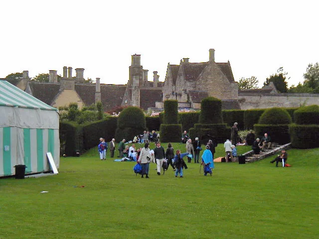
Neston Park — architectural structure in Corsham, Wiltshire, England, UK.
.jpg?width=1200)
Wikimedia Commons contributors — see linked file page for photographer and licence licence
.jpg)
Plan your visit
- Typical visit
- 1 h–2 h
- Nearest railway station
- Melksham · 4.6 km
- Family-friendly
- Limited wheelchair access
Getting there & planning your visit
To visit Neston Park, the nearest railway station is Melksham, located 4.6 km away. The postcode for sat-nav is SN13 9TG. Accessibility is limited for wheelchair users.
About
Neston Park is a historic house in the United Kingdom — typically a country seat, manor, or town house with notable architecture or history. Heritage designation: Grade II* listed building. Wikidata describes it as: "architectural structure in Corsham, Wiltshire, England, UK". Coordinates: 51.4030°, -2.2000°.
Photo gallery
Protected designations
- Area of Outstanding Natural Beauty: Cotswolds
Designations sourced from Natural England open data under OGL v3.
From the Wikipedia article
Neston Park is an English country house and estate in the village of Neston, some 2 miles (3 km) south of Corsham, Wiltshire. The name of the village of Neston is derived from the name of the house. The present house dates from 1790 and has been extended several times since then. It is ashlar-built in two storeys (three storeys at rear) with a frontage of eight bays, and is Grade II* listed. The grounds of the house contain farmland: the estate extends from north of Neston village, southwards beyond Atworth, to South Wraxall, and includes the certified organic home farm with a herd of Jersey cattle and unusual Aberdeen Angus and Jersey cross-bred cattle. The route of the ancient Roman road from London to Bath crosses the home farm from east to west, about 200 metres (700 feet) south of the house. The local portion of the road is sometimes known as the Wansdyke.
Excerpt from Wikipedia under CC BY-SA 4.0. See the source article linked in Sources below.
Background
History
The Neston estate was built up by Thomas Tropenell in the 15th century, passed to the Eyre family and then by marriage to the Baronets Hanham. They sold it c. 1790 to John Fuller (died 1839), who built Neston House. John was succeeded in turn by John Bird Fuller (died 1872), George Pargiter Fuller MP (died 1927), and other descendants. The Fuller family became well known for its ownership of Fuller's Brewery in London, producer of Fuller's London Pride cask ale. In 1864 John Hanning Speke, an explorer and a nephew of John Bird Fuller, died from a self-inflicted gunshot wound while shooting partridge at Neston Park, seemingly an accident in climbing over a wall. In 1910, the then owner of…
Sourced from Wikipedia under CC BY-SA 4.0.
- Coordinates
- 51.4030, -2.2000
- District
- Wiltshire
- Parish
- Corsham
- Postcode
- SN13 9TG
- Parliamentary constituency
- Chippenham
- Nearest railway station
- Melksham — 4.6 km
Sources
- wikidata: Q6997938 (CC0)
- wikipedia: Neston Park (CC BY-SA 4.0)
- commons: Neston Park, Neston (geograph 3499288).jpg (CC BY-SA 4.0)
Other places nearby

Atworth
Museums · 1.2 km
J H Speke Monument
Memorials & monuments · 1.9 km

Stonar School
Natural landmarks · 2.0 km
.jpg?width=1200)
Congregational Chapel
Chapels · 2.0 km

Chapel Plaister
Chapels · 2.3 km

Potley Lane Bridge (MLN1/98 50)
Historic bridges · 2.5 km

Hawthorn
Villages · 2.9 km
Hazelbury Manor
Stately homes · 2.9 km
.jpg?width=1200)
Gifford Hall
Historic houses · 3.0 km
Box Hill
Mountains & hills · 3.1 km

Lady Margaret Hungerford Almshouses and Schoolroom
Natural landmarks · 3.2 km

The Grove
Historic houses · 3.3 km
Nearby
📷 5Museums · South West England
Atworth
Atworth is a village and civil parish in west Wiltshire, England. The village is on the A365 between Melksham and Box, about 2.5 miles (4 km) northwest of Melksham and 4 miles (6 km) northeast of Brad
Memorials & monuments · South West England
J H Speke Monument
J H Speke Monument — a memorial in england south west.
📷 5Natural landmarks · South West England
Stonar School
Stonar School — a school heritage in england-south-east, United Kingdom.
📷 5Chapels · South West England
Congregational Chapel
Congregational Chapel — Grade I listed chapel in Corsham, Wiltshire, England, UK.
📷 5Chapels · South West England
Chapel Plaister
Chapel Plaister — Anglican church and listed building in Box, Wiltshire, England, UK.
📷 5Historic bridges · South West England
Potley Lane Bridge (MLN1/98 50)
Potley Lane Bridge (MLN1/98 50) — Grade II listed building-listed bridge in england-south-east, United Kingdom.
Where to eat & stay near Neston Park
Places to stay
 📷 7
📷 7Hotels · South West England
Methuen Arms
Methuen Arms — a hotel in england south east.
 📷 5
📷 5Caravan parks · South West England
Copse Farm Camping
Copse Farm Camping — a caravan park in england south east.
 📷 4
📷 4Caravan parks · South West England
Orchard Farm
Orchard Farm — a caravan park in england south east.
 📷 5
📷 5Campsites · South West England
Piccadilly Caravan Park
Piccadilly Caravan Park — a campsite in england south east.
 📷 5
📷 5Hotels · South West England
At the Sign of the Angel
At the Sign of the Angel — a hotel in england south east.
 📷 5
📷 5Campsites · South West England
The Blackberries Camping Park
The Blackberries Camping Park — a campsite in england south east.
Places to eat & drink
 📷 5
📷 5Historic pubs · South West England
The Hare And Hounds
The Hare And Hounds in England South West, United Kingdom.
 📷 7
📷 7Historic pubs · South West England
The Cross Keys Inn
The Cross Keys Inn in England South West, United Kingdom.
 📷 5
📷 5Historic pubs · South West England
The Fox And Hounds Public House
The Fox And Hounds Public House in England South West, United Kingdom.
 📷 7
📷 7Historic pubs · South West England
The Pheasant Public House
The Pheasant Public House in England South West, United Kingdom.
 📷 6
📷 6Historic pubs · South West England
Bunch Of Grapes
Bunch Of Grapes in England South West, United Kingdom.
 📷 7
📷 7Historic pubs · South West England
The Inn And Public House
The Inn And Public House in England South West, United Kingdom.
More historic houses in this region
 📷 5
📷 5Historic houses · South West England
1 South Parade
1 South Parade — Grade I listed house in Bath, Somerset, England, UK.
_(geograph_6440799).jpg?width=1200) 📷 5
📷 5Historic houses · South West England
1-4 Lansdowne Grove, Morris Lane
1-4 Lansdowne Grove, Morris Lane — houses in Devizes, Wiltshire, England, UK.
 📷 5
📷 5Historic houses · South West England
2 North Parade
2 North Parade — building in Bath, UK; part of Abbey Hotel.
 📷 5
📷 5Historic houses · South West England
2, South Place, Lacock Road
2, South Place, Lacock Road — house in Corsham, Wiltshire, England, UK.
Frequently asked questions
- Where is Neston Park?
- Neston Park is in South-West England, United Kingdom (postcode SN13 9TG), in the parish of Corsham.
- What is Neston Park?
- Neston Park — architectural structure in Corsham, Wiltshire, England, UK.
- How do I get to Neston Park?
- The nearest railway station is Melksham, about 4.6 km away. The nearest town is Box. Drivers can use postcode SN13 9TG.
- Is Neston Park a listed building?
- Neston Park is officially recognised as Grade II* listed building listed.
- Is Neston Park a protected site?
- Yes — Neston Park is part of the Cotswolds National Landscape (AONB).
- How do I get to Neston Park?
- The nearest railway station is Melksham, about 4.6 km away. Drivers can navigate to postcode SN13 9TG.