Wildlife reserves · Northern Ireland
Murlough Nature Reserve
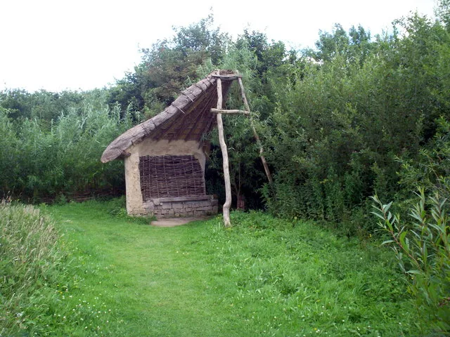
Murlough Nature Reserve — Irish nature reserve.

Wikimedia Commons contributors — see linked file page for photographer and licence licence
%2C_February_2010.JPG)
Plan your visit
- Typical visit
- 2 h–4 h
- Best time of year
- Autumn & winter (migration & wildfowl)
- Free entry
- Dog-friendly
About
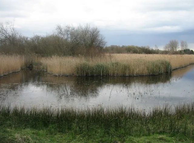
Murlough Nature Reserve is a wildlife reserve in the United Kingdom. Records date its origin to 1967. It covers approximately 3 km². Wikidata describes it as: "Irish nature reserve". Coordinates: 54.2342°, -5.8528°.
Photo gallery
From the Wikipedia article
Murlough Nature Reserve is a dune heathland on the coast of County Down in Northern Ireland, near Newcastle. It is on a peninsula between Dundrum Bay and Murlough Bay (Irish: Murlach, meaning 'sea inlet') and has views of Slieve Donard, the highest peak in the Mourne Mountains. Its 6,000-year-old sand dune system has been managed by the National Trust since 1967, when it became Ireland's first nature reserve. It is also home to Murlough Beach.
Excerpt from Wikipedia under CC BY-SA 4.0. See the source article linked in Sources below.
Background
History
In 1857, Arthur Hill, 4th Marquess of Downshire built Murlough House as a summer residence on the peninsula. A wooden bridge was built connecting to Keel Point, replaced in 1893 with the current granite one. The house and sand dunes were extensively used by the US Army during the Second World War. In 1942 the US 1st Battalion, 13th Armored (1st Division) arrived followed by the 818th Tank Destroyer Battalion (XV Corps) in April 1944.
Description
At 697 acres, Rare plants local to the site are pyramidal orchid and carline thistle. On the Dundrum Bay side of the nature reserve is Murlough Beach, a shingle beach and four-mile-long Blue Flag beach.
Sourced from Wikipedia under CC BY-SA 4.0.
- Coordinates
- 54.2342, -5.8528
- District
- Newry, Mourne and Down
- Postcode
- BT33 0LW
- Parliamentary constituency
- South Down
- Established
- 1967
Sources
- wikidata: Q15260305 (CC0)
- wikipedia: Murlough Nature Reserve (CC BY-SA 4.0)
- commons: Murlough National Nature Reserve (17), February 2010.JPG (CC BY-SA 4.0)
Other places nearby
Loading nearby places…
Nearby
 📷 3
📷 3Natural landmarks · Northern Ireland
Twelve Arches Recreation Area
Twelve Arches Recreation Area — a other in northern-ireland, United Kingdom.
 📷 3
📷 3Burial mounds & barrows · Northern Ireland
Slidderyford Dolmen
Slidderyford Dolmen — a burial mound in northern-ireland, United Kingdom.
 📷 3
📷 3Natural landmarks · Northern Ireland
Dundrum Inner Bay
Dundrum Inner Bay — a other in northern-ireland, United Kingdom.
 📷 5
📷 5Natural landmarks · Northern Ireland
Dundrum
Dundrum in Northern Ireland, United Kingdom.
Caravan parks · Northern Ireland
Windsor Holiday Park
Windsor Holiday Park — a caravan park in northern ireland.
Caravan parks · Northern Ireland
Woodcroft Caravan Park
Woodcroft Caravan Park — a caravan park in northern ireland.
Other places from this era
 Flagship📷 10
Wildlife reserves · London
Fowlmere RSPB reserve
Fowlmere RSPB reserve — RSPB nature reserve in the United Kingdom.
 Flagship📷 8
Wildlife reserves · London
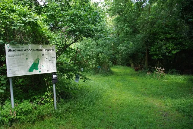
Hales and Shadwell Woods
Hales and Shadwell Woods — Essex Wildlife Trust Nature reserve.
 Flagship📷 9
Wildlife reserves · London
Kingcup Meadows and Oldhouse Wood
Kingcup Meadows and Oldhouse Wood is a wildlife reserve in the United Kingdom.
 Flagship📷 10
Wildlife reserves · London
WWT London Wetland Centre
WWT London Wetland Centre — wetland reserve in the Barnes area of the London Borough of Richmond upon Thames.
More places in this region
 Flagship📷 3
Wildlife reserves · Northern Ireland
Oxford Island
Oxford Island — nature reserve in the United Kingdom.
 📷 3
📷 3Wildlife reserves · Northern Ireland
Banagher Glen
Banagher Glen — Protected area in Northern Ireland.
 📷 3
📷 3Wildlife reserves · Northern Ireland
Belshaw's Quarry Nature Reserve
Belshaw's Quarry Nature Reserve — nature reserve in County Antrim, Northern Ireland.
 📷 3
📷 3Wildlife reserves · Northern Ireland
Bog Meadows
Bog Meadows — nature reserve in Belfast, Northern Ireland, UK.
Frequently asked questions
- Where is Murlough Nature Reserve?
- Murlough Nature Reserve is in Northern Ireland, United Kingdom (postcode BT33 0LW).
- When was Murlough Nature Reserve built?
- Built or established in 1967.
- Who owns Murlough Nature Reserve?
- Murlough Nature Reserve is owned by National Trust.
- Is Murlough Nature Reserve free to visit?
- Yes, Murlough Nature Reserve is free to enter.
- How do I get to Murlough Nature Reserve?
- Drivers can navigate to postcode BT33 0LW. It sits within the South Down parliamentary constituency.
- Are dogs allowed at Murlough Nature Reserve?
- Most wildlife reserves allow dogs on lead only, with restrictions during ground-nesting bird season (March-July). Check signage at the reserve.