National parks · North East England
Muggleswick, Stanhope and Edmundbyers Commons and Blanchland Moor
In or near Townfield.
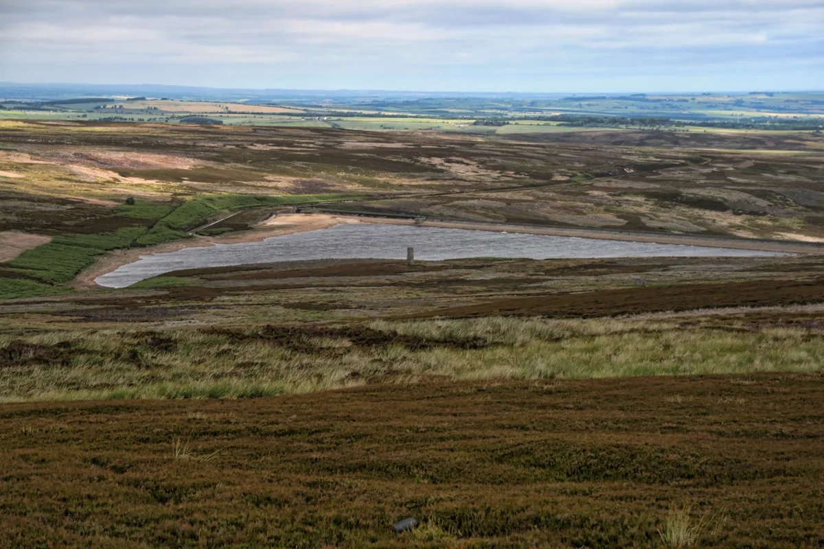
Muggleswick, Stanhope and Edmundbyers Commons and Blanchland Moor in England North East, United Kingdom.

Oliver Dixon — CC BY-SA 2.0 via Wikimedia Commons licence
Plan your visit
- Typical visit
- 4 h–8 h
- Best time of year
- Spring – autumn (Apr–Oct)
- Nearest railway station
- Stanhope · 8.2 km
- Free entry
- Dog-friendly
- Limited wheelchair access
Getting there & planning your visit
To visit Muggleswick, Stanhope and Edmundbyers Commons and Blanchland Moor, the nearest railway station is Stanhope, located 8.2 km away. Entry is free, but please note that wheelchair accessibility is limited.
About
Muggleswick, Stanhope and Edmundbyers Commons and Blanchland Moor is a place of interest in England North East, United Kingdom — drawn from open-data sources for visitor reference. See the linked Wikipedia article for the full description.
Photo gallery
Official information
Muggleswick, Stanhope and Edmundbyers Commons and Blanchland Moor is a Site of Special Scientific Interest (SSSI) located in County Durham and Northumberland. It encompasses a diverse range of biological features and habitats, making it significant for conservation and ecological studies.
Protected designations
- Site of Special Scientific Interest: Muggleswick, Stanhope and Edmundbyers Commons and Blanchland Moor SSSI
- Area of Outstanding Natural Beauty: North Pennines
Designations sourced from Natural England open data under OGL v3.
From the Wikipedia article
Muggleswick, Stanhope and Edmundbyers Commons and Blanchland Moor is a Site of Special Scientific Interest in County Durham and Northumberland, England. It consists of two separate areas, the larger—encompassing the upland areas of Muggleswick, Stanhope and Edmundbyers Commons—in the Derwentside and Wear Valley districts of north Durham, the smaller—Blanchland Moor—in the Tynedale district of south-west Northumberland. The site has one of the most extensive areas of dry heath in northern England. There are also areas of wet heath, acid grassland, flushes, relict juniper woodland and small areas of open water.
Excerpt from Wikipedia under CC BY-SA 4.0. See the source article linked in Sources below.
- Coordinates
- 54.8167, -2.0000
- Established
- 1997
- Nearest railway station
- Stanhope — 8.2 km
- Official site
- designatedsites.naturalengland.org.uk
Sources
- wikidata: Q15260181 (CC0)
- wikipedia: Muggleswick, Stanhope and Edmundbyers Commons and Blanchland Moor (CC BY-SA 4.0)
Other places nearby

Feldon Smelt Mill
Archaeological sites · 1.7 km

Feldon Smelt Mill
Archaeological sites · 1.7 km

Burnhope Lead Mine
Archaeological sites · 2.0 km

Edmundbyer's Cross
Memorials & monuments · 2.1 km
Hisehope Reservoir
Reservoirs & lochs · 2.2 km

Swandale Lead Mine
Archaeological sites · 2.3 km

Stoterley Hill
Mountains & hills · 2.4 km

The Burnside
B&Bs · 3.1 km

Sandyford Lead Mine
Archaeological sites · 3.2 km

Hawkburn Head Picnic Area
Natural landmarks · 3.4 km

Waskerley Reservoir
Reservoirs & lochs · 3.4 km

Burnhope Linn
Waterfalls · 3.5 km
Nearby
📷 3Archaeological sites · North East England
Feldon Smelt Mill
Feldon Smelt Mill — a archaeological in scotland-lowlands, United Kingdom.
📷 5Archaeological sites · North East England
Feldon Smelt Mill
Feldon Smelt Mill — archaeological in scotland lowlands.
📷 3Archaeological sites · North East England
Burnhope Lead Mine
Burnhope Lead Mine — a archaeological in scotland-lowlands, United Kingdom.
📷 3Memorials & monuments · North East England
Edmundbyer's Cross
Edmundbyer's Cross — a memorial in scotland-lowlands, United Kingdom.
📷 3Reservoirs & lochs · North East England
Hisehope Reservoir
Hisehope Reservoir — reservoir in County Durham, England, UK.
📷 3Archaeological sites · North East England
Swandale Lead Mine
Swandale Lead Mine — a archaeological in scotland-lowlands, United Kingdom.
Where to eat & stay near Muggleswick, Stanhope and Edmundbyers Commons and Blanchland Moor
Places to stay
📷 5B&Bs · North East England
The Burnside
The Burnside — a bed-and-breakfast in scotland lowlands.
 📷 5
📷 5Caravan parks · North East England
Struthers Farm Caravan Site
Struthers Farm Caravan Site — a caravan park in scotland lowlands.
📷 5Hostels · North East England
Edmundbyers Youth Hostel at Low House Haven
Edmundbyers Youth Hostel at Low House Haven — a hostel in scotland lowlands. Brand: Youth Hostels Association.
 📷 5
📷 5Caravan parks · North East England
Derwent View
Derwent View — a caravan park in scotland lowlands.
📷 5Campsites · North East England
Derwent View
Derwent View — a campsite in scotland lowlands.
 📷 5
📷 5Caravan parks · North East England
Bolbec Manor Campsite
Bolbec Manor Campsite — a caravan park in scotland lowlands.
Places to eat & drink
 📷 5
📷 5Historic pubs · North East England
The Lord Crewe Arms Hotel
The Lord Crewe Arms Hotel in Scotland Lowlands, United Kingdom.
 📷 5
📷 5Cafés · North East England
The White Monk Tearoom
The White Monk Tearoom — a café in scotland lowlands.
 📷 5
📷 5Historic pubs · North East England
Black Bull Public House
Black Bull Public House in Scotland Lowlands, United Kingdom.
 📷 5
📷 5Historic pubs · North East England
Travellers' Rest Inn
Travellers' Rest Inn in Scotland Lowlands, United Kingdom.
 📷 4
📷 4Historic pubs · North East England
Delves Lane
Delves Lane in England North East, United Kingdom.
 📷 4
📷 4More national parks in this region
 📷 4
📷 4 📷 4
📷 4National parks · North East England
Mallerstang
Mallerstang in England North East, United Kingdom.
 📷 4
📷 4National parks · North East England
Kisdon Force
Kisdon Force in England North East, United Kingdom.
 📷 4
📷 4Frequently asked questions
- Where is Muggleswick, Stanhope and Edmundbyers Commons and Blanchland Moor?
- Muggleswick, Stanhope and Edmundbyers Commons and Blanchland Moor is in North-East England, United Kingdom.
- What is Muggleswick, Stanhope and Edmundbyers Commons and Blanchland Moor?
- Muggleswick, Stanhope and Edmundbyers Commons and Blanchland Moor in England North East, United Kingdom.
- How do I get to Muggleswick, Stanhope and Edmundbyers Commons and Blanchland Moor?
- The nearest railway station is Stanhope, about 8.2 km away. Its coordinates are 54.8167°, -2.0000°.
- When was Muggleswick, Stanhope and Edmundbyers Commons and Blanchland Moor built?
- Built or established in 1997.
- Is Muggleswick, Stanhope and Edmundbyers Commons and Blanchland Moor a protected site?
- Yes — Muggleswick, Stanhope and Edmundbyers Commons and Blanchland Moor is part of the Muggleswick, Stanhope and Edmundbyers Commons and Blanchland Moor SSSI Site of Special Scientific Interest and the North Pennines National Landscape (AONB).