
Mountain bike trails · South East England
Mr Pink
In or near Wonersh.
Mr Pink — a mtb trail in england south east.

Colin Smith — CC BY-SA 2.0 via Wikimedia Commons licence

Plan your visit
- Typical visit
- 1 h–2 h
- Nearest railway station
- Gomshall · 4.6 km
About
Mr Pink is a mtb trail located in england south east, mapped by OpenStreetMap contributors. Detailed amenities and visitor information may vary; check the OSM page for the latest tagged metadata.
Photo gallery
Protected designations
- Area of Outstanding Natural Beauty: Surrey Hills
Designations sourced from Natural England open data under OGL v3.
Place summary
Mr Pink is a mountain biking trail located in South-East England. This trail is designed for mountain biking enthusiasts, offering varied terrain suitable for different skill levels. Visitors can expect a mix of natural features and constructed elements that enhance the riding experience. The trail is set in a scenic area, providing a backdrop for outdoor activities.
AI-generated from the structured facts on this page (operator, designation, listing, era). Not a substitute for visiting.
- Coordinates
- 51.1783, -0.4303
- County
- Surrey
- District
- Waverley
- Parish
- Ewhurst
- Postcode
- GU6 7NT
- Parliamentary constituency
- Dorking and Horley
- Nearest railway station
- Gomshall — 4.6 km
Sources
- osm: r8399184 (ODbL)
Other places nearby
Mr Pink
Mountain bike trails · 0.0 km

Jackie Brown
Mountain bike trails · 0.4 km
Jackie Brown
Mountain bike trails · 0.4 km

Surfer Rosa
Mountain bike trails · 0.5 km
Surfer Rosa
Mountain bike trails · 0.5 km

I Should Coco
Mountain bike trails · 0.6 km
I should coco
Mountain bike trails · 0.6 km

Yoghurt Pots
Mountain bike trails · 0.6 km
Yoghurt Pots
Mountain bike trails · 0.6 km
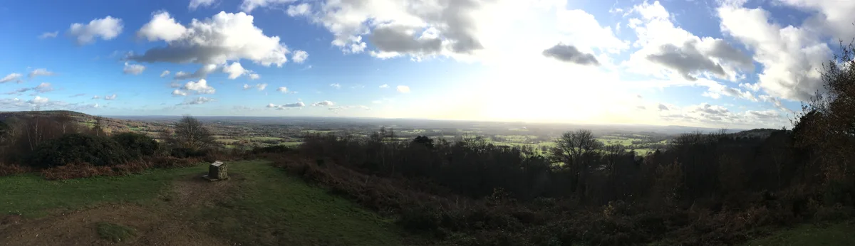
Holmbury Hill
Mountains & hills · 0.7 km

Holmbury Camp: a small multivallate hillfort north of Three Mile Road
Vineyards · 0.7 km

Holmbury Camp
Archaeological sites · 0.7 km
Nearby
📷 5📷 5Mountain bike trails · South East England
Jackie Brown
Jackie Brown — a mtb trail in england south east.
📷 5Mountain bike trails · South East England
Jackie Brown
Jackie Brown — a mtb trail in england south east.
📷 5Mountain bike trails · South East England
Surfer Rosa
Surfer Rosa — a mtb trail in england south east.
📷 5Mountain bike trails · South East England
Surfer Rosa
Surfer Rosa — a mtb trail in england south east.
📷 5Mountain bike trails · South East England
I Should Coco
I Should Coco — a mtb trail in england south east.
Where to eat & stay near Mr Pink
Places to stay
 📷 5
Hostels · South East England
Hurtwood Hideout
Hurtwood Hideout — a hostel in england south east.
 📷 5
 📷 5
Campsites · South East England
Bentley Copse Activity Centre
Bentley Copse Activity Centre — a campsite in england south east.
 📷 5
 📷 5
 📷 5
Caravan parks · South East England
Edgeley Holiday Park
Edgeley Holiday Park — a caravan park in england south east.
Places to eat & drink
 📷 5
Historic pubs · South East England
The Scarlett Arms Public House
The Scarlett Arms Public House in England South East, United Kingdom.
 📷 5
Historic pubs · South East England
The Old School Public House
The Old School Public House in England South East, United Kingdom.
 📷 7
 📷 7
Historic pubs · South East England
Duke Of Wellington Public House
Duke Of Wellington Public House in England South East, United Kingdom.
 📷 5
Historic pubs · South East England
The Chequers Inn Public House
The Chequers Inn Public House in England South East, United Kingdom.
 📷 7
Historic pubs · South East England
The Bulls Head Public House
The Bulls Head Public House in England South East, United Kingdom.
More places in this region
 📷 5
 📷 5
 📷 5
 📷 5
Frequently asked questions
- Where is Mr Pink?
- Mr Pink is in Surrey, South-East England, United Kingdom (postcode GU6 7NT), in the parish of Ewhurst.
- What is Mr Pink?
- Mr Pink — a mtb trail in england south east.
- How do I get to Mr Pink?
- The nearest railway station is Gomshall, about 4.6 km away. The nearest town is Wonersh. Drivers can use postcode GU6 7NT.
- Is Mr Pink a protected site?
- Yes — Mr Pink is part of the Surrey Hills National Landscape (AONB).
- How do I get to Mr Pink?
- The nearest railway station is Gomshall, about 4.6 km away. Drivers can navigate to postcode GU6 7NT.