Castles · East of England
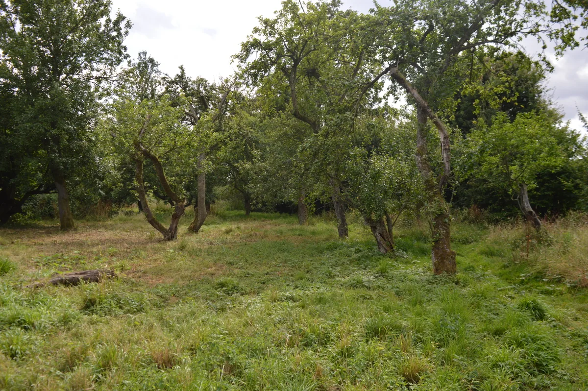
Mount Bures
In or near Wakes Colne.
Mount Bures is a small village and civil parish in the City of Colchester district of Essex, England. It adjoins the county boundary with Suffolk. At the 2021 census the parish had a population of 218

Roger Jones — CC BY-SA 2.0 via Wikimedia Commons licence
Plan your visit
- Typical visit
- 1.5 h–3 h
- Nearest railway station
- Bures · 2.4 km
- Family-friendly
- Limited wheelchair access
Getting there & planning your visit
To visit Mount Bures, the nearest railway station is Bures, which is 2.4 km away. The postcode for sat-nav is CO8 5AU. Accessibility is limited for wheelchair users.
About
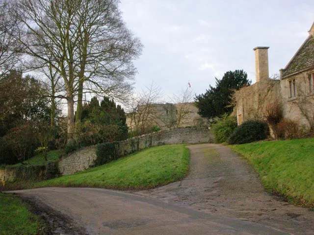
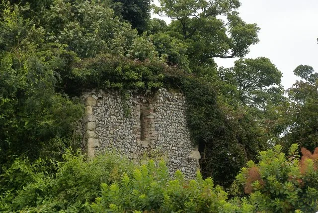
Mount Bures is a small village and civil parish in the City of Colchester district of Essex, England. It adjoins the county boundary with Suffolk. At the 2021 census the parish had a population of 218. It takes its name from the mount or motte believed to have been built shortly after the invasion by William the Conqueror in 1066. The Gainsborough railway line that runs through the village is believed to have been opened in 1848. A few miles down the line from Mount Bures is the Chappel Viaduct. The Thatchers Arms in Mount Bures was thought to have become a brewhouse or public house to quench the thirst of the navvies working on the railway line and the viaduct in the late 1840s. A bunker from the Colchester Stop Line, a series of bunkers built during World War II, can be found at Mount Bures. Sergeants Orchard is a nature reserve managed by the Essex Wildlife Trust south of the village.
Photo gallery
From the Wikipedia article
Mount Bures is a small village and civil parish in the City of Colchester district of Essex, England. It adjoins the county boundary with Suffolk. At the 2021 census the parish had a population of 218. It takes its name from the mount or motte believed to have been built shortly after the invasion by William the Conqueror in 1066. The Gainsborough railway line that runs through the village is believed to have been opened in 1848. A few miles down the line from Mount Bures is the Chappel Viaduct. The Thatchers Arms in Mount Bures was thought to have become a brewhouse or public house to quench the thirst of the navvies working on the railway line and the viaduct in the late 1840s. A bunker from the Colchester Stop Line, a series of bunkers built during World War II, can be found at Mount Bures. Sergeants Orchard is a nature reserve managed by the Essex Wildlife Trust south of the village.
Excerpt from Wikipedia under CC BY-SA 4.0. See the source article linked in Sources below.
- Coordinates
- 51.9500, 0.7670
- County
- Essex
- District
- Colchester
- Parish
- Mount Bures
- Postcode
- CO8 5AU
- Parliamentary constituency
- Harwich and North Essex
- Nearest railway station
- Bures — 2.4 km
- Official site
- www.mountbures.com
Sources
- wikipedia: Mount Bures (CC BY-SA 4.0)
Other places nearby
Sergeants Orchard
Wildlife reserves · 1.0 km

Mount Bures
Literary houses · 1.0 km

Lodge Hills
Mountains & hills · 2.3 km

Silver Jubilee
Public art & sculpture · 2.4 km
Bures Village Sign
Public art & sculpture · 2.5 km

Bures St Mary
Other places · 2.5 km

Bures St Mary War Memorial
Memorials & monuments · 2.5 km

Restoration Shed
Museums · 2.6 km

East Anglian Railway Museum
Museums · 2.7 km
Heritage Centre & Platforms 5 + 6
Museums · 2.7 km
Wormingford
Villages · 2.9 km

Wakes Colne
Towns & cities · 2.9 km
Nearby
Flagship📷 5Wildlife reserves · East of England
Sergeants Orchard
Sergeants Orchard — Essex Wildlife Trust Nature reserve.
📷 5📷 5Mountains & hills · East of England
Lodge Hills
Lodge Hills — mountain in england east. Elevation: 69 m.
📷 3Public art & sculpture · East of England
Silver Jubilee
Silver Jubilee — a public art in england-east, United Kingdom.
📷 3Public art & sculpture · East of England
Bures Village Sign
Bures Village Sign — a public art in england-east, United Kingdom.
📷 5Where to eat & stay near Mount Bures
Places to stay
 📷 5
📷 5Campsites · East of England
Rushbanks Campsite
Rushbanks Campsite — a campsite in england east.
 📷 5
📷 5Campsites · East of England
Little Ropers Woodland Camping
Little Ropers Woodland Camping — a campsite in england east.
 📷 5
📷 5 📷 5
📷 5 📷 5
📷 5Campsites · East of England
Colchester Country Park
Colchester Country Park — a campsite in england east.
 📷 7
📷 7Hotels · East of England
White Hart Hotel
White Hart Hotel — a hotel in england east.
Places to eat & drink
 📷 5
📷 5Historic pubs · East of England
The Anchor Public House
The Anchor Public House in England East, United Kingdom.
 📷 5
📷 5 📷 7
📷 7Historic pubs · East of England
Napier Arms Public House
Napier Arms Public House in England East, United Kingdom.
 📷 5
📷 5Historic pubs · East of England
The Griffin Public House
The Griffin Public House in England East, United Kingdom.
 📷 5
📷 5Historic pubs · East of England
The Locomotive Public House
The Locomotive Public House in England East, United Kingdom.
 📷 7
📷 7Historic pubs · East of England
Bird In Hand Public House
Bird In Hand Public House in England East, United Kingdom.
More castles in this region
 📷 5
📷 5Castles · East of England
Barnwell Castle
Barnwell Castle — castle in Northamptonshire, England, UK.
 📷 5
📷 5Castles · East of England
Benington Castle
Benington Castle — Grade I listed castle in East Hertfordshire, England, UK.
 📷 5
📷 5Castles · East of England
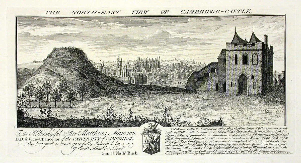
Cambridge Castle
Cambridge Castle — Castle in Cambridge, England.
 📷 5
📷 5Castles · East of England
Camera Obscura
Camera Obscura is a place of interest in the United Kingdom.
Frequently asked questions
- Where is Mount Bures?
- Mount Bures is in Essex, East of England, United Kingdom (postcode CO8 5AU), in the parish of Mount Bures.
- What is Mount Bures?
- Mount Bures is a small village and civil parish in the City of Colchester district of Essex, England. It adjoins the county boundary with Suffolk. At the 2021 census the parish had a population of 218
- How do I get to Mount Bures?
- The nearest railway station is Bures, about 2.4 km away. Drivers can use postcode CO8 5AU.
- Does Mount Bures charge admission?
- Mount Bures typically charges admission. Check the official site for current ticket prices and opening hours.
- How do I get to Mount Bures?
- The nearest railway station is Bures, about 2.4 km away. Drivers can navigate to postcode CO8 5AU.