Memorials & monuments · North East England
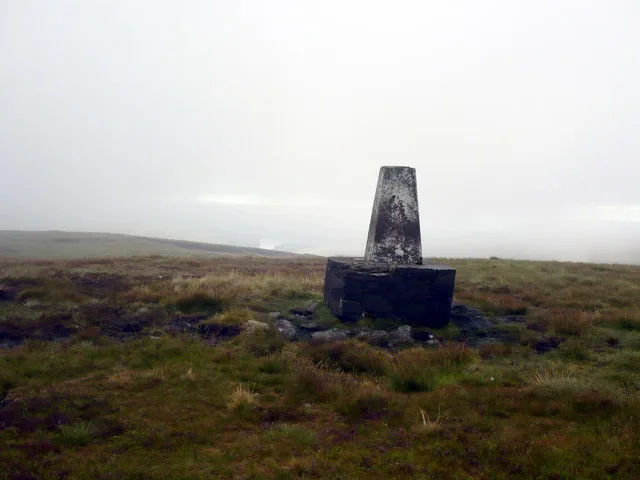
Moorhouse and Cross Fell
In or near Alston.
Moorhouse and Cross Fell in England North East, United Kingdom.

Keith Burns — CC BY-SA 2.0 via Wikimedia Commons licence
Plan your visit
- Typical visit
- 15 min–45 min
- Free entry
- Dog-friendly
About
Moorhouse and Cross Fell is a place of interest in England North East, United Kingdom — drawn from open-data sources for visitor reference. See the linked Wikipedia article for the full description.
Photo gallery
Official information
Moorhouse and Cross Fell is a Site of Special Scientific Interest (SSSI) located in County Durham and Cumbria. It features a diverse range of habitats and is part of several overlapping designations, including Moor House-Upper Teesdale NNR and North Pennine Moors SPA.
Protected designations
- Site of Special Scientific Interest: River Eden and Tributaries SSSI
- Site of Special Scientific Interest: Moorhouse and Cross Fell SSSI
- Area of Outstanding Natural Beauty: North Pennines
Designations sourced from Natural England open data under OGL v3.
From the Wikipedia article
Moorhouse and Cross Fell is a Site of Special Scientific Interest covering an extensive area of moorland in the Wear Valley district of west County Durham and the Eden district of Cumbria, England. It is contiguous with Upper Teesdale SSSI to the east and Appleby Fells SSSI to the south. The area covered extends roughly from an arc through the villages of Gamblesby, Leadgate and Garrigill southward as far as Milburn in the west and Cow Green Reservoir in the east. It includes the whole of Cross Fell, the summit of which, at 893 metres asl, is the highest point in the Pennines and in England outside the Lake District. The area is important for its wide variety of upland habitats, especially blanket bog, sub-montane and montane heath, montane bryophyte heath, limestone grassland and flushes, and for the fauna and flora that they support. The site also includes a number of localities of geological interest.
Excerpt from Wikipedia under CC BY-SA 4.0. See the source article linked in Sources below.
- Coordinates
- 54.7167, -2.3833
- Established
- 1951
- Official site
- designatedsites.naturalengland.org.uk
Sources
- wikidata: Q15255985 (CC0)
- wikipedia: Moorhouse and Cross Fell (CC BY-SA 4.0)
Other places nearby

The Source
Public art & sculpture · 0.5 km

Round Hill
Mountains & hills · 1.0 km
Round Hill
Mountains & hills · 1.0 km

Slack's Rigg
Mountains & hills · 1.7 km

Noonstones Hill
Mountains & hills · 2.3 km

Metalband Hill
Mountains & hills · 2.5 km

Paper Hill
Mountains & hills · 3.2 km

Long Man Hill
Mountains & hills · 3.4 km

Hard Hill
Mountains & hills · 3.5 km

Burnhope Seat
Natural landmarks · 3.5 km
Burnhope Seat
Mountains & hills · 3.6 km

Rake End
Mountains & hills · 3.6 km
Nearby
📷 3Public art & sculpture · North East England
The Source
The Source — a public art in scotland-lowlands, United Kingdom.
📷 5Mountains & hills · North East England
Round Hill
Round Hill — a hill or mountain in scotland lowlands.
📷 5Mountains & hills · North East England
Round Hill
Round Hill — mountain in scotland lowlands. Elevation: 685.5 m.
📷 5Mountains & hills · North East England
Slack's Rigg
Slack's Rigg — mountain in scotland lowlands. Elevation: 608.4 m.
📷 5Mountains & hills · North East England
Noonstones Hill
Noonstones Hill — mountain in scotland lowlands. Elevation: 626 m.
📷 5Mountains & hills · North East England
Metalband Hill
Metalband Hill — mountain in scotland lowlands. Elevation: 560.2 m.
Where to eat & stay near Moorhouse and Cross Fell
Places to stay
 📷 5
📷 5Campsites · North East England
Garrigill Village Hall Camp Site
Garrigill Village Hall Camp Site — a campsite in scotland lowlands.
 📷 5
📷 5Hostels · North East England
Assay Office Bunkhouse
Assay Office Bunkhouse — a hostel in scotland lowlands.
 📷 5
📷 5Campsites · North East England
Haggs Bank Bunkhouse and Campsite
Haggs Bank Bunkhouse and Campsite — a campsite in scotland lowlands.
📷 5Caravan parks · North East England
Horse & Wagon Caravan Park
Horse & Wagon Caravan Park — a caravan park in scotland lowlands.
 📷 5
📷 5Caravan parks · North East England
Hudgill Caravan Park
Hudgill Caravan Park — a caravan park in scotland lowlands.
 📷 5
📷 5Campsites · North East England
Killhope Lead Mining Museum Yurts
Killhope Lead Mining Museum Yurts — a campsite in scotland lowlands.
Places to eat & drink
 📷 5
📷 5Historic pubs · North East England
1, Scattergate
1, Scattergate in England North East, United Kingdom.
 📷 3
📷 3 📷 5
📷 5 📷 7
📷 7Cafés · North West England
Narrowbar Cafe
Narrowbar Cafe — a café in scotland lowlands.
 📷 7
📷 7Historic pubs · North West England
Two Lions public house and integral stables
Two Lions public house and integral stables in Scotland Lowlands, United Kingdom.
 📷 6
📷 6Historic pubs · North West England
Gloucester Arms
Gloucester Arms in Scotland Lowlands, United Kingdom.
More memorials in this region
 📷 3
📷 3Memorials & monuments · North East England
Hurworth and Neasham War Memorial
Hurworth and Neasham War Memorial — Grade II listed building-listed memorial in england-yorkshire, United Kingdom.
 📷 3
📷 3Memorials & monuments · North East England
Fryingpan Stone
Fryingpan Stone — a memorial in england-yorkshire, United Kingdom.
 📷 3
📷 3Memorials & monuments · North East England
Yoak Stone
Yoak Stone — a memorial in england-yorkshire, United Kingdom.
 📷 3
📷 3Memorials & monuments · North East England
Pump Cottage 1680
Pump Cottage 1680 — a memorial in england-yorkshire, United Kingdom.
Frequently asked questions
- Where is Moorhouse and Cross Fell?
- Moorhouse and Cross Fell is in North-East England, United Kingdom.
- What is Moorhouse and Cross Fell?
- Moorhouse and Cross Fell in England North East, United Kingdom.
- How do I get to Moorhouse and Cross Fell?
- Its coordinates are 54.7167°, -2.3833°.
- When was Moorhouse and Cross Fell built?
- Built or established in 1951.
- Is Moorhouse and Cross Fell a protected site?
- Yes — Moorhouse and Cross Fell is part of the River Eden and Tributaries SSSI Site of Special Scientific Interest and the Moorhouse and Cross Fell SSSI Site of Special Scientific Interest.
- Is Moorhouse and Cross Fell free to visit?
- Yes, Moorhouse and Cross Fell is free to enter.