
Memorials & monuments · East Midlands
Monument To South Of Cemetery Chapels
In or near Tupton.
Monument To South Of Cemetery Chapels — Grade II listed building-listed memorial in england-east-midlands, United Kingdom.

Andrew Hill — CC BY-SA 2.0 via Wikimedia Commons licence

Plan your visit
- Typical visit
- 15 min–45 min
- Nearest railway station
- Alfreton · 7.2 km
- Free entry
- Dog-friendly
Getting there & planning your visit
The Monument To South Of Cemetery Chapels is located in North East Derbyshire, postcode S45 9RN. The nearest railway station is Alfreton, which is 7.2 km away. Entry to the memorial is free.
About
Monument To South Of Cemetery Chapels is a Grade II listed building-listed memorial in england-east-midlands, United Kingdom, registered on the National Heritage List for England (NHLE entry 1087811). Listed status protects buildings and structures of special architectural or historic interest. See the linked Wikipedia article for further details.
Photo gallery
Heritage listing
Details SK 36 SE 2/22 TOWN OF CLAY CROSS CEMETERY ROAD (North side) Monument to south of Cemetery Chapels GV II Monument. 1884. Stone. Stepped plinth with pedestal base over. Inset cusped panels with inscriptions to three sides. South face inscribed 'This monument is in memory of the Fourty-Five men and boys who lost their lives in an explosion at Park House Pit ,Clay Cross, November 7th 1882 and was erected by their fellow workmen and the Public 1884'. To west and east sides the names of the deceased. Over, tall quatrefoil pillar with gableted base and band of ballflower decoration. Foliate capital and weeping woman in white marble above. Included for group value only. Listing NGR: SK3973462863 Legacy The contents of this record have been generated from a legacy data system. Legacy System number: 79410 Legacy System: LBS
From the Historic England List Entry under OGL v3.
Place summary
The Monument to the South of Cemetery Chapels is a Grade II listed memorial located in the East Midlands. It serves as a notable example of commemorative architecture in the region.
AI-generated from the structured facts on this page (operator, designation, listing, era). Not a substitute for visiting.
- Coordinates
- 53.1614, -1.4072
- County
- Derbyshire
- District
- North East Derbyshire
- Parish
- Clay Cross
- Postcode
- S45 9RN
- Parliamentary constituency
- North East Derbyshire
- Nearest railway station
- Alfreton — 7.2 km
Sources
- wikidata: Q26380207 (CC0)
Other places nearby

Clay Cross
Museums · 0.5 km

Danesmoor War Memorial
Memorials & monuments · 0.6 km

St Bartholomew’s Church, Clay Cross
Historic churches · 0.7 km
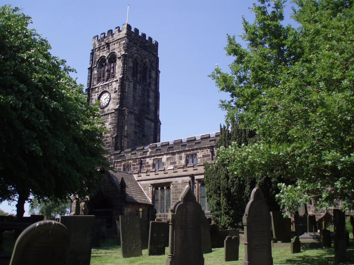
Church of St Lawrence
Historic churches · 1.8 km

10 Acres Farm
Campsites · 2.0 km

Tupton Hall School
Historic houses · 2.3 km

Millfield Mobile Home Park
Caravan parks · 2.4 km

Brookfield Mobile Home Park
Caravan parks · 2.6 km

Morton War Memorial
Memorials & monuments · 2.9 km

Pilsley
Villages · 3.0 km

Stretton
Villages · 3.2 km

Tupton
Towns & cities · 3.2 km
Nearby
📷 5📷 4Memorials & monuments · East Midlands
Danesmoor War Memorial
Danesmoor War Memorial — Grade II listed building-listed memorial in england-east-midlands, United Kingdom.
📷 4Historic churches · East Midlands
St Bartholomew’s Church, Clay Cross
St Bartholomew’s Church, Clay Cross — a Grade II*-listed church in england-east-midlands, United Kingdom.
📷 3Historic churches · East Midlands
Church of St Lawrence
Church of St Lawrence — church in North East Derbyshire, England, UK.
📷 4📷 5Historic houses · East Midlands
Tupton Hall School
Tupton Hall School — a school heritage in england-east-midlands, United Kingdom.
Where to eat & stay near Monument To South Of Cemetery Chapels
Places to stay
📷 4📷 5Caravan parks · East Midlands
Millfield Mobile Home Park
Millfield Mobile Home Park — a caravan park in england east midlands.
📷 5Caravan parks · East Midlands
Brookfield Mobile Home Park
Brookfield Mobile Home Park — a caravan park in england east midlands.
 📷 5
📷 5Caravan parks · East Midlands
Broomhill Farm
Broomhill Farm — a caravan park in england east midlands.
 📷 5
📷 5B&Bs · East Midlands
Goss Hall
Goss Hall — a bed-and-breakfast in england east midlands.
 📷 5
📷 5Caravan parks · East Midlands
Timberland Motorhomes
Timberland Motorhomes — a caravan park in england east midlands.
Places to eat & drink
 📷 5
📷 5Historic pubs · East Midlands
The Miners Arms Public House
The Miners Arms Public House in England East Midlands, United Kingdom.
 📷 5
📷 5Historic pubs · East Midlands
The Crispin Inn
The Crispin Inn in England East Midlands, United Kingdom.
 📷 5
📷 5Historic pubs · East Midlands
The Royal Oak Inn
The Royal Oak Inn in England East Midlands, United Kingdom.
 📷 5
📷 5 📷 5
📷 5Historic pubs · East Midlands
The Black Swan Public House And Attached L Shaped Range Of Outbuildings To The North-East
The Black Swan Public House And Attached L Shaped Range Of Outbuildings To The North-East in England East Midlands, United Kingdom.
 📷 5
📷 5Historic pubs · East Midlands
Duke William Inn
Duke William Inn in England East Midlands, United Kingdom.
More memorials in this region
 📷 5
📷 5Memorials & monuments · East Midlands
Bainton Buttercross
Bainton Buttercross is a memorial in the United Kingdom.
 📷 5
📷 5Memorials & monuments · East Midlands
clock tower and war memorial
clock tower and war memorial is a memorial in the United Kingdom.
 📷 5
📷 5Memorials & monuments · East Midlands
John Clare Memorial
John Clare Memorial is a memorial in the United Kingdom.
 📷 5
📷 5Memorials & monuments · East Midlands
The Butter Cross
The Butter Cross is a memorial in the United Kingdom.
Frequently asked questions
- Where is Monument To South Of Cemetery Chapels?
- Monument To South Of Cemetery Chapels is in Derbyshire, the East Midlands, United Kingdom (postcode S45 9RN), in the parish of Clay Cross.
- What is Monument To South Of Cemetery Chapels?
- Monument To South Of Cemetery Chapels — Grade II listed building-listed memorial in england-east-midlands, United Kingdom.
- How do I get to Monument To South Of Cemetery Chapels?
- The nearest railway station is Alfreton, about 7.2 km away. Drivers can use postcode S45 9RN.
- Is Monument To South Of Cemetery Chapels a listed building?
- Monument To South Of Cemetery Chapels is officially recognised as Grade II listed building listed.
- Is Monument To South Of Cemetery Chapels free to visit?
- Yes, Monument To South Of Cemetery Chapels is free to enter.
- How do I get to Monument To South Of Cemetery Chapels?
- The nearest railway station is Alfreton, about 7.2 km away. Drivers can navigate to postcode S45 9RN.