
Historic houses · Scottish Lowlands
Monkredding House
In or near Kilmaurs.
Monkredding House — house in Kilwinning, North Ayrshire, Scotland, UK.

Wikimedia Commons contributors — see linked file page for photographer and licence licence

Plan your visit
- Typical visit
- 1 h–2 h
- Nearest railway station
- Kilwinning · 3.3 km
- Family-friendly
- Limited wheelchair access
Getting there & planning your visit
To visit Monkredding House, the nearest railway station is Kilwinning, located 3.3 km away. The postcode for sat-nav is KA13 7QF. Please note that wheelchair accessibility is limited.
About
Monkredding House is a historic house in the United Kingdom — typically a country seat, manor, or town house with notable architecture or history. Heritage designation: category B listed building. Wikidata describes it as: "house in Kilwinning, North Ayrshire, Scotland, UK". Coordinates: 55.6734°, -4.6668°.
Photo gallery
From the Wikipedia article
Monkredding (NS 3240 4534) formed a small estate in the Parish of Kilwinning, North Ayrshire lying between Kilwinning and Auchentiber on the B778. The property was originally held by the Tironensian monks of Kilwinning Abbey and was the 'Monk's Garden', the rest home for the brothers. Monkcastle near Dalgarven was the abbot's country retreat. Monkredding remains in good condition and is in use as a private house in 2010.
Excerpt from Wikipedia under CC BY-SA 4.0. See the source article linked in Sources below.
Background
History
Between 1539 and 1545, the Nevin family obtained the lands of East and West Monkredding from Alexander, Abbot of Kilwinning. Thomas Nevin was the first secular proprietor of the lands, "part of the ancient halydom of Kilwinning, which about this time was beginning to be parcelled out by the Abbots, to whoever would best remunerate them for the ostensible gift, foreseeing that their own possession was becoming doubtful and unsteady." Savio records that Thomas Nevin in 1539 feued the lands of East Monkredding; in 1543 those of Guslone and Bannach; and in 1545 those of West Monkredding and Gaitmureland. As well as security of tenure, feuing gave the right to the feuar to exploit any minerals…
Description
The 1775 map shows a mansion house with substantial woodland policies, as does Thomson's map of 1820. In the 1920s a large beech tree fell at Monkredding and was found to be around 400 years old. Several large beeches still stand on the roadside opposite the old entrance, part of the old policies before the new road was built. The OS maps show that the first entrance off the Auchentiber Road, with its lodge, 'Golconda' was abandoned, probably due to limestone workings and the present day entrance with its Edwardian Monkredding Lodge was built to replace it. Before the turnpike road was built the entrance was off the ancient Kilwinning to Beith Road near Laigh Gooseloan that ran onwards via…
Sourced from Wikipedia under CC BY-SA 4.0.
- Coordinates
- 55.6734, -4.6668
- District
- North Ayrshire
- Postcode
- KA13 7QF
- Parliamentary constituency
- North Ayrshire and Arran
- Nearest railway station
- Kilwinning — 3.3 km
- Official site
- www.scotland.org.uk
Sources
- wikidata: Q6900930 (CC0)
- wikipedia: Monkredding House, North Ayrshire (CC BY-SA 4.0)
- commons: Monkredding.JPG (CC BY-SA 4.0)
Other places nearby

Arran Hills
Caravan parks · 0.4 km

Cleeves Cove
Caves · 2.1 km
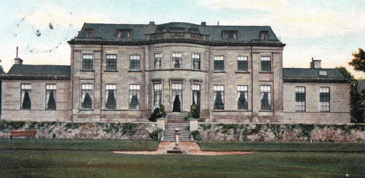
Montgreenan
Stately homes · 2.1 km
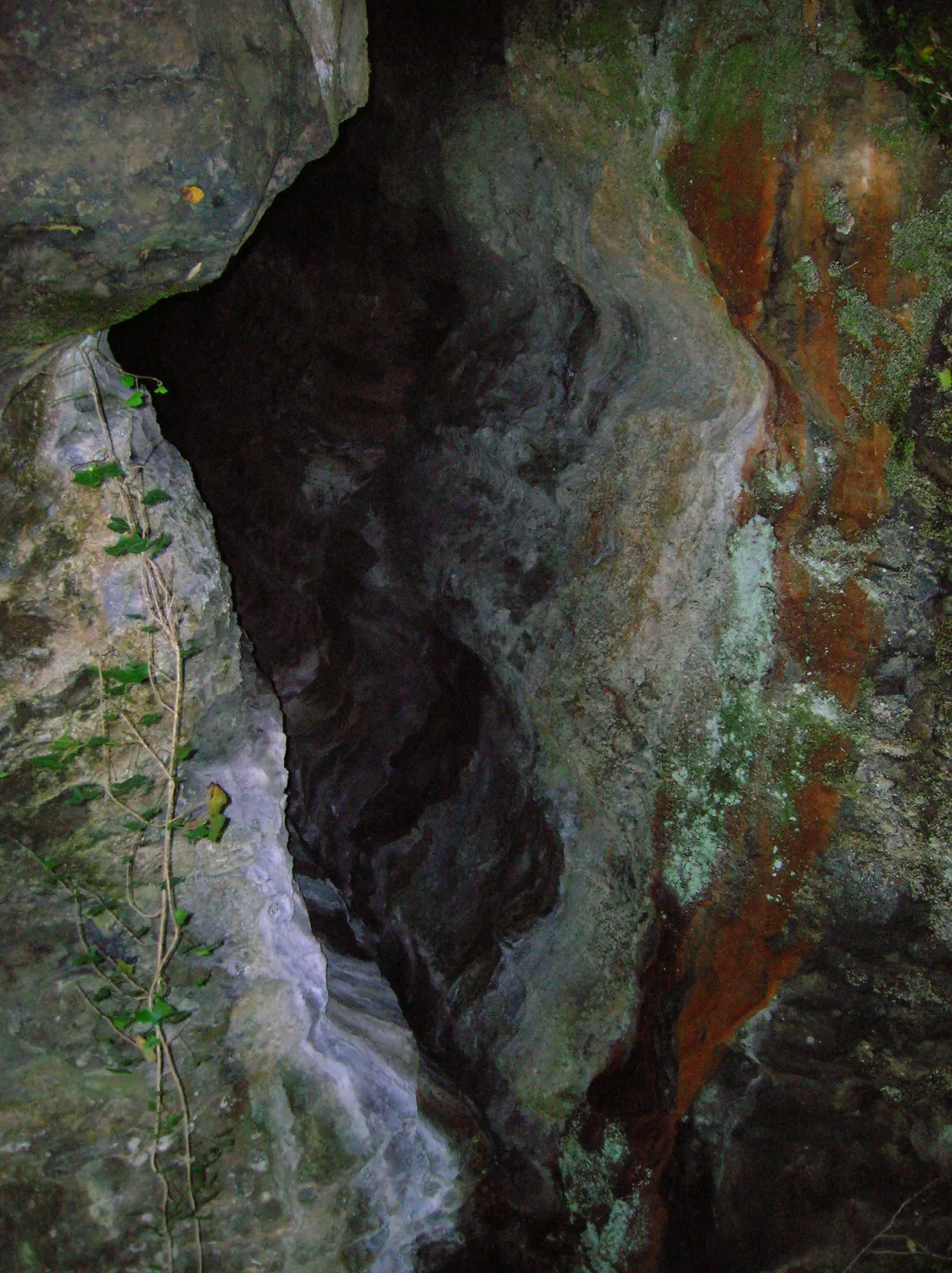
Cleeves Cove
Mountains & hills · 2.2 km

Dalgarven Mill Museum
Watermills · 2.7 km
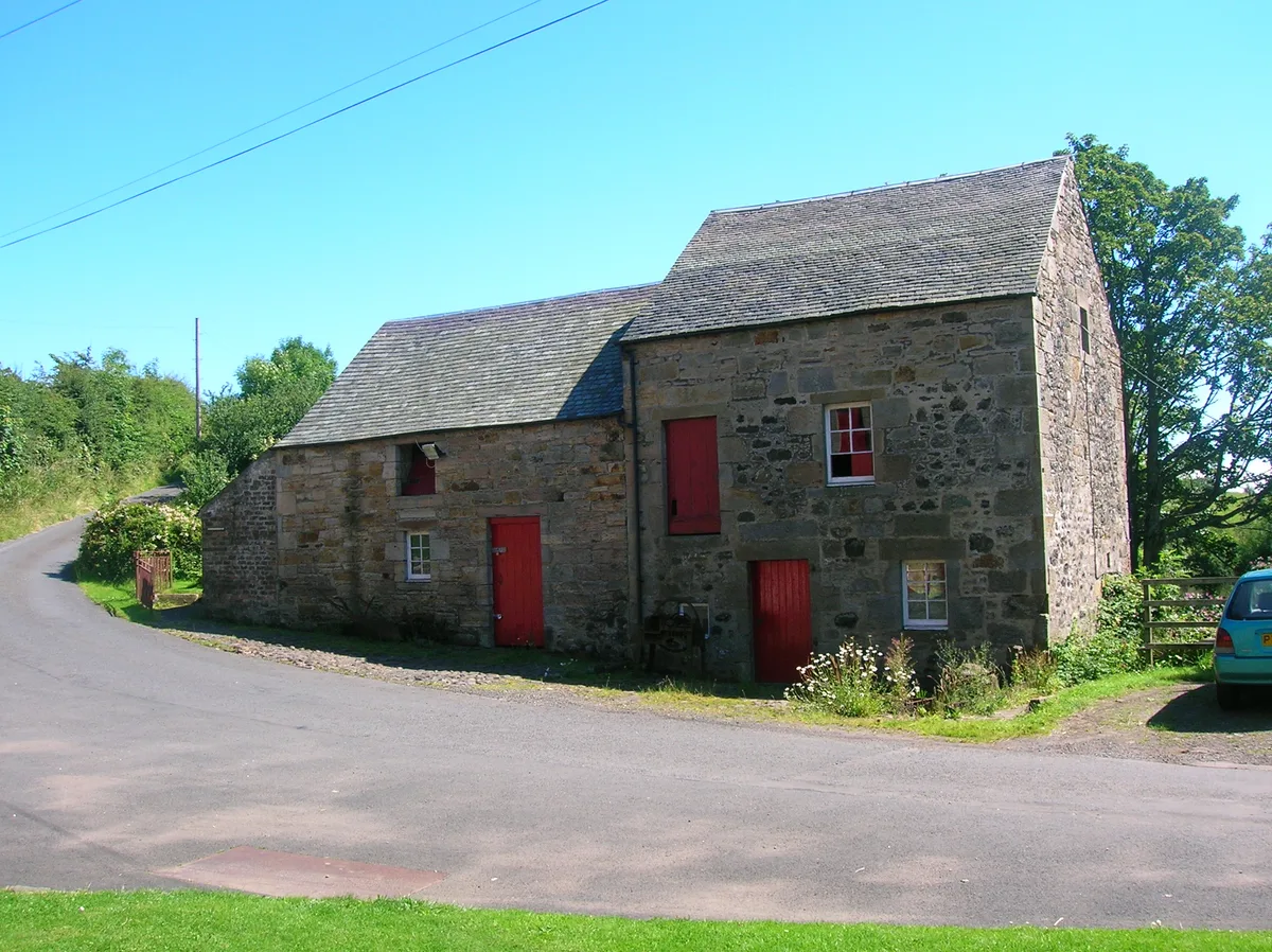
Dalgarven Mill Museum of Country Life and Costume
Museums · 2.7 km

Groatholm Bridge
Historic bridges · 2.7 km

Bridge, Kilwinning
Historic bridges · 2.8 km

Robert W Service Monument
Memorials & monuments · 2.8 km

Kingsway Bar, 26-28 Main Street, Kilwinning
Historic pubs · 2.8 km

Erskine Church, Kilwinning
Historic churches · 2.9 km
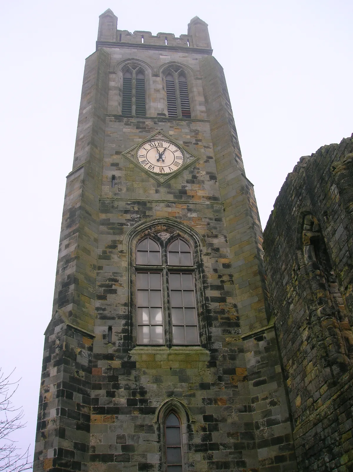
Kilwinning Old Parish church
Historic churches · 3.0 km
Nearby
📷 5📷 5📷 4Stately homes · Scottish Lowlands
Montgreenan
Montgreenan — manor house in North Ayrshire, Scotland, UK.
📷 4Mountains & hills · Scottish Lowlands
Cleeves Cove
Cleeves Cove — cave in North Ayrshire, Scotland, UK.
📷 5Watermills · Scottish Lowlands
Dalgarven Mill Museum
Dalgarven Mill Museum is a watermill in the United Kingdom.
📷 5Museums · Scottish Lowlands
Dalgarven Mill Museum of Country Life and Costume
Dalgarven Mill Museum of Country Life and Costume — museum in Kilwinning, North Ayrshire, Scotland, United Kingdom.
Where to eat & stay near Monkredding House
Places to stay
📷 5 📷 5
📷 5Campsites · Scottish Lowlands
Eglinton Camping and Touring Site
Eglinton Camping and Touring Site — a campsite in scotland highlands.
 📷 5
📷 5Caravan parks · Scottish Lowlands
Viewfield Manor Leisure Park
Viewfield Manor Leisure Park — a caravan park in scotland highlands.
 📷 5
📷 5Caravan parks · Scottish Lowlands
Sandylands Holiday Park
Sandylands Holiday Park — a caravan park in scotland highlands. Brand: Parkdean Resorts.
 📷 5
📷 5Caravan parks · Scottish Lowlands
Glenview Caravan Park
Glenview Caravan Park — a caravan park in scotland highlands.
 📷 5
📷 5Caravan parks · Scottish Lowlands
Crosbie Towers
Crosbie Towers — a caravan park in scotland highlands.
Places to eat & drink
📷 5Historic pubs · Scottish Lowlands
Kingsway Bar, 26-28 Main Street, Kilwinning
Kingsway Bar, 26-28 Main Street, Kilwinning in Scotland Central, United Kingdom.
 📷 5
📷 5Historic pubs · Scottish Lowlands
Public House, Lawthorn, Irvine
Public House, Lawthorn, Irvine in Scotland Central, United Kingdom.
 📷 5
📷 5Historic pubs · Scottish Lowlands
The Auld Hoose Bar, 9 Main Street, Dalry
The Auld Hoose Bar, 9 Main Street, Dalry in Scotland Central, United Kingdom.
 📷 5
📷 5Restaurants · Scottish Lowlands
Braidwoods
Braidwoods — a restaurant in scotland highlands.
 📷 7
📷 7Historic pubs · Scottish Lowlands
Champion Shell Inn, 5 Schoolwell Street, Stevenston
Champion Shell Inn, 5 Schoolwell Street, Stevenston in Scotland Central, United Kingdom.
 📷 5
📷 5Historic pubs · Central Scotland
The Smugglers Tavern, 53, 55 Eglinton Street, Beith
The Smugglers Tavern, 53, 55 Eglinton Street, Beith in Scotland Central, United Kingdom.
More historic houses in this region
 📷 4
📷 4Historic houses · Scottish Lowlands
Chesters estate
Chesters estate in England North East, United Kingdom.
 📷 4
📷 4 📷 3
📷 3 📷 3
📷 3Historic houses · Scottish Lowlands
Barnhills Tower
Barnhills Tower in England North East, United Kingdom.
Frequently asked questions
- Where is Monkredding House?
- Monkredding House is in the Scottish Highlands, United Kingdom (postcode KA13 7QF).
- What is Monkredding House?
- Monkredding House — house in Kilwinning, North Ayrshire, Scotland, UK.
- How do I get to Monkredding House?
- The nearest railway station is Kilwinning, about 3.3 km away. Drivers can use postcode KA13 7QF.
- Is Monkredding House a listed building?
- Monkredding House is officially recognised as category B listed building listed.
- How do I get to Monkredding House?
- The nearest railway station is Kilwinning, about 3.3 km away. Drivers can navigate to postcode KA13 7QF.