
Museums · London
Mole Valley
In or near Byfleet.
Mole Valley is a local government district in Surrey, England. Its council is based in Dorking, and the district's other town is Leatherhead. The largest villages are Ashtead, Fetcham and Great Bookha

Colin Smith — CC BY-SA 2.0 via Wikimedia Commons licence

Plan your visit
- Typical visit
- 1.5 h–3 h
- Best time of year
- Year-round
- Nearest railway station
- West Byfleet · 2.7 km
- Family-friendly
- Limited wheelchair access
Getting there & planning your visit
To visit Mole Valley, the nearest railway station is West Byfleet, located 2.7 km away. The postcode for sat-nav is GU22 8XR. Please note that wheelchair accessibility is limited.
About
Mole Valley is a local government district in Surrey, England. Its council is based in Dorking, and the district's other town is Leatherhead. The largest villages are Ashtead, Fetcham and Great Bookham, in the northern third of the district. Most of the district is on the escarpments of or adjoins the Surrey Hills, a designated Area of Outstanding Natural Beauty, which cover parts of the North Downs and Greensand Ridge, including locally Leith Hill, Polesden Lacey and Box Hill. Denbies Wine Estate, the largest vineyard in the country, is on the hills north-west of Dorking. The Pilgrims' Way footpath runs along the North Downs. There are stations on the London–Worthing and Reading–Gatwick Airport railways, and in the northern third, a commuter stopping-service pattern line, London–Guildford (via Epsom) line. The A24 road and the M25 motorway are the main thoroughfares and relative to London the incidence of car ownership is high. Between 2011 and its final iteration in 2019, the area hosted hill-focused sub-laps of the London–Surrey Classic cycling tour, an event established as preparation for the visit to Mole Valley of the 2012 Olympic Games Road Races. The neighbouring districts are Epsom and Ewell, Reigate and Banstead, Crawley, Horsham, Waverley, Guildford, Elmbridge and the London borough Kingston upon Thames.
Photo gallery
From the Wikipedia article
Mole Valley is a local government district in Surrey, England. Its council is based in Dorking, and the district's other town is Leatherhead. The largest villages are Ashtead, Fetcham and Great Bookham, in the northern third of the district. Most of the district is on the escarpments of or adjoins the Surrey Hills, a designated Area of Outstanding Natural Beauty, which cover parts of the North Downs and Greensand Ridge, including locally Leith Hill, Polesden Lacey and Box Hill. Denbies Wine Estate, the largest vineyard in the country, is on the hills north-west of Dorking. The Pilgrims' Way footpath runs along the North Downs. There are stations on the London–Worthing and Reading–Gatwick Airport railways, and in the northern third, a commuter stopping-service pattern line, London–Guildford (via Epsom) line. The A24 road and the M25 motorway are the main thoroughfares and relative to London the incidence of car ownership is high. Between 2011 and its final iteration in 2019, the area hosted hill-focused sub-laps of the London–Surrey Classic cycling tour, an event established as preparation for the visit to Mole Valley of the 2012 Olympic Games Road Races. The neighbouring districts are Epsom and Ewell, Reigate and Banstead, Crawley, Horsham, Waverley, Guildford, Elmbridge and the London borough Kingston upon Thames.
Excerpt from Wikipedia under CC BY-SA 4.0. See the source article linked in Sources below.
Background
History
The district was created on 1 April 1974 under the Local Government Act 1972, covering three former districts which were all abolished at the same time: The new district was named after the River Mole, which flows through the area. As part of upcoming structural changes to local government in England, the district will be abolished in April 2027 and the area will become part of the new unitary authority of East Surrey.
Sourced from Wikipedia under CC BY-SA 4.0.
- Coordinates
- 51.3160, -0.4937
- County
- Surrey
- District
- Woking
- Parish
- Woking, unparished area
- Postcode
- GU22 8XR
- Parliamentary constituency
- Woking
- Nearest railway station
- West Byfleet — 2.7 km
Sources
- wikipedia: Mole Valley (CC BY-SA 4.0)
Other places nearby

Pyrford War Memorial
Memorials & monuments · 1.1 km
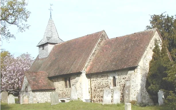
St Nicholas's Church, Pyrford
Historic churches · 1.1 km

Pyrford
Villages · 1.2 km

RHS Garden Wisley
Gardens · 1.2 km

Newark Priory Ruin
Archaeological sites · 1.2 km

Newark Priory
Abbeys & priories · 1.2 km
Newark Priory
Archaeological sites · 1.2 km

Fruit Hill
Viewpoints · 1.2 km
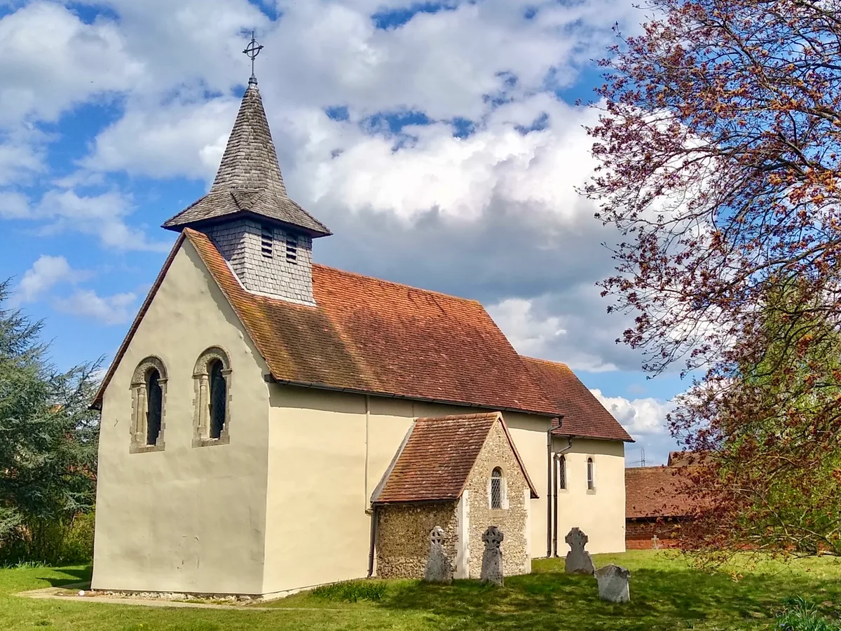
Wisley Church
Historic churches · 1.3 km

carved tree
Public art & sculpture · 1.3 km

RHS Garden, Wisley
Botanic gardens · 1.4 km

Wisley
Villages · 1.4 km
Nearby
📷 5Memorials & monuments · London
Pyrford War Memorial
Pyrford War Memorial — Grade II listed building-listed memorial in england-london, United Kingdom.
📷 5Historic churches · London
St Nicholas's Church, Pyrford
St Nicholas's Church, Pyrford — church in Pyrford, Surrey, England, UK.
📷 5Flagship📷 10Gardens · South East England
RHS Garden Wisley
The RHS flagship — 240 acres in Surrey, science centre, 12m canopy walkway.
📷 5Archaeological sites · London
Newark Priory Ruin
Newark Priory Ruin — a archaeological site in england london.
📷 5Abbeys & priories · London
Newark Priory
Newark Priory — a abbey in england-london, United Kingdom.
Where to eat & stay near Mole Valley
Places to stay
 📷 7
📷 7 📷 5
📷 5Campsites · London
Birchmere Scout Camp Site
Birchmere Scout Camp Site — a campsite in england london.
 📷 5
📷 5 📷 5
📷 5Hotels · South East England
DoubleTree by Hilton Hotel Woking
DoubleTree by Hilton Hotel Woking — a hotel in england london. 4-star. Brand: DoubleTree.
 📷 5
📷 5Campsites · London
Horsley Camping and Caravan Club Site
Horsley Camping and Caravan Club Site — a campsite in england london.
 📷 5
📷 5Campsites · London
Walton Firs Activity Centre
Walton Firs Activity Centre — a campsite in england london.
Places to eat & drink
 📷 7
📷 7Historic pubs · London
The Ship Inn And Ye Olde Sweet Shoppe
The Ship Inn And Ye Olde Sweet Shoppe in England London, United Kingdom.
 📷 7
📷 7 📷 7
📷 7Historic pubs · South East England
The Bulls Head Public House
The Bulls Head Public House in England South East, United Kingdom.
 📷 7
📷 7Historic pubs · South East England
Duke Of Wellington Public House
Duke Of Wellington Public House in England South East, United Kingdom.
 📷 7
📷 7Historic pubs · London
The Old Crown Public House
The Old Crown Public House in England London, United Kingdom.
 📷 5
📷 5More museums in this region
 Flagship📷 10
Museums · London
Kenwood House
Kenwood House — art museum and historic house in Hampstead, London.
 📷 5
📷 5Museums · London
Amora London
Amora London — European touring exhibition dedicated to love, relationships and sexual wellbeing.
 📷 5
📷 5Museums · London
Antique Breadboard Museum
Antique Breadboard Museum — small museum in Putney, London, England, UK.
 📷 5
📷 5Museums · London
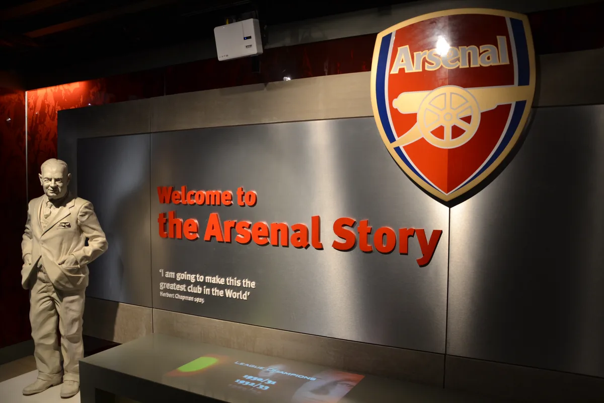
Arsenal Football Club Museum
Arsenal Football Club Museum — sports museum in London.
Frequently asked questions
- Where is Mole Valley?
- Mole Valley is in Surrey, London, United Kingdom (postcode GU22 8XR), in the parish of Woking, unparished area.
- What is Mole Valley?
- Mole Valley is a local government district in Surrey, England. Its council is based in Dorking, and the district's other town is Leatherhead. The largest villages are Ashtead, Fetcham and Great Bookha
- How do I get to Mole Valley?
- The nearest railway station is West Byfleet, about 2.7 km away. Drivers can use postcode GU22 8XR.
- Who owns Mole Valley?
- Mole Valley is owned by Mole Valley District Council.
- How do I get to Mole Valley?
- The nearest railway station is West Byfleet, about 2.7 km away. Drivers can navigate to postcode GU22 8XR.