Mountains & hills · North Wales
Moel y Gydros
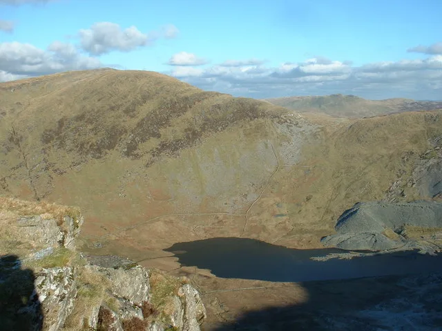
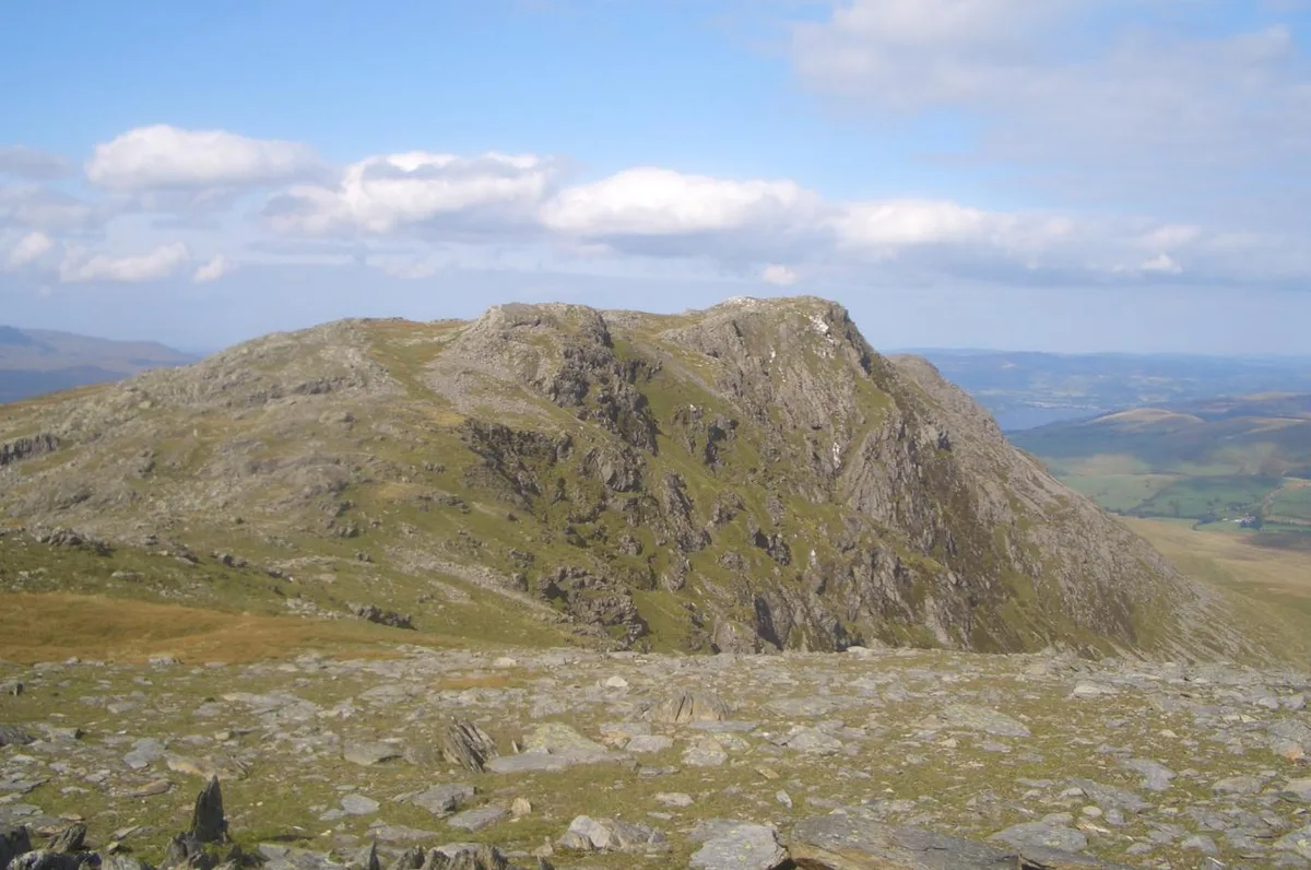
Moel y Gydros — Named summit at 522.3 m.

Wikimedia Commons contributors — see linked file page for photographer and licence licence
Plan your visit
- Typical visit
- 3 h–8 h
- Best time of year
- Late spring – early autumn (May–Oct)
- Free entry
- Dog-friendly
About
Moel y Gydros is a named summit in the United Kingdom. Wikidata describes it as: "Named summit at 522.3 m.". Coordinates: 52.9947°, -3.6191°.
Photo gallery
From the Wikipedia article
Moel y Gydros (English: Bare Hill of Gydros) is a hill located just outside the Snowdonia National Park on the Gwynedd / Conwy border in North Wales. The B4501, Frongoch to Cerrigydrudion road skirts the hills lower slopes.
Excerpt from Wikipedia under CC BY-SA 4.0. See the source article linked in Sources below.
- Coordinates
- 52.9947, -3.6191
- District
- Gwynedd
- Parish
- Llandderfel
- Postcode
- LL21 0RN
- Parliamentary constituency
- Dwyfor Meirionnydd
Sources
- osm: n3287608366 (ODbL)
- wikipedia: Moel y Gydros (CC BY-SA 4.0)
- commons: Moel y Gydros summit - geograph.org.uk - 1233190.jpg (CC BY-SA 4.0)
Other places nearby
Loading nearby places…
Nearby
 📷 3
📷 3Mountains & hills · North Wales
Moel y Gydros South Top
Moel y Gydros South Top — a mountain in wales-north, United Kingdom, 510 m.
 📷 5
📷 5Mountains & hills · North Wales
Moel Cwm-Main
Moel Cwm-Main — mountain in wales north. Elevation: 466 m.
 📷 5
📷 5Mountains & hills · North Wales
Moel Llechwedd-Figyn
Moel Llechwedd-Figyn — mountain in wales north. Elevation: 405 m.
 📷 5
📷 5Mountains & hills · North Wales
Cadair Benllyn
Cadair Benllyn — mountain in wales north. Elevation: 410 m.
 📷 5
📷 5Mountains & hills · North Wales
Foel Hafotty Uchaf
Foel Hafotty Uchaf — mountain in wales north. Elevation: 442 m.
📷 5Mountains & hills · North Wales
Y Gesail
Y Gesail — a mountain in wales-north, United Kingdom, 486 m.
Where to eat & stay near Moel y Gydros
Places to stay
 📷 5
📷 5Caravan parks · North Wales
Glan Ceirw
Glan Ceirw — a caravan park in wales north.
 📷 5
📷 5Campsites · North Wales
Llwyn Onn Campsite
Llwyn Onn Campsite — a campsite in wales north.
 📷 5
📷 5Caravan parks · North Wales
Fron-deg Caravan Park
Fron-deg Caravan Park — a caravan park in wales north.
📷 5B&Bs · North Wales
Llwyn Onn Guest House
Llwyn Onn Guest House — a bed-and-breakfast in wales north.
 📷 5
📷 5Campsites · North Wales
Tyn Cornel
Tyn Cornel — a campsite in wales north.
 📷 5
📷 5Hotels · North Wales
The Goat Hotel
The Goat Hotel — a hotel in wales north.
Places to eat & drink
 📷 5
📷 5Restaurants · North Wales
Palé Hall Hotel Restaurant
Palé Hall Hotel Restaurant — a restaurant in wales north. Cuisine: welsh;british;fine dining. 5-star.
 📷 5
📷 5Historic pubs · North Wales
Tŷ Mawr
Tŷ Mawr in Wales North, United Kingdom.
 📷 5
📷 5Historic pubs · North Wales
Leyland Arms
Leyland Arms in Wales North, United Kingdom.
 📷 5
📷 5Historic pubs · North Wales
Ruthin Castle Hotel
Ruthin Castle Hotel in Wales North, United Kingdom.
 📷 5
📷 5Restaurants · North Wales
The Star Bistro
The Star Bistro — a restaurant in wales north.
 📷 5
📷 5Historic pubs · North Wales
Castle Hotel
Castle Hotel in Wales North, United Kingdom.
More mountains in this region
 📷 5
📷 5Mountains & hills · North Wales
Cemlyn Bay and lagoon
Cemlyn Bay and lagoon — Site of Special Scientific Interest in Wales.
 📷 3
📷 3Mountains & hills · North Wales
Aberffraw Bay
Aberffraw Bay — bay on the west coast of Anglesey, in Wales, UK.
 📷 3
📷 3Mountains & hills · North Wales
Allt-fawr
Allt-fawr — Named summit at 698 m.
 📷 3
📷 3Mountains & hills · North Wales
Aran Benllyn
Aran Benllyn — Named summit at 884 m.
Frequently asked questions
- Where is Moel y Gydros?
- Moel y Gydros is in North Wales, United Kingdom (postcode LL21 0RN), in the parish of Llandderfel.
- What is Moel y Gydros?
- Moel y Gydros — Named summit at 522.3 m.
- How do I get to Moel y Gydros?
- Drivers can use postcode LL21 0RN.
- Is Moel y Gydros free to visit?
- Yes, Moel y Gydros is free to enter.
- How do I get to Moel y Gydros?
- Drivers can navigate to postcode LL21 0RN. It sits within the Dwyfor Meirionnydd parliamentary constituency.