Mountains & hills · North Wales
Moel y Gamelin
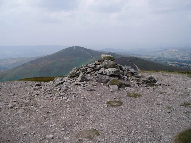
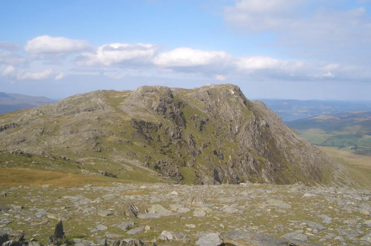
Moel y Gamelin — Named summit at 577 m.

Wikimedia Commons contributors — see linked file page for photographer and licence licence
Plan your visit
- Typical visit
- 3 h–8 h
- Best time of year
- Late spring – early autumn (May–Oct)
- Nearest railway station
- Berwyn · 4.0 km
- Free entry
- Dog-friendly
About
Moel y Gamelin is a named summit in the United Kingdom. Wikidata describes it as: "Named summit at 577 m.". Coordinates: 53.0096°, -3.2290°.
Photo gallery
From the Wikipedia article
Both Llantysilio Mountain and Maesyrchen Mountain re-direct here. Moel y Gamelin is a hill in Denbighshire, North Wales, to the northwest of the town of Llangollen. It is the highest summit of a range which stretches eastwards from near the village of Carrog to the Horseshoe Pass (Welsh: Bwlch yr Oernant) traversed by the A542 road, and reaches an elevation of 577 metres (1,893 ft) above sea level. The western part of the range is known as Llantysilio Mountain whilst the eastern end is referred to as Maesyrchen Mountain. At its top is a round cairn, of unknown date, measuring about 30 metres (100 ft) in diameter and 1.8 metres (6 ft) high. It is in the Clwydian Range and Dee Valley Area of Outstanding Natural Beauty.
Excerpt from Wikipedia under CC BY-SA 4.0. See the source article linked in Sources below.
- Coordinates
- 53.0096, -3.2290
- District
- Denbighshire
- Parish
- Llantysilio
- Postcode
- LL20 8DP
- Parliamentary constituency
- Clwyd East
- Nearest railway station
- Berwyn — 4 km
Sources
- osm: n1860791433 (ODbL)
- wikipedia: Moel y Gamelin (CC BY-SA 4.0)
- commons: Summit cairn, Moel y Gamelin - geograph.org.uk - 206767.jpg (CC BY-SA 4.0)
Other places nearby
Loading nearby places…
Nearby
 📷 3
📷 3Hill forts · North Wales
Moel y Gamelin
Moel y Gamelin — hill (576.9m) in Denbighshire, Wales, UK.
Vineyards · North Wales
Moel y Gaer, Llantysilio
Moel y Gaer, Llantysilio — a UK vineyard in wales north, producing English or Welsh wine from cool-climate grape varieties.
 📷 3
📷 3Mountains & hills · North Wales
Moel y Gaer
Moel y Gaer — a mountain in wales-north, United Kingdom, 504 m.
 📷 3
📷 3Hill forts · North Wales
Moel-y-gaer Llantysilio Hillfort
Moel-y-gaer Llantysilio Hillfort — a hill fort in wales-north, United Kingdom.
 📷 3
📷 3Mountains & hills · North Wales
Moel y Faen
Moel y Faen — a mountain in wales-north, United Kingdom, 547 m.
 📷 3
📷 3Mountains & hills · North Wales
Maesyrychen Mountain
Maesyrychen Mountain — a mountain in wales-north, United Kingdom, 421 m.
More mountains in this region
 📷 5
📷 5Mountains & hills · North Wales
Cemlyn Bay and lagoon
Cemlyn Bay and lagoon — Site of Special Scientific Interest in Wales.
 📷 3
📷 3Mountains & hills · North Wales
Aberffraw Bay
Aberffraw Bay — bay on the west coast of Anglesey, in Wales, UK.
 📷 3
📷 3Mountains & hills · North Wales
Allt-fawr
Allt-fawr — Named summit at 698 m.
 📷 3
📷 3Mountains & hills · North Wales
Aran Benllyn
Aran Benllyn — Named summit at 884 m.
Frequently asked questions
- Where is Moel y Gamelin?
- Moel y Gamelin is in North Wales, United Kingdom (postcode LL20 8DP), in the parish of Llantysilio.
- Is Moel y Gamelin free to visit?
- Yes, Moel y Gamelin is free to enter.
- How do I get to Moel y Gamelin?
- The nearest railway station is Berwyn, about 4.0 km away. Drivers can navigate to postcode LL20 8DP.