
Mountains & hills · North Wales
Moel Gyw
Moel Gyw — Named summit at 467 m.

Wikimedia Commons contributors — see linked file page for photographer and licence licence

Plan your visit
- Typical visit
- 3 h–8 h
- Best time of year
- Late spring – early autumn (May–Oct)
- Free entry
- Dog-friendly
About
Moel Gyw is a named summit in the United Kingdom. Wikidata describes it as: "Named summit at 467 m.". Coordinates: 53.1082°, -3.2395°.
Photo gallery
From the Wikipedia article
Moel Gyw is a hill in Denbighshire, North Wales and forms part of the Clwydian Range. It is situated just to the south of Moel Famau and Foel Fenlli.
Excerpt from Wikipedia under CC BY-SA 4.0. See the source article linked in Sources below.
- Coordinates
- 53.1082, -3.2395
- District
- Denbighshire
- Parish
- Llanbedr Dyffryn Clwyd
- Postcode
- LL15 1YG
- Parliamentary constituency
- Clwyd East
Sources
- osm: n286510563 (ODbL)
- wikipedia: Moel Gyw (CC BY-SA 4.0)
- commons: Foel Gyw, un o Fryniau Clwyd - Foel Gyw near Rhuthun, in the Clwydian range of hills called 'Bryniau Clwyd' 01.jpg (CC BY-SA 4.0)
Other places nearby

Moel Llanfair
Mountains & hills · 1.0 km

Moel Llanfair
Mountains & hills · 1.0 km

Pen-yr-Allt or Penrallt Defended Enclosure
Vineyards · 1.1 km

Gyrn
Mountains & hills · 1.2 km

Moel Eithinen
Mountains & hills · 1.8 km

Moel Eithinen
Mountains & hills · 1.8 km

Parry Monument
Memorials & monuments · 1.8 km

Moel y Plas
Mountains & hills · 2.1 km

Moel y Plas
Mountains & hills · 2.1 km
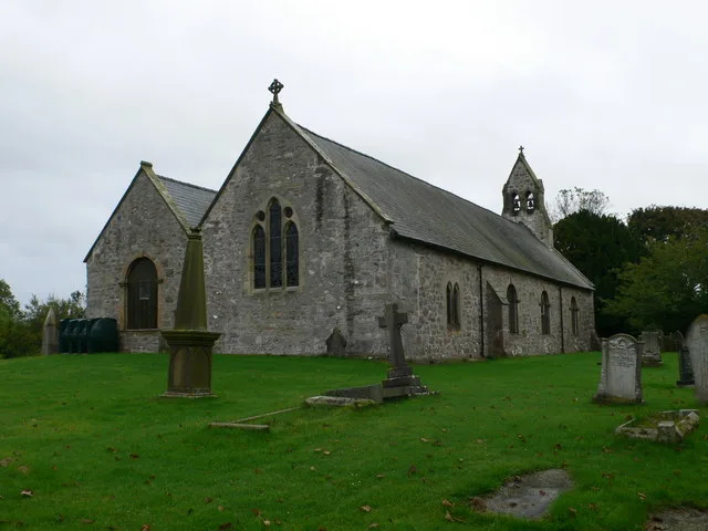
St Garmon's Church
Historic churches · 2.4 km
%2C_by_the_foot_of_Moel_y_Plas%2C_Bryniau_Clwyd_01.jpg?width=1200)
Llyn Gweryd
Reservoirs & lochs · 2.5 km

Pont Llanarmon
Historic bridges · 2.5 km
Nearby
📷 3Mountains & hills · North Wales
Moel Llanfair
Moel Llanfair — a mountain in wales-north, United Kingdom, 447 m.
📷 5Mountains & hills · North Wales
Moel Llanfair
Moel Llanfair — mountain in wales north. Elevation: 447 m.
📷 5Vineyards · North Wales
Pen-yr-Allt or Penrallt Defended Enclosure
Pen-yr-Allt or Penrallt Defended Enclosure — a UK vineyard in wales north, producing English or Welsh wine from cool-climate grape varieties.
📷 5📷 5Mountains & hills · North Wales
Moel Eithinen
Moel Eithinen — mountain in wales north. Elevation: 434 m.
📷 3Mountains & hills · North Wales
Moel Eithinen
Moel Eithinen — a mountain in wales-north, United Kingdom, 434 m.
Where to eat & stay near Moel Gyw
Places to stay
 📷 5
📷 5 📷 5
📷 5Campsites · North Wales
Llanbenwch Caravan Park
Llanbenwch Caravan Park — a campsite in wales north.
 📷 5
📷 5 📷 5
📷 5Campsites · North Wales
Llyn Rhys Campsite
Llyn Rhys Campsite — a campsite in wales north.
 📷 3
📷 3Caravan parks · North Wales
Woodlands Hall Caravan Park and Country Club
Woodlands Hall Caravan Park and Country Club — a caravan park in wales north.
 📷 5
📷 5Campsites · North Wales
Gwyliau Clwydian Holidays
Gwyliau Clwydian Holidays — a campsite in wales north.
Places to eat & drink
 📷 5
📷 5Historic pubs · North Wales
Castle Hotel
Castle Hotel in Wales North, United Kingdom.
 📷 5
📷 5Historic pubs · North Wales
Ruthin Castle Hotel
Ruthin Castle Hotel in Wales North, United Kingdom.
 📷 5
📷 5 📷 5
📷 5Historic pubs · North Wales
Leyland Arms
Leyland Arms in Wales North, United Kingdom.
 📷 5
📷 5 📷 5
📷 5More mountains in this region
 📷 5
📷 5Mountains & hills · North Wales
Cemlyn Bay and lagoon
Cemlyn Bay and lagoon — Site of Special Scientific Interest in Wales.
 📷 3
📷 3Mountains & hills · North Wales
Aberffraw Bay
Aberffraw Bay — bay on the west coast of Anglesey, in Wales, UK.
 📷 3
📷 3 📷 3
📷 3Mountains & hills · North Wales
Aran Benllyn
Aran Benllyn — Named summit at 884 m.
Frequently asked questions
- Where is Moel Gyw?
- Moel Gyw is in North Wales, United Kingdom (postcode LL15 1YG), in the parish of Llanbedr Dyffryn Clwyd.
- What is Moel Gyw?
- Moel Gyw — Named summit at 467 m.
- How do I get to Moel Gyw?
- Drivers can use postcode LL15 1YG.
- Is Moel Gyw free to visit?
- Yes, Moel Gyw is free to enter.
- How do I get to Moel Gyw?
- Drivers can navigate to postcode LL15 1YG. It sits within the Clwyd East parliamentary constituency.