Mountains & hills · North East England
Mockerkin How
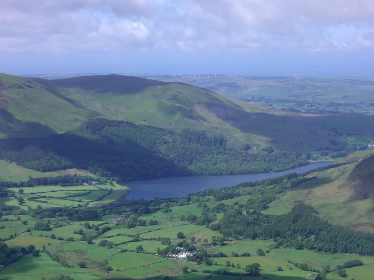
Mockerkin How — mountain in england north east. Elevation: 247 m.

Michael Graham — CC BY-SA 2.0 via Wikimedia Commons licence
Plan your visit
- Typical visit
- 3 h–8 h
- Best time of year
- Late spring – early autumn (May–Oct)
About
Mockerkin How is a mountain located in england north east. Elevation: 247 m. A named British peak recorded in OpenStreetMap. Peaks are typically named on Ordnance Survey 1:50k mapping.
Photo gallery
Place summary
Mockerkin How is a mountain located in North-East England. It offers a rugged landscape typical of the region, appealing to outdoor enthusiasts and hikers. The area provides various walking routes, allowing visitors to explore its natural beauty.
AI-generated from the structured facts on this page (operator, designation, listing, era). Not a substitute for visiting.
- Coordinates
- 54.5916, -3.3961
Sources
- osm: n5201930153 (ODbL)
Other places nearby
Loading nearby places…
Nearby
 📷 5
📷 5Mountains & hills · North East England
Toot Hill
Toot Hill — mountain in england north east. Elevation: 185 m.
 📷 5
📷 5Villages · North East England
Mockerkin
Mockerkin — a village in england north east.
 📷 5
📷 5Mountains & hills · North East England
Owsen Fell
Owsen Fell — mountain in england north east. Elevation: 408 m.
 📷 5
📷 5Hostels · North East England
Swallow Barn
Swallow Barn — a hostel in england north east.
 📷 5
📷 5Villages · North East England
Lamplugh
Lamplugh — a village in england north east.
 📷 3
📷 3Mountains & hills · North East England
Burnbank Fell
Burnbank Fell — Named summit at 475 m.
Where to eat & stay near Mockerkin How
Places to stay
📷 5Hostels · North East England
Swallow Barn
Swallow Barn — a hostel in england north east.
 📷 5
📷 5Caravan parks · North East England
Inglenook Caravan Park
Inglenook Caravan Park — a caravan park in england north east.
 📷 5
📷 5Caravan parks · Scottish Lowlands
Whinfell Caravan Park
Whinfell Caravan Park — a caravan park in scotland lowlands.
 📷 5
📷 5Campsites · Scottish Lowlands
Whinfell Hall Farm Campsite
Whinfell Hall Farm Campsite — a campsite in scotland lowlands.
 📷 5
📷 5Caravan parks · Scottish Lowlands
Wheatsheaf Caravan and Camping Park
Wheatsheaf Caravan and Camping Park — a caravan park in scotland lowlands.
 📷 5
📷 5Caravan parks · Scottish Lowlands
Violet Bank holiday Home Park
Violet Bank holiday Home Park — a caravan park in scotland lowlands.
Places to eat & drink
 📷 5
📷 5Historic pubs · Scottish Lowlands
The Pheasant Inn
The Pheasant Inn in Scotland Lowlands, United Kingdom.
 📷 5
📷 5Historic pubs · North West England
Fox and Grapes
Fox and Grapes in England North West, United Kingdom.
 📷 5
📷 5Cafés · North East England
Grange Bridge Cottage
Grange Bridge Cottage — a café in england north east.
 📷 5
📷 5Cafés · Scottish Lowlands
YHA Cafe
YHA Cafe — a café in scotland lowlands.
More mountains in this region
 📷 3
📷 3Mountains & hills · North East England
Angletarn Pikes
Angletarn Pikes — Named summit at 566 m.
 📷 3
📷 3Mountains & hills · North East England
Angletarn Pikes South Top
Angletarn Pikes South Top — Named summit at 563.6 m.
 📷 3
📷 3Mountains & hills · North East England
Ard Crags
Ard Crags — Named summit at 581 m.
 📷 3
📷 3Mountains & hills · North East England
Arnison Crag
Arnison Crag — Named summit at 433 m.
Frequently asked questions
- Where is Mockerkin How?
- Mockerkin How is in North-East England, United Kingdom.
- What is Mockerkin How?
- Mockerkin How — mountain in england north east. Elevation: 247 m.
- How do I get to Mockerkin How?
- Its coordinates are 54.5916°, -3.3961°.