
Castles · West Midlands
Moated site, prospect mound and fishponds adjacent to Isle Farm
In or near Fitz.
Moated site, prospect mound and fishponds adjacent to Isle Farm — scheduled monument-listed castle in wales-north, United Kingdom.

Row17 — CC BY-SA 2.0 via Wikimedia Commons licence

Plan your visit
- Typical visit
- 1.5 h–3 h
- Nearest railway station
- Shrewsbury · 5.3 km
- Family-friendly
- Limited wheelchair access
Getting there & planning your visit
To visit the Moated site, prospect mound and fishponds adjacent to Isle Farm, the nearest railway station is Shrewsbury, located 5.3 km away. The postcode for navigation is SY3 8EE. Accessibility is limited for wheelchair users.
About
Moated site, prospect mound and fishponds adjacent to Isle Farm is a scheduled monument-listed castle in wales-north, United Kingdom, registered on the National Heritage List for England (NHLE entry 1019301). Listed status protects buildings and structures of special architectural or historic interest. See the linked Wikipedia article for further details.
Photo gallery
Heritage listing
Details The monument includes the earthwork and buried remains of a medieval moated site, a prospect mound and fishponds to the south east of Isle Farm. The moated site is considered to be the manorial centre of Rossall, which was held by Vivian de Rossall (Rosshall) in the early 13th century. The manor was held by the Rossalls until the early 15th century, when it passed to the Englefield family. A survey of the manor by John Lovell for Francis Englefield in 1587 records that the moated manor site was used as an orchard by this date and that no buildings remained standing. This survey also notes the presence of a former chapel in Chapel Field to the south of the moated site. Documentary sources list the incumbents from the 13th century until the 15th century. It has been alleged that the chapel was burnt down during the Reformation. Its position is approximately marked on the earliest large scale Ordnance Survey map of 1881 as being adjacent to the south west corner of the moated site. There are no visible indications of this building since the area has been heavily disturbed by tree planting. The chapel site is not therefore included in the scheduling as its exact location and form are not known. The moated site was built on western side of the neck of a large meander of the River Severn. It is situated on level ground next to the very steep slope cut by the river. The rectangular moated island, which measures approximately 60m north-south and 70m east-west, is defined on its western side by the steep slope and on the other sides by a moat, now dry, consisting of three arms between 9m and 15m wide. Water within the moat would have been held by dams constructed at the western ends of the north and south arms. Of these two dams the one crossing the northern arm is still
From the Historic England List Entry under OGL v3.
Place summary
The moated site, prospect mound, and fishponds adjacent to Isle Farm are located in Bicton, North Wales. This scheduled monument features remnants of historical significance, reflecting the landscape's medieval heritage. The site offers insights into the area's past and its agricultural practices.
AI-generated from the structured facts on this page (operator, designation, listing, era). Not a substitute for visiting.
- Coordinates
- 52.7452, -2.8049
- District
- Shropshire
- Parish
- Bicton
- Postcode
- SY3 8EE
- Parliamentary constituency
- Shrewsbury
- Nearest railway station
- Shrewsbury — 5.3 km
Sources
- wikidata: Q17673981 (CC0)
Other places nearby

Bicton The Isle
Castles · 0.0 km

Fitz
Towns & cities · 1.4 km

Fitz Manor
Stately homes · 1.4 km

River Perry
Museums · 1.7 km
Mytton Bridge (That Part In Bomere Heath)
Historic bridges · 1.9 km

Leaton War Memorial
Memorials & monuments · 2.0 km

Leaton
Villages · 2.1 km

Severn House Camp Site
Campsites · 2.7 km

Oxon Hall Touring & Holiday Home Park
Caravan parks · 2.9 km
The Wingfield Caravan Park
Campsites · 3.0 km
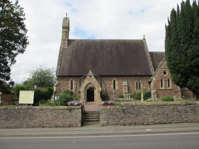
Christ Church Shelton and Oxon
Historic churches · 3.5 km

Safari Lodge Glamping Village
Campsites · 3.8 km
Nearby
📷 5📷 3📷 3Stately homes · West Midlands
Fitz Manor
Fitz Manor — country house in Pimhill, Shropshire, England, UK.
📷 5📷 3Historic bridges · West Midlands
Mytton Bridge (That Part In Bomere Heath)
Mytton Bridge (That Part In Bomere Heath) — Grade II listed building-listed bridge in wales-north, United Kingdom.
📷 3Memorials & monuments · West Midlands
Leaton War Memorial
Leaton War Memorial — Grade II listed building-listed memorial in wales-north, United Kingdom.
Where to eat & stay near Moated site, prospect mound and fishponds adjacent to Isle Farm
Places to stay
📷 5📷 5Caravan parks · West Midlands
Oxon Hall Touring & Holiday Home Park
Oxon Hall Touring & Holiday Home Park — a caravan park in wales north.
📷 5Campsites · West Midlands
The Wingfield Caravan Park
The Wingfield Caravan Park — a campsite in wales north.
📷 5Campsites · West Midlands
Safari Lodge Glamping Village
Safari Lodge Glamping Village — a campsite in wales north.
 📷 7
📷 7Hotels · West Midlands
The Shrewsbury Hotel
The Shrewsbury Hotel — a hotel in wales north.
 📷 7
📷 7Places to eat & drink
 📷 7
📷 7Historic pubs · West Midlands
Canal Tavern Public House And Attached Outbuilding Range
Canal Tavern Public House And Attached Outbuilding Range in Wales North, United Kingdom.
 📷 7
📷 7Historic pubs · West Midlands
The Castle Vaults Public House
The Castle Vaults Public House in Wales North, United Kingdom.
 📷 7
📷 7Historic pubs · West Midlands
The Hole In The Wall Public House
The Hole In The Wall Public House in Wales North, United Kingdom.
 📷 5
📷 5Historic pubs · West Midlands
Admiral Benbow Public House
Admiral Benbow Public House in Wales North, United Kingdom.
 📷 7
📷 7Historic pubs · West Midlands
Yorkshire House Public House
Yorkshire House Public House in Wales North, United Kingdom.
 📷 7
📷 7Restaurants · West Midlands
The Golden Cross
The Golden Cross — a restaurant in wales north.
More castles in this region
 📷 3
📷 3 📷 3
📷 3Castles · West Midlands
Hoar Cross Hall
Hoar Cross Hall — a castle in england-east-midlands, United Kingdom.
 📷 3
📷 3Castles · West Midlands
Chartley Castle, Chartley Old Hall and associated water control systems including garden remains
Chartley Castle, Chartley Old Hall and associated water control systems including garden remains — scheduled monument-listed castle in england-east-midlands, United Kingdom.
 📷 5
📷 5Frequently asked questions
- Where is Moated site, prospect mound and fishponds adjacent to Isle Farm?
- Moated site, prospect mound and fishponds adjacent to Isle Farm is in the West Midlands, United Kingdom (postcode SY3 8EE), in the parish of Bicton.
- What is Moated site, prospect mound and fishponds adjacent to Isle Farm?
- Moated site, prospect mound and fishponds adjacent to Isle Farm — scheduled monument-listed castle in wales-north, United Kingdom.
- How do I get to Moated site, prospect mound and fishponds adjacent to Isle Farm?
- The nearest railway station is Shrewsbury, about 5.3 km away. The nearest town is Fitz. Drivers can use postcode SY3 8EE.
- Is Moated site, prospect mound and fishponds adjacent to Isle Farm a listed building?
- Moated site, prospect mound and fishponds adjacent to Isle Farm is officially recognised as scheduled monument listed.
- Does Moated site, prospect mound and fishponds adjacent to Isle Farm charge admission?
- Moated site, prospect mound and fishponds adjacent to Isle Farm typically charges admission. Check the official site for current ticket prices and opening hours.
- How do I get to Moated site, prospect mound and fishponds adjacent to Isle Farm?
- The nearest railway station is Shrewsbury, about 5.3 km away. Drivers can navigate to postcode SY3 8EE.