
Natural landmarks · Northern Ireland
Millisle Road Halt railway station
In or near Seahill.
Millisle Road Halt railway station in Northern Ireland, United Kingdom.

Sue Adair — CC BY-SA 2.0 via Wikimedia Commons licence

Plan your visit
- Typical visit
- 1 h–2 h
- Nearest railway station
- Drumawhey Junction · 5.5 km
- Free entry
- Dog-friendly
About
Millisle Road Halt railway station is a place of interest in Northern Ireland, United Kingdom — drawn from open-data sources for visitor reference. See the linked Wikipedia article for the full description.
Photo gallery
See it from the streetimagery from 2025
Imagery © Mapillary contributors, CC BY-SA 4.0
From the Wikipedia article
Millisle Road Halt railway station was on the Belfast and County Down Railway which ran from Belfast to Donaghadee in Northern Ireland.
Excerpt from Wikipedia under CC BY-SA 4.0. See the source article linked in Sources below.
Background
History
The station was opened by the Belfast and County Down Railway on 1 June 1928. The station closed to passengers in 1950, by which time it had been taken over by the Ulster Transport Authority.
Sourced from Wikipedia under CC BY-SA 4.0.
- Coordinates
- 54.6349, -5.5333
- District
- Ards and North Down
- Postcode
- BT21 0LE
- Parliamentary constituency
- North Down
- Nearest railway station
- Drumawhey Junction — 5.5 km
Sources
- wikidata: Q6859875 (CC0)
- wikipedia: Millisle Road Halt railway station (CC BY-SA 4.0)
Other places nearby

Seahill
Towns & cities · 0.2 km

Donaghadee
Villages · 0.7 km

Donaghadee railway station
Natural landmarks · 0.7 km

Grace Neill's
Natural landmarks · 0.8 km

Grace Neill's
Historic pubs · 0.8 km
_(cropped).jpg?width=1200)
Former Town Hall 24 High Street Donaghadee Co Down
Historic houses · 0.8 km

Donaghadee Lifeboat Station
Natural landmarks · 0.9 km

BCDR Crane
Memorials & monuments · 1.0 km

Donaghadee harbour
Marinas · 1.1 km
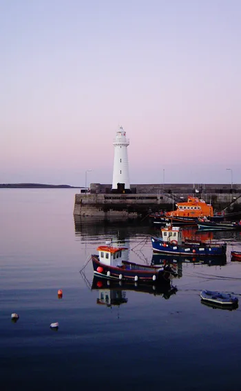
Donaghadee lighthouse
Lighthouses · 1.1 km

Millisle Lagoon
Wild swimming spots · 2.9 km

Millisle
Towns & cities · 3.0 km
Nearby
📷 3Towns & cities · Northern Ireland
Seahill
Seahill — village in County Down, Northern Ireland, UK.
📷 5📷 4Natural landmarks · Northern Ireland
Donaghadee railway station
Donaghadee railway station in Northern Ireland, United Kingdom.
📷 4Natural landmarks · Northern Ireland
Grace Neill's
Grace Neill's in Northern Ireland, United Kingdom.
📷 7Historic pubs · Northern Ireland
Grace Neill's
Grace Neill's in Northern Ireland, United Kingdom.
📷 3Historic houses · Northern Ireland
Former Town Hall 24 High Street Donaghadee Co Down
Former Town Hall 24 High Street Donaghadee Co Down — town hall in Donaghadee, County Down, Northern Ireland.
Where to eat & stay near Millisle Road Halt railway station
Places to stay
 📷 5
📷 5Caravan parks · Northern Ireland
Ballywhiskin Caravan and Camping Park
Ballywhiskin Caravan and Camping Park — a caravan park in northern ireland.
 📷 5
📷 5Hostels · Northern Ireland
Lakewood Secure Care Centre
Lakewood Secure Care Centre — a hostel in northern ireland.
📷 5📷 5📷 5 📷 5
📷 5Campsites · Northern Ireland
Crawfordsburn Scout Centre
Crawfordsburn Scout Centre — a campsite in northern ireland.
Places to eat & drink
📷 7Historic pubs · Northern Ireland
Grace Neill's
Grace Neill's in Northern Ireland, United Kingdom.
More natural landmarks in this region
 Flagship📷 4
Natural landmarks · Northern Ireland
Lough Erne
Lough Erne — lake in County Fermanagh, Northern Ireland, UK.
 Flagship📷 4
Natural landmarks · Northern Ireland
Lough Neagh
Lough Neagh — large lake in Northern Ireland.
 📷 3
📷 3Natural landmarks · Northern Ireland
Ballysaggart Lough
Ballysaggart Lough — lake in the United Kingdom.
 📷 5
📷 5Natural landmarks · Northern Ireland
Belmore Mountain
Belmore Mountain — mountain in the United Kingdom.
Frequently asked questions
- Where is Millisle Road Halt railway station?
- Millisle Road Halt railway station is in Northern Ireland, United Kingdom (postcode BT21 0LE).
- What is Millisle Road Halt railway station?
- Millisle Road Halt railway station in Northern Ireland, United Kingdom.
- How do I get to Millisle Road Halt railway station?
- The nearest railway station is Drumawhey Junction, about 5.5 km away. The nearest town is Seahill. Drivers can use postcode BT21 0LE.
- Is Millisle Road Halt railway station free to visit?
- Yes, Millisle Road Halt railway station is free to enter.
- How do I get to Millisle Road Halt railway station?
- The nearest railway station is Drumawhey Junction, about 5.5 km away. Drivers can navigate to postcode BT21 0LE.