Abbeys & priories · North East England
Middlehaven
In or near Middlesbrough.
Middlehaven in England North East, United Kingdom.

JThomas — CC BY-SA 2.0 via Wikimedia Commons licence
Plan your visit
- Typical visit
- 45 min–1.5 h
- Nearest railway station
- Middlesbrough · 0.4 km
- Family-friendly
- Limited wheelchair access
Getting there & planning your visit
To visit Middlehaven in Middlesbrough, the nearest railway station is Middlesbrough, located 0.4 km away. The postcode for sat-nav is TS2 1DX. Accessibility is limited for wheelchair users.
About
Middlehaven is a place of interest in England North East, United Kingdom — drawn from open-data sources for visitor reference. See the linked Wikipedia article for the full description.
Photo gallery
Protected designations
- Site of Special Scientific Interest: Teesmouth and Cleveland Coast SSSI
Designations sourced from Natural England open data under OGL v3.
From the Wikipedia article
Middlehaven is the oldest part of Middlesbrough, North Yorkshire, England. It is directly south of the River Tees, and north of the current town centre, separated from it by the railway and A66. The area has had waves of regeneration since post-war devastation. It currently includes, from west to east: a manufacturing and industrial sector, Boho Zone developments (residential and commercial), the Old Town Hall, the Transporter Bridge, Middlesbrough College, docks, and the Riverside Stadium. The term St Hilda's for the area relates to the former priory, founded by Hilda of Whitby (the first mention of the town) and later also former church as named after the saint. The railway, and the much later-built A66, separating the area from the rest of the town created the term Over the Border for the area. The name Middlehaven is a back formation from Middlesbrough, combining "Middle" with "haven": the haven relates to Middlesbrough Dock.
Excerpt from Wikipedia under CC BY-SA 4.0. See the source article linked in Sources below.
Background
History
The area formed what was the original town centre of Middlesbrough after its foundation around 1830, and was originally known as St. Hilda's after the parish church of the same name. The district was eventually separated from the southward expansion of the town by the railway in 1846. By the 1930s, the area had become slums, with overcrowding and high crime, and demolitions begun despite protests from residents. Later, in the 1950s, the clearance continued with sweeping demolitions, and the replacement of the remaining homes by low-rise flat blocks. Once again, beginning in 1969, there was another wave of demolition, this time replacing the 1950s flats with a suburban housing estate. In the…
Sourced from Wikipedia under CC BY-SA 4.0.
- Coordinates
- 54.5825, -1.2338
- District
- Middlesbrough
- Parish
- Middlesbrough, unparished area
- Postcode
- TS2 1DX
- Parliamentary constituency
- Middlesbrough and Thornaby East
- Nearest railway station
- Middlesbrough — 0.4 km
Sources
- wikidata: Q113349801 (CC0)
- wikipedia: Middlehaven (CC BY-SA 4.0)
Other places nearby

Middlesbrough Priory
Abbeys & priories · 0.1 km

Theatre Royal, Middlesbrough
Theatres · 0.3 km

Transporter Bridge Visitor Centre
Museums · 0.3 km

Middlesbrough railway station
Memorials & monuments · 0.4 km

Esk Valley line
Heritage railways · 0.4 km

Platform Arts
Museums · 0.4 km

Middlesbrough Transporter Bridge
Historic bridges · 0.4 km
Tees Transporter Bridge
Historic bridges · 0.4 km

The Zetland
Historic pubs · 0.4 km

Middlesbrough College
Other places · 0.5 km

Henry Bolckow
Heritage railway stations · 0.5 km

Hippodrome, Middlesbrough
Theatres · 0.6 km
Nearby
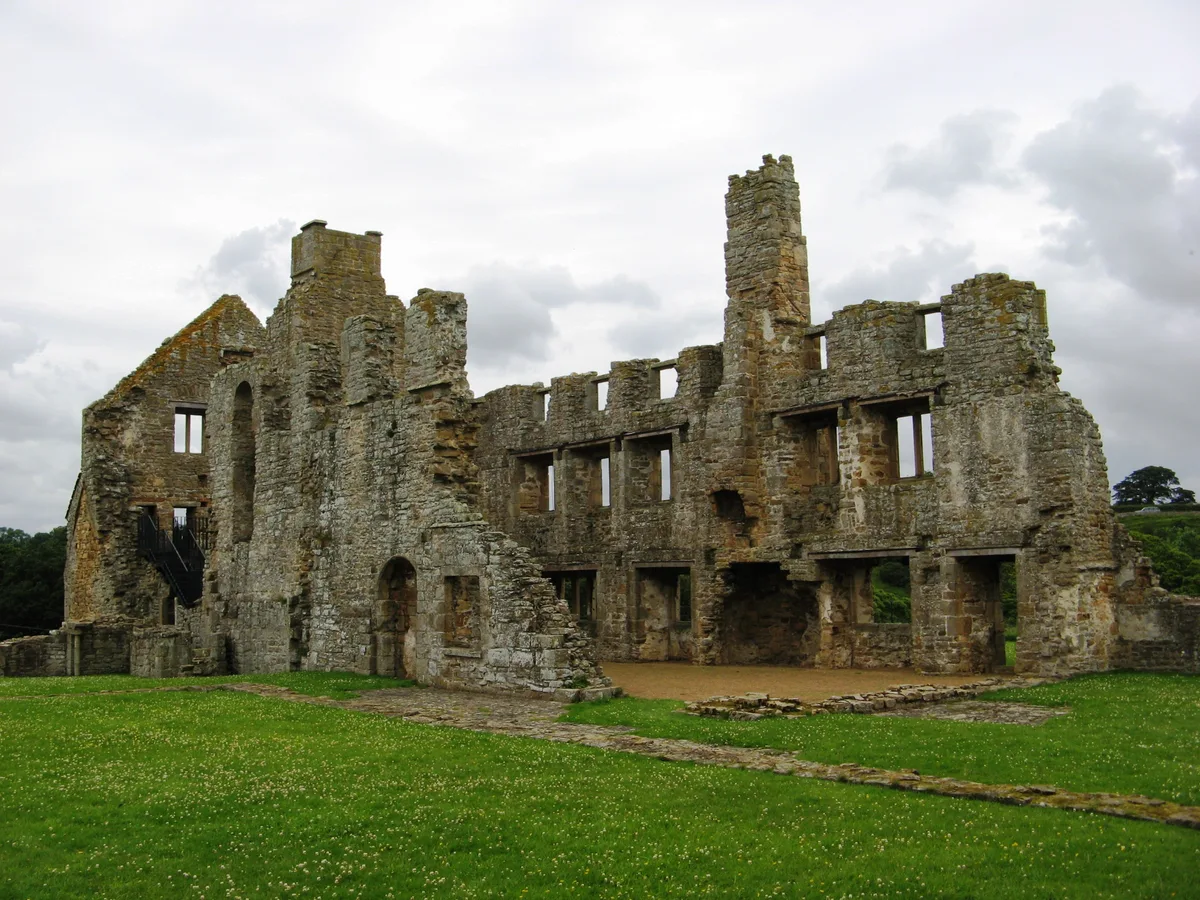
📷 3Abbeys & priories · North East England
Middlesbrough Priory
Middlesbrough Priory in England North East, United Kingdom.
📷 3Theatres · North East England
Theatre Royal, Middlesbrough
Theatre Royal, Middlesbrough in England North East, United Kingdom.
📷 3Museums · North East England
Transporter Bridge Visitor Centre
Transporter Bridge Visitor Centre — a museum in england-north-east, United Kingdom.
📷 4Memorials & monuments · North East England
Middlesbrough railway station
Middlesbrough railway station in England North East, United Kingdom.
📷 5Heritage railways · North East England
Esk Valley line
The Esk Valley Line is a railway line located in the north of England, covering a total distance of approximately 35 miles (56 km), running from Middlesbrough to Whitby. The line follows the course of
📷 3Museums · North East England
Platform Arts
Platform Arts — a museum in england-north-east, United Kingdom.
Where to eat & stay near Middlehaven
Places to stay
 📷 5
📷 5Hotels · North East England
Baltimore Hotel
Baltimore Hotel — a hotel in england north east.
 📷 5
📷 5Caravan parks · North East England
White Water Park Caravan Club Site
White Water Park Caravan Club Site — a caravan park in england north east.
 📷 5
📷 5Hotels · North East England
Hampton by Hilton Stockton on Tees
Hampton by Hilton Stockton on Tees — a hotel in england north east. 3-star. Brand: Hampton.
 📷 5
📷 5Hostels · North East England
Bridge House Hostel
Bridge House Hostel — a hostel in england north east.
📷 5Hostels · North East England
Bridge House Hostel
Bridge House Hostel — a hostel in england north east.
 📷 5
📷 5Places to eat & drink
📷 6Historic pubs · North East England
The Zetland
The Zetland in England North East, United Kingdom.
 📷 5
📷 5 📷 5
📷 5Historic pubs · North East England
The Stainton Public House
The Stainton Public House in England North East, United Kingdom.
 📷 4
📷 4 📷 5
📷 5Historic pubs · North East England
1 Bridgewater, Levenbank
1 Bridgewater, Levenbank in England North East, United Kingdom.
 📷 5
📷 5Historic pubs · North East England
The Ketton Ox Public House
The Ketton Ox Public House in England North East, United Kingdom.
More abbeys in this region
 📷 5
📷 5Abbeys & priories · North East England
Egglestone Abbey
Egglestone Abbey is a abbey in the United Kingdom.
 📷 5
📷 5 📷 4
📷 4Abbeys & priories · North East England
St Cuthbert's Way
St Cuthbert's Way in England North East, United Kingdom.
 Flagship📷 3
Abbeys & priories · North East England
The Abbey, Skirwith
The Abbey, Skirwith in England North East, United Kingdom.
Frequently asked questions
- Where is Middlehaven?
- Middlehaven is in North-East England, United Kingdom (postcode TS2 1DX), in the parish of Middlesbrough, unparished area.
- What is Middlehaven?
- Middlehaven in England North East, United Kingdom.
- How do I get to Middlehaven?
- The nearest railway station is Middlesbrough, about 0.4 km away. Drivers can use postcode TS2 1DX.
- Is Middlehaven a protected site?
- Yes — Middlehaven is part of the Teesmouth and Cleveland Coast SSSI Site of Special Scientific Interest.
- How do I get to Middlehaven?
- The nearest railway station is Middlesbrough, about 0.4 km away. Drivers can navigate to postcode TS2 1DX.