
Natural landmarks · North West England
Merchant Taylors' Girls' School
In or near Sefton.
Merchant Taylors' Girls' School — a school heritage in wales-north, United Kingdom.

Ian Greig — CC BY-SA 2.0 via Wikimedia Commons licence

Plan your visit
- Typical visit
- 1 h–2 h
- Nearest railway station
- Blundellsands & Crosby · 1.1 km
- Free entry
- Dog-friendly
About
Merchant Taylors' Girls' School is a school heritage located in wales-north, United Kingdom. Catalogued from Wikidata's UK heritage register; see the Wikipedia article for further historical and visitor details.
Photo gallery
See it from the streetimagery from 2019
Imagery © Mapillary contributors, CC BY-SA 4.0
Official information
Merchant Taylors' Girls' School is an independent school located in Crosby, UK. It offers a range of educational programs and extracurricular activities for girls, focusing on academic excellence and personal development.
Protected designations
- Site of Special Scientific Interest: Sefton Coast SSSI
- Ramsar wetland: Ribble & Alt Estuaries
Designations sourced from Natural England open data under OGL v3.
Place summary
Merchant Taylors' Girls' School is located in North Wales. It is an independent school known for its academic excellence and strong emphasis on personal development. The institution has a long-standing history and is part of the Merchant Taylors' Company, showcasing a commitment to education for young women.
AI-generated from the structured facts on this page (operator, designation, listing, era). Not a substitute for visiting.
Background
History
Merchant Taylors' Girls' School was established in 1888, having inherited the buildings from the boys' school that had moved less than a mile away in 1874. The then governing body was dilatory in providing for the 'new' school and it was due to the insistence of James Fenning, the Master of the Worshipful Company of Merchant Taylors, that the girls' school was started. At the School's opening all of the women staff were graduates. This was a feat, considering that at the time only four universities granted degrees to women. Latin was taught at the school from the beginning, as was mathematics. Early governors of the school insisted that the girls also learnt sewing and cooking. In 1911 the…
Sourced from Wikipedia under CC BY-SA 4.0.
- Coordinates
- 53.4900, -3.0245
- District
- Sefton
- Parish
- Sefton, unparished area
- Postcode
- L23 5SJ
- Parliamentary constituency
- Bootle
- Established
- 1888
- Nearest railway station
- Blundellsands & Crosby — 1.1 km
- Official site
- www.merchanttaylors.com
Sources
- wikidata: Q6818401 (CC0)
- wikipedia: Merchant Taylors' Girls' School (CC BY-SA 4.0)
Other places nearby
Regent Cinema, Crosby
Theatres · 0.1 km
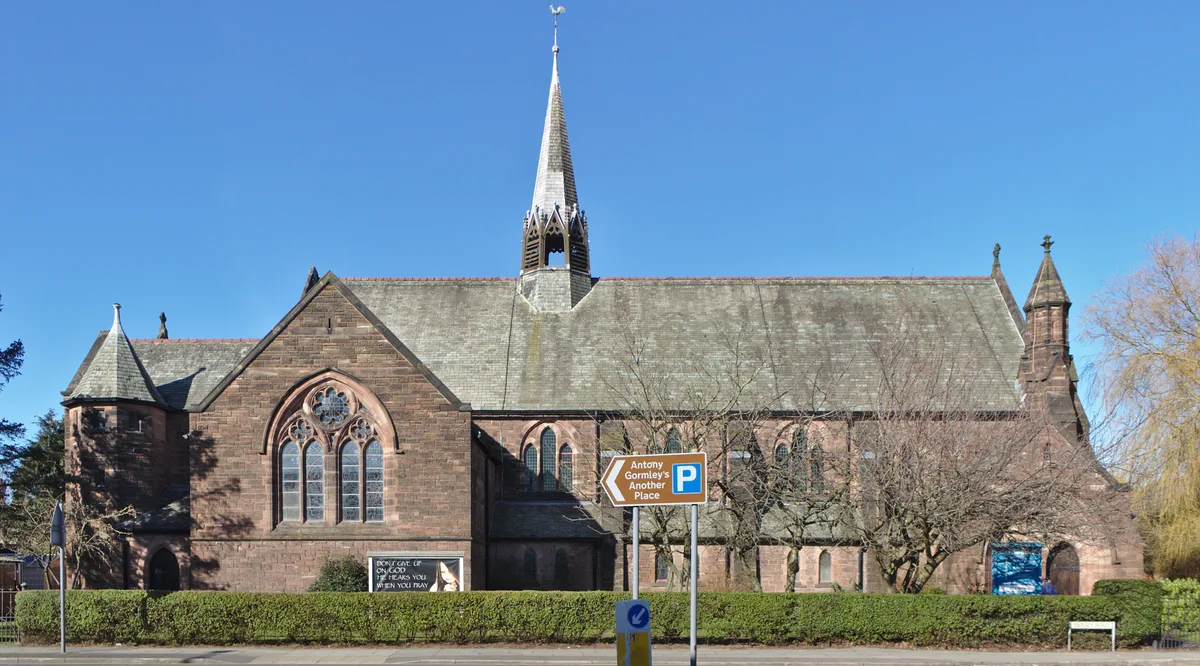
Crosby United Reformed Church
Historic churches · 0.2 km

Great Crosby
Villages · 0.4 km

Crosby and Blundellsands Civic War Memorial in Alexandra Park
Memorials & monuments · 0.5 km
Great Crosby and Blundellsands War Memorial
Memorials & monuments · 0.5 km

Crosby, Merseyside
Museums · 0.7 km

Moor Lane windmill, Crosby
Windmills · 0.9 km

Plaza Cinema, Waterloo
Theatres · 1.4 km

Wayside cross 100m north of Liverpool Lodge, Little Crosby
Historic houses · 1.4 km

The Queen's Picture House
Theatres · 1.7 km

Crosby War Memorial
Memorials & monuments · 1.9 km
Seaforth and Waterloo War Memorial
Memorials & monuments · 1.9 km
Nearby
📷 3Theatres · North West England
Regent Cinema, Crosby
Regent Cinema, Crosby in Wales North, United Kingdom.
📷 3Historic churches · North West England
Crosby United Reformed Church
Crosby United Reformed Church — grade II listed church in Great Crosby, Merseyside, England, UK.
📷 5📷 3Memorials & monuments · North West England
Crosby and Blundellsands Civic War Memorial in Alexandra Park
Crosby and Blundellsands Civic War Memorial in Alexandra Park — a memorial in wales-north, United Kingdom.
📷 3Memorials & monuments · North West England
Great Crosby and Blundellsands War Memorial
Great Crosby and Blundellsands War Memorial — Grade II listed building-listed memorial in wales-north, United Kingdom.
📷 5Museums · North West England
Crosby, Merseyside
Crosby is a coastal town in the Metropolitan Borough of Sefton, Merseyside, England. it is north of Bootle, south of Southport and Formby, and west of Netherton. It abuts the areas of Blundellsands to
Where to eat & stay near Merchant Taylors' Girls' School
Places to stay
 📷 5
📷 5Campsites · North West England
Hidden Corner Camp Site
Hidden Corner Camp Site — a campsite in england north west.
 📷 5
📷 5Caravan parks · North West England
Formby Point Caravan Park
Formby Point Caravan Park — a caravan park in england north west.
 📷 5
📷 5 📷 5
📷 5 📷 5
📷 5 📷 5
📷 5Hotels · North West England
Atlantic Tower Hotel
Atlantic Tower Hotel — a hotel in wales north.
Places to eat & drink
 📷 5
📷 5Historic pubs · North West England
Former bank and residence
Former bank and residence in Wales North, United Kingdom.
 📷 5
📷 5Historic pubs · North West England
Throstles Nest Hotel, Scotland Road
Throstles Nest Hotel, Scotland Road in Wales North, United Kingdom.
 📷 5
📷 5Historic pubs · North West England
That Part Of The Brighton Public House Contained Within Buchanan Road The Brighton Public House
That Part Of The Brighton Public House Contained Within Buchanan Road The Brighton Public House in Wales North, United Kingdom.
 📷 5
📷 5Restaurants · North West England
Panoramic (restaurant)
Panoramic 34 is a restaurant and bar located on the 34th floor of West Tower, Liverpool. It is 300 feet above ground and claims to be 'one of the UK's highest restaurants' with views as far away as No
 📷 5
📷 5Historic pubs · North West England
Rigby's Buildings
Rigby's Buildings in Wales North, United Kingdom.
 📷 5
📷 5Historic pubs · North West England
Flanagan's Apple
Flanagan's Apple in Wales North, United Kingdom.
More natural landmarks in this region
 📷 3
📷 3Natural landmarks · North West England
Statue of Oliver Cromwell
Statue of Oliver Cromwell — Public artwork (statue).
 📷 3
📷 3Natural landmarks · North West England
Dagfields Craft Centre
Dagfields Craft Centre — a other in england-west-midlands, United Kingdom.
 📷 3
📷 3Natural landmarks · North West England
Weaver Valley Cruises
Weaver Valley Cruises — a other in england-west-midlands, United Kingdom.
 📷 3
📷 3Natural landmarks · North West England
Golden Gates
Golden Gates — a other in england-west-midlands, United Kingdom.
Frequently asked questions
- Where is Merchant Taylors' Girls' School?
- Merchant Taylors' Girls' School is in North Wales, United Kingdom (postcode L23 5SJ), in the parish of Sefton, unparished area.
- What is Merchant Taylors' Girls' School?
- Merchant Taylors' Girls' School — a school heritage in wales-north, United Kingdom.
- How do I get to Merchant Taylors' Girls' School?
- The nearest railway station is Blundellsands & Crosby, about 1.1 km away. Drivers can use postcode L23 5SJ.
- When was Merchant Taylors' Girls' School built?
- Built or established in 1888.
- Is Merchant Taylors' Girls' School a protected site?
- Yes — Merchant Taylors' Girls' School is part of the Sefton Coast SSSI Site of Special Scientific Interest and the Ribble & Alt Estuaries Ramsar wetland.
- Is Merchant Taylors' Girls' School free to visit?
- Yes, Merchant Taylors' Girls' School is free to enter.
- How do I get to Merchant Taylors' Girls' School?
- The nearest railway station is Blundellsands & Crosby, about 1.1 km away. Drivers can navigate to postcode L23 5SJ.