
Vineyards · South West England
Medieval settlement remains 800m south of Manor Farm
In or near Milborne St Andrew.
Medieval settlement remains 800m south of Manor Farm — a UK vineyard in england south east, producing English or Welsh wine from cool-climate grape varieties.

John Walton — CC BY-SA 2.0 via Wikimedia Commons licence

Plan your visit
- Typical visit
- 1 h–2 h
- Best time of year
- Late summer & autumn (Aug–Oct)
- Nearest railway station
- Moreton · 7.6 km
About
Medieval settlement remains 800m south of Manor Farm is one of Britain's growing number of vineyards, located in england south east. UK viticulture has expanded significantly since the 1980s, with English sparkling wines now winning international awards. Most British vineyards offer tours and tastings of their estate-grown wines. human settlement in Milborne St Andrew, Dorset, England, UK
Photo gallery
Protected designations
- Area of Outstanding Natural Beauty: Dorset
Designations sourced from Natural England open data under OGL v3.
Place summary
The Medieval settlement remains 800m south of Manor Farm is an archaeological site located in South-East England. The site features remnants of a settlement from the Medieval period, providing insight into historical living conditions. Nearby, a vineyard offers the opportunity to explore viticulture in the region, where visitors can expect a scenic landscape and potential tastings. This combination of history and agriculture adds a unique aspect to the area.
AI-generated from the structured facts on this page (operator, designation, listing, era). Not a substitute for visiting.
- Coordinates
- 50.7665, -2.2824
- District
- Dorset
- Parish
- Milborne St. Andrew
- Postcode
- DT11 0JS
- Parliamentary constituency
- North Dorset
- Nearest railway station
- Moreton — 7.6 km
Sources
- wikidata: Q17674705 (CC0)
Other places nearby

Weatherby Castle Obelisk
Memorials & monuments · 0.5 km

Obelisk On Weatherbury Castle
Forts · 0.5 km
Weatherby Castle, an Iron Age hillfort 1020m north west of Ashley Barn Farm
Vineyards · 0.5 km
Weatherby Castle
Castles · 0.5 km

Heathcote House
B&Bs · 1.3 km

Milborne St Andrew
Towns & cities · 1.5 km
_(geograph_6775240).jpg?width=1200)
Former Methodist Chapel To East Of Martyrs' Cottages
Chapels · 2.1 km

Martyrs Cottage
Memorials & monuments · 2.1 km

Grave of James Hammett
Memorials & monuments · 2.2 km

Tolpuddle
Towns & cities · 2.2 km

Tolpuddle Manor House
Historic houses · 2.2 km
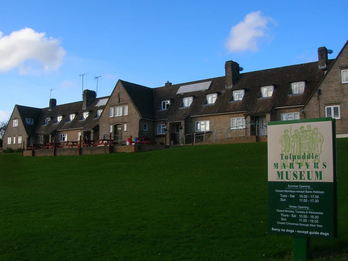
Tolpuddle Martyrs Museum
Museums · 2.2 km
Nearby
📷 5Memorials & monuments · South West England
Weatherby Castle Obelisk
Weatherby Castle Obelisk — a memorial in england-south-east, United Kingdom.
📷 5Forts · South West England
Obelisk On Weatherbury Castle
Obelisk On Weatherbury Castle — a martello broad in england-south-east, United Kingdom.
📷 5Vineyards · South West England
Weatherby Castle, an Iron Age hillfort 1020m north west of Ashley Barn Farm
Weatherby Castle, an Iron Age hillfort 1020m north west of Ashley Barn Farm — a UK vineyard in england south east, producing English or Welsh wine from cool-climate grape varieties.
📷 5Castles · South West England
Weatherby Castle
Weatherby Castle — a castle in england-south-east, United Kingdom.
📷 7B&Bs · South West England
Heathcote House
Heathcote House — a bed-and-breakfast in england south east.
📷 5Towns & cities · South West England
Milborne St Andrew
Milborne St Andrew — village and civil parish in Dorset, England, UK.
Where to eat & stay near Medieval settlement remains 800m south of Manor Farm
Places to stay
📷 7B&Bs · South West England
Heathcote House
Heathcote House — a bed-and-breakfast in england south east.
 📷 5
📷 5Caravan parks · South West England
Lady Bailey Residential Park
Lady Bailey Residential Park — a caravan park in england south east.
 📷 5
📷 5Campsites · South West England
Snelling Farm Campsite
Snelling Farm Campsite — a campsite in england south east.
 📷 5
📷 5Caravan parks · South West England
Moreton Camping & Caravanning Club Site
Moreton Camping & Caravanning Club Site — a caravan park in england south east.
 📷 5
📷 5Caravan parks · South West England
Caravan and Motorhome Club Crossways
Caravan and Motorhome Club Crossways — a caravan park in england south east.
 📷 5
📷 5Places to eat & drink
 📷 5
📷 5Historic pubs · South West England
The Drax Arms, Including The Attached Stable At Rear
The Drax Arms, Including The Attached Stable At Rear in England South West, United Kingdom.
 📷 5
📷 5Historic pubs · South West England
The Hambro Arms Inn
The Hambro Arms Inn in England South West, United Kingdom.
 📷 7
📷 7Historic pubs · South West England
The Frampton Arms
The Frampton Arms in England South West, United Kingdom.
 📷 7
📷 7Historic pubs · South West England
Old House at Home
Old House at Home in England South West, United Kingdom.
 📷 5
📷 5Historic pubs · South West England
Plume Of Feathers Public House
Plume Of Feathers Public House in England South West, United Kingdom.
 📷 5
📷 5Historic pubs · South West England
Junction Hotel
Junction Hotel in England South West, United Kingdom.
More places in this region
 📷 5
📷 5Vineyards · South West England
Castle Rings
Castle Rings — a UK vineyard in england south east, producing English or Welsh wine from cool-climate grape varieties.
 📷 5
📷 5Vineyards · South West England
Large univallate hillfort with a bowl barrow and pillow mounds 970m west of The Bungalow
Large univallate hillfort with a bowl barrow and pillow mounds 970m west of The Bungalow — a UK vineyard in england south east, producing English or Welsh wine from cool-climate grape varieties.

Vineyards · South West England
Hillfort on Banbury Hill
Hillfort on Banbury Hill — a UK vineyard in england south east, producing English or Welsh wine from cool-climate grape varieties.
 📷 5
📷 5Vineyards · South West England
Hillfort, two bowl barrows, medieval strip lynchets and a cross dyke on Cley Hill
Hillfort, two bowl barrows, medieval strip lynchets and a cross dyke on Cley Hill — a UK vineyard in england south east, producing English or Welsh wine from cool-climate grape varieties.
Frequently asked questions
- Where is Medieval settlement remains 800m south of Manor Farm?
- Medieval settlement remains 800m south of Manor Farm is in South-East England, United Kingdom (postcode DT11 0JS), in the parish of Milborne St. Andrew.
- What is Medieval settlement remains 800m south of Manor Farm?
- Medieval settlement remains 800m south of Manor Farm — a UK vineyard in england south east, producing English or Welsh wine from cool-climate grape varieties.
- How do I get to Medieval settlement remains 800m south of Manor Farm?
- The nearest railway station is Moreton, about 7.6 km away. Drivers can use postcode DT11 0JS.
- Is Medieval settlement remains 800m south of Manor Farm a protected site?
- Yes — Medieval settlement remains 800m south of Manor Farm is part of the Dorset National Landscape (AONB).
- How do I get to Medieval settlement remains 800m south of Manor Farm?
- The nearest railway station is Moreton, about 7.6 km away. Drivers can navigate to postcode DT11 0JS.