
Vineyards · East Midlands
Medieval settlement remains 230m north west and 140m west of the junction of Main Street and Hothorpe Road
In or near Husbands Bosworth.
Medieval settlement remains 230m north west and 140m west of the junction of Main Street and Hothorpe Road — a UK vineyard in england west midlands, producing English or Welsh wine from cool-climate grape varieties.

Bikeboy — CC BY-SA 2.0 via Wikimedia Commons licence

Plan your visit
- Typical visit
- 1 h–2 h
- Best time of year
- Late summer & autumn (Aug–Oct)
- Nearest railway station
- Market Harborough · 7.7 km
About
Medieval settlement remains 230m north west and 140m west of the junction of Main Street and Hothorpe Road is one of Britain's growing number of vineyards, located in england west midlands. UK viticulture has expanded significantly since the 1980s, with English sparkling wines now winning international awards. Most British vineyards offer tours and tastings of their estate-grown wines. human settlement in Theddingworth, Harborough, Leicestershire, England, UK
Photo gallery
Place summary
Medieval settlement remains located 230m north-west and 140m west of the junction of Main Street and Hothorpe Road in the West Midlands. This site features archaeological remnants from the medieval period, reflecting the area's historical significance. Nearby, a vineyard operates, offering a range of wines and a picturesque setting for visitors. The vineyard typically includes facilities for tastings and tours, allowing an exploration of the local viticulture.
AI-generated from the structured facts on this page (operator, designation, listing, era). Not a substitute for visiting.
- Coordinates
- 52.4666, -1.0212
- County
- Leicestershire
- District
- Harborough
- Parish
- Theddingworth
- Postcode
- LE17 6QS
- Parliamentary constituency
- Harborough, Oadby and Wigston
- Nearest railway station
- Market Harborough — 7.7 km
Sources
- wikidata: Q17663456 (CC0)
Other places nearby
Theddingworth
Villages · 0.2 km

Theddingworth War Memorial
Memorials & monuments · 0.2 km

Hothorpe Hall
Hotels · 0.8 km

Grand Union Canal Bridge Number 54
Historic bridges · 2.0 km
.jpg?width=1200)
Chapel Of St Mary
Chapels · 2.4 km

Papillon Hall
Manor houses · 2.5 km

Brook Meadow
Campsites · 2.6 km

Husbands Bosworth War Memorial
Memorials & monuments · 2.6 km
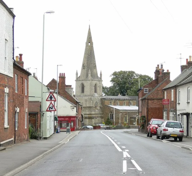
Husbands Bosworth
Towns & cities · 2.8 km

Bridge Number 58, Grand Union Canal
Historic bridges · 3.1 km

Bridge Number 59, Grand Union Canal
Historic bridges · 3.4 km

Bridge Over River Welland 300 Metres North West Of Thorpe Lubenham Hall (Not Included) (That Part In Parish Of Marston Trussell)
Historic bridges · 3.4 km
Nearby
📷 5📷 3Memorials & monuments · East Midlands
Theddingworth War Memorial
Theddingworth War Memorial — Grade II listed building-listed memorial in england-west-midlands, United Kingdom.
📷 5📷 3Historic bridges · East Midlands
Grand Union Canal Bridge Number 54
Grand Union Canal Bridge Number 54 — Grade II listed building-listed bridge in england-west-midlands, United Kingdom.
📷 3Chapels · East Midlands
Chapel Of St Mary
Chapel Of St Mary — chapel in Husbands Bosworth, Leicestershire, England, UK.
📷 2Manor houses · East Midlands
Papillon Hall
Papillon Hall — a manor in england-west-midlands, United Kingdom.
Where to eat & stay near Medieval settlement remains 230m north west and 140m west of the junction of Main Street and Hothorpe Road
Places to stay
📷 5📷 5Campsites · East Midlands
Brook Meadow
Brook Meadow — a campsite in england west midlands.
 📷 5
📷 5Campsites · East Midlands
Country Bumpkin Yurts
Country Bumpkin Yurts — a campsite in england west midlands.
 📷 3
📷 3Caravan parks · East Midlands
Stanford Hall Caravan Park
Stanford Hall Caravan Park — a caravan park in england west midlands.
 📷 5
📷 5 📷 5
📷 5Places to eat & drink
 📷 5
📷 5Historic pubs · East Midlands
The Three Swans Hotel
The Three Swans Hotel in England East Midlands, United Kingdom.
 📷 5
📷 5Historic pubs · East Midlands
The Shoulder Of Mutton Public House
The Shoulder Of Mutton Public House in England East Midlands, United Kingdom.
 📷 6
📷 6Historic pubs · East Midlands
Coach And Horses Inn Public House
Coach And Horses Inn Public House in England East Midlands, United Kingdom.
 📷 5
📷 5Historic pubs · East Midlands
Old Grey Hound Inn Public House
Old Grey Hound Inn Public House in England East Midlands, United Kingdom.
 📷 5
📷 5Historic pubs · East Midlands
The Cavalier Public House
The Cavalier Public House in England East Midlands, United Kingdom.
 📷 7
📷 7Historic pubs · East Midlands
The Greyhound Coaching Inn
The Greyhound Coaching Inn in England East Midlands, United Kingdom.
More places in this region
 📷 5
📷 5Vineyards · East Midlands
Settlement site E of Uffington and Barnack Station
Settlement site E of Uffington and Barnack Station — a UK vineyard in england london, producing English or Welsh wine from cool-climate grape varieties.
 📷 5
📷 5Vineyards · East Midlands
Settlement site E of Greatford village
Settlement site E of Greatford village — a UK vineyard in england london, producing English or Welsh wine from cool-climate grape varieties.
 📷 4
📷 4Vineyards · East Midlands
Fleet settlement site near Lambert Drain
Fleet settlement site near Lambert Drain — a UK vineyard in england london, producing English or Welsh wine from cool-climate grape varieties.
 📷 5
📷 5Vineyards · East Midlands
Settlement site at Greatford
Settlement site at Greatford — a UK vineyard in england london, producing English or Welsh wine from cool-climate grape varieties.
Frequently asked questions
- Where is Medieval settlement remains 230m north west and 140m west of the junction of Main Street and Hothorpe Road?
- Medieval settlement remains 230m north west and 140m west of the junction of Main Street and Hothorpe Road is in Leicestershire, the West Midlands, United Kingdom (postcode LE17 6QS), in the parish of Theddingworth.
- What is Medieval settlement remains 230m north west and 140m west of the junction of Main Street and Hothorpe Road?
- Medieval settlement remains 230m north west and 140m west of the junction of Main Street and Hothorpe Road — a UK vineyard in england west midlands, producing English or Welsh wine from cool-climate grape varieties.
- How do I get to Medieval settlement remains 230m north west and 140m west of the junction of Main Street and Hothorpe Road?
- The nearest railway station is Market Harborough, about 7.7 km away. Drivers can use postcode LE17 6QS.
- How do I get to Medieval settlement remains 230m north west and 140m west of the junction of Main Street and Hothorpe Road?
- The nearest railway station is Market Harborough, about 7.7 km away. Drivers can navigate to postcode LE17 6QS.