
Farms (open to visitors) · East Midlands
Medieval cross 170m south west of Hall Farm
In or near Grendon.
Medieval cross 170m south west of Hall Farm — a Grade II-listed farm in england-west-midlands, United Kingdom.

Kokai — CC BY-SA 2.0 via Wikimedia Commons licence

Plan your visit
- Typical visit
- 2 h–4 h
- Nearest railway station
- Wellingborough · 7.5 km
- Family-friendly
About
Medieval cross 170m south west of Hall Farm is a Grade II-listed building in england-west-midlands, United Kingdom. Grade II status is conferred by Historic England (or Cadw, Historic Environment Scotland or NIEA equivalents) on buildings of exceptional national interest. See the linked Wikipedia article for full historical and architectural details.
Photo gallery
Protected designations
- Site of Special Scientific Interest: Upper Nene Valley Gravel Pits SSSI
Designations sourced from Natural England open data under OGL v3.
Place summary
The Medieval cross, located 170m south-west of Hall Farm in Grendon, West Midlands, is a Grade II* listed structure. This designation highlights its architectural significance and historical value within the parish.
AI-generated from the structured facts on this page (operator, designation, listing, era). Not a substitute for visiting.
- Coordinates
- 52.2400, -0.7102
- District
- North Northamptonshire
- Parish
- Grendon
- Postcode
- NN7 1JR
- Parliamentary constituency
- South Northamptonshire
- Nearest railway station
- Wellingborough — 7.5 km
Sources
- wikidata: Q17663478 (CC0)
Other places nearby
.jpg?width=1200)
Half Moon
Historic pubs · 0.4 km

Grendon
Towns & cities · 0.7 km

Grendon Lake Camping
Campsites · 1.2 km

Roman site
Archaeological sites · 1.5 km

Strixton
Villages · 2.1 km

Church of St Peter and St Paul, Easton Maudit
Historic churches · 2.3 km

Strixton
Towns & cities · 2.5 km

Church of St Mary Magdalen, Castle Ashby
Historic churches · 2.6 km

Castle Ashby
Castles · 2.6 km
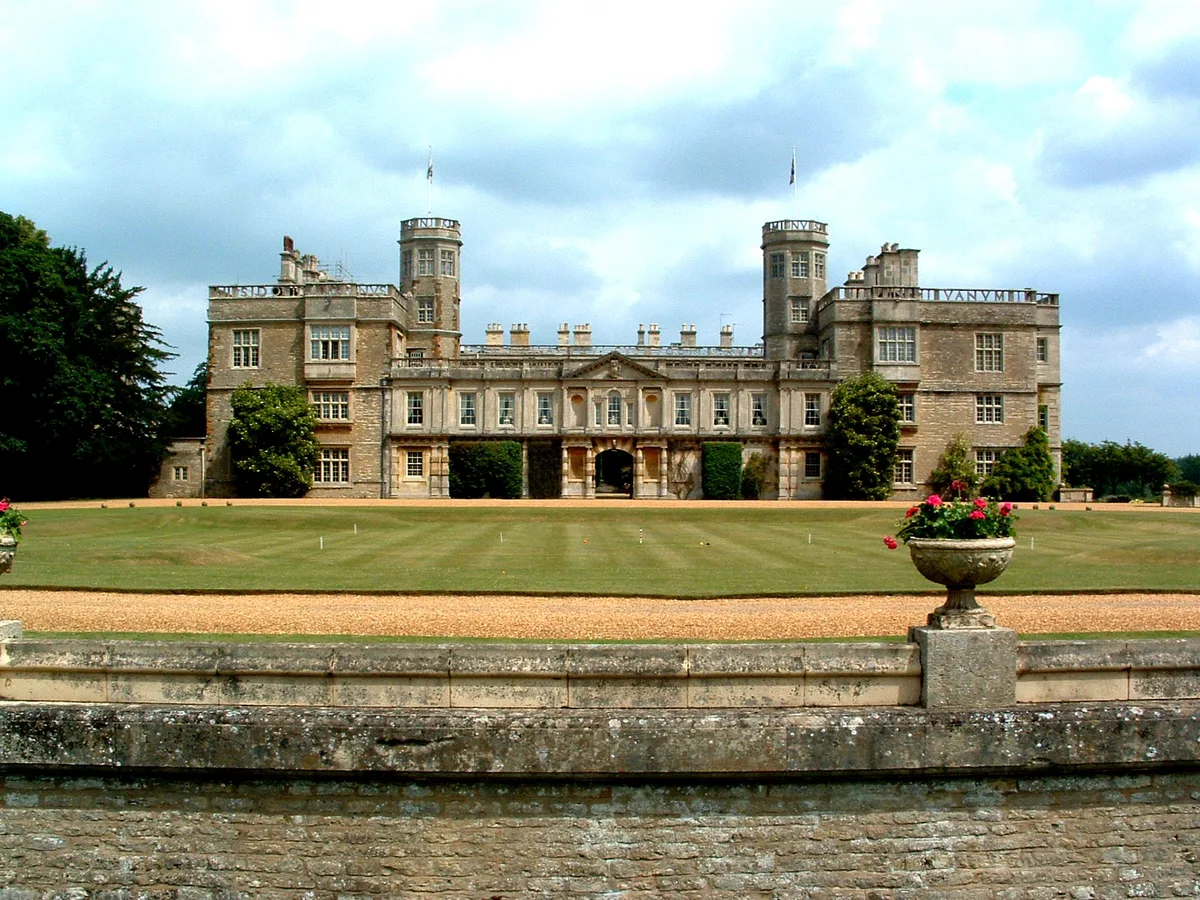
Castle Ashby House
Castles · 2.6 km

Remains Of Former Greenhouse, Attached Monument, Wall, Gate And Gatepiers
Memorials & monuments · 2.6 km
Castle Ashby War Memorial
Memorials & monuments · 2.6 km
Nearby
📷 3Historic pubs · East Midlands
Half Moon
Half Moon — Historic pub — listed building or notable heritage status.
📷 5Towns & cities · East Midlands
Grendon
Grendon — village and civil parish in Northamptonshire, England, UK.
📷 3Campsites · East Midlands
Grendon Lake Camping
Grendon Lake Camping — a campsite in england west midlands.
📷 5Archaeological sites · East Midlands
Roman site
Roman site — a archaeological in england-west-midlands, United Kingdom.
📷 5📷 3Historic churches · East Midlands
Church of St Peter and St Paul, Easton Maudit
Church of St Peter and St Paul, Easton Maudit — church in Easton Maudit, Northamptonshire, England, UK.
Where to eat & stay near Medieval cross 170m south west of Hall Farm
Places to stay
📷 3Campsites · East Midlands
Grendon Lake Camping
Grendon Lake Camping — a campsite in england west midlands.
 📷 5
📷 5 📷 7
📷 7Hotels · East Midlands
The Hind Hotel
The Hind Hotel — a hotel in england west midlands.
 📷 5
📷 5 📷 5
📷 5Caravan parks · East Midlands
Billing Aquadrome
Billing Aquadrome — a caravan park in england west midlands.
 📷 5
📷 5Caravan parks · East Midlands
Overstone Lakes Caravan Site
Overstone Lakes Caravan Site — a caravan park in england west midlands.
Places to eat & drink
📷 3Historic pubs · East Midlands
Half Moon
Half Moon — Historic pub — listed building or notable heritage status.
 📷 7
📷 7Historic pubs · East Midlands
South Wing Of Nags Head Public House
South Wing Of Nags Head Public House in England East, United Kingdom.
 📷 5
📷 5Historic pubs · East Midlands
Stag's Head Public House
Stag's Head Public House in England South East, United Kingdom.
 📷 5
📷 5Historic pubs · East Midlands
Stags Head Public House
Stags Head Public House in England South East, United Kingdom.
 📷 7
📷 7Historic pubs · East Midlands
The Old Swan Public House
The Old Swan Public House in England South East, United Kingdom.
 📷 5
📷 5Historic pubs · East Midlands
The George Inn Public House And Barn Attached To West
The George Inn Public House And Barn Attached To West in England South East, United Kingdom.
More places in this region
 📷 3
📷 3Farms (open to visitors) · East Midlands
Heeley City Farm
Heeley City Farm — a other in england-east-midlands, United Kingdom.
 📷 3
📷 3Farms (open to visitors) · East Midlands
Sunnydown Farm
Sunnydown Farm — a other in england-east-midlands, United Kingdom.
 📷 3
📷 3Farms (open to visitors) · East Midlands
Lane's Garden Centre and Open Farm
Lane's Garden Centre and Open Farm — a other in england-east-midlands, United Kingdom.
 📷 4
📷 4Farms (open to visitors) · East Midlands
Mercaston Hall
Mercaston Hall — a Grade II-listed farm in england-east-midlands, United Kingdom.
Frequently asked questions
- Where is Medieval cross 170m south west of Hall Farm?
- Medieval cross 170m south west of Hall Farm is in the East Midlands, United Kingdom (postcode NN7 1JR), in the parish of Grendon.
- What is Medieval cross 170m south west of Hall Farm?
- Medieval cross 170m south west of Hall Farm — a Grade II-listed farm in england-west-midlands, United Kingdom.
- How do I get to Medieval cross 170m south west of Hall Farm?
- The nearest railway station is Wellingborough, about 7.5 km away. The nearest town is Grendon. Drivers can use postcode NN7 1JR.
- Is Medieval cross 170m south west of Hall Farm a listed building?
- Medieval cross 170m south west of Hall Farm is officially recognised as Grade II listed.
- Is Medieval cross 170m south west of Hall Farm a protected site?
- Yes — Medieval cross 170m south west of Hall Farm is part of the Upper Nene Valley Gravel Pits SSSI Site of Special Scientific Interest.
- How do I get to Medieval cross 170m south west of Hall Farm?
- The nearest railway station is Wellingborough, about 7.5 km away. Drivers can navigate to postcode NN7 1JR.