
Archaeological sites · North East England
Medieval chapel, 220m south east of White Gables
In or near Akeld.
Medieval chapel, 220m south east of White Gables — archaeological site in Akeld, Northumberland, England, UK.
.jpg?width=1200)
Wikimedia Commons contributors — see linked file page for photographer and licence licence
.jpg)
Plan your visit
- Typical visit
- 45 min–1.5 h
- Free entry
- Dog-friendly
About
Medieval chapel, 220m south east of White Gables is an archaeological site in the United Kingdom. Heritage designation: scheduled monument. Wikidata describes it as: "archaeological site in Akeld, Northumberland, England, UK". Coordinates: 55.5494°, -2.0369°.
Photo gallery
Protected designations
- Site of Special Scientific Interest: Tweed Catchment Rivers - England: Till Catchment SSSI
Designations sourced from Natural England open data under OGL v3.
Place summary
The Medieval chapel, located 220 metres south-east of White Gables in central Scotland, is a scheduled monument of archaeological significance. It is situated within the Tweed Catchment Rivers SSSI, which highlights its ecological importance.
AI-generated from the structured facts on this page (operator, designation, listing, era). Not a substitute for visiting.
- Coordinates
- 55.5494, -2.0369
- District
- Northumberland
- Parish
- Akeld
- Postcode
- NE71 6SU
- Parliamentary constituency
- North Northumberland
Sources
- wikidata: Q17664776 (CC0)
- commons: Site of Humbleton Chapel (geograph 6185273).jpg (CC BY-SA 4.0)
Other places nearby

Highburn House Country Holiday Park
Caravan parks · 0.7 km

Green Castle
Literary houses · 0.7 km

Brown's Law
Vineyards · 0.8 km

Humbleton Hill
Mountains & hills · 1.1 km
Humbleton Hill
Mountains & hills · 1.1 km
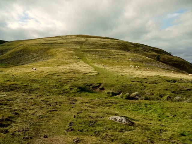
Prehistoric enclosed settlement, Iron Age hillfort and medieval shielings on Humbleton Hill
Archaeological sites · 1.1 km

Humbleton Hill Hillfort
Hill forts · 1.1 km
Humbleton Hill Hill Fort
Hill forts · 1.1 km

Humbleton Burn Picnic Area
Natural landmarks · 1.1 km

St Ninian's Church, Wooler
Historic churches · 1.2 km
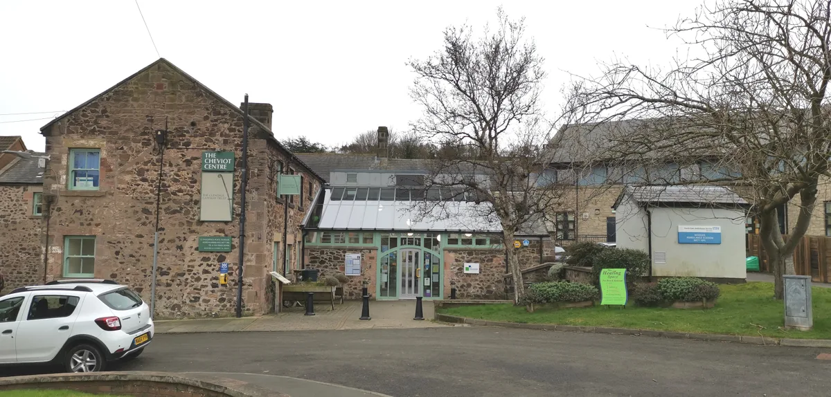
Cheviot Museum And Field Centre
Museums · 1.2 km

Brown's Law
Mountains & hills · 1.2 km
Nearby
📷 5Caravan parks · North East England
Highburn House Country Holiday Park
Highburn House Country Holiday Park — a caravan park in scotland central.
📷 5Literary houses · North East England
Green Castle
Green Castle — a literary house museum in scotland central.
📷 5Vineyards · North East England
Brown's Law
Brown's Law — a UK vineyard in scotland central, producing English or Welsh wine from cool-climate grape varieties.
📷 5Mountains & hills · North East England
Humbleton Hill
Humbleton Hill — mountain in scotland central. Elevation: 298 m.
📷 5Mountains & hills · North East England
Humbleton Hill
Humbleton Hill — a hill or mountain in scotland central.
📷 3Archaeological sites · North East England
Prehistoric enclosed settlement, Iron Age hillfort and medieval shielings on Humbleton Hill
Prehistoric enclosed settlement, Iron Age hillfort and medieval shielings on Humbleton Hill — hillfort in Northumberland, England, UK.
Where to eat & stay near Medieval chapel, 220m south east of White Gables
Places to stay
📷 5Caravan parks · North East England
Highburn House Country Holiday Park
Highburn House Country Holiday Park — a caravan park in scotland central.
 📷 7
📷 7Hotels · North East England
Tankerville Arms Hotel
Tankerville Arms Hotel — a hotel in scotland central.
 📷 7
📷 7 📷 5
📷 5 📷 5
📷 5Hostels · North East England
Wooler Hostel
Wooler Hostel — a hostel in scotland central.
 📷 5
📷 5Caravan parks · North East England
Bridgend Park
Bridgend Park — a caravan park in scotland central.
Places to eat & drink
 📷 7
📷 7 📷 7
📷 7Historic pubs · North East England
Plough Inn With Outbuilding To North
Plough Inn With Outbuilding To North in Scotland Lowlands, United Kingdom.
 📷 4
📷 4Historic pubs · Scottish Lowlands
Newcastle Arms
Newcastle Arms — Historic pub — listed building or notable heritage status.
 📷 7
📷 7Historic pubs · North East England
Bridge Of Aln Hotel
Bridge Of Aln Hotel in Scotland Lowlands, United Kingdom.
 📷 5
📷 5Historic pubs · Scottish Lowlands
The Masons Arms
The Masons Arms in Scotland Lowlands, United Kingdom.
 📷 7
📷 7Historic pubs · Scottish Lowlands
The Victoria Hotel
The Victoria Hotel in Scotland Lowlands, United Kingdom.
More archaeological sites in this region
 📷 5
📷 5Archaeological sites · North East England
Medieval Manorial Site of Low Dinsdale
Medieval Manorial Site of Low Dinsdale — archaeological in england yorkshire.
 📷 3
📷 3Archaeological sites · North East England
Old Smelting Mill
Old Smelting Mill — a archaeological in england-north-west, United Kingdom.
 📷 5
📷 5Archaeological sites · North East England
Roper Castle or Round Table (Roman Signal Station)
Roper Castle or Round Table (Roman Signal Station) — archaeological in england north west.
 📷 5
📷 5Archaeological sites · North East England
Nine Standards Rigg
Nine Standards Rigg — archaeological in england north west. Elevation: 662 m.
Frequently asked questions
- Where is Medieval chapel, 220m south east of White Gables?
- Medieval chapel, 220m south east of White Gables is in North-East England, United Kingdom (postcode NE71 6SU), in the parish of Akeld.
- What is Medieval chapel, 220m south east of White Gables?
- Medieval chapel, 220m south east of White Gables — archaeological site in Akeld, Northumberland, England, UK.
- How do I get to Medieval chapel, 220m south east of White Gables?
- The nearest town is Akeld. Drivers can use postcode NE71 6SU.
- Is Medieval chapel, 220m south east of White Gables a listed building?
- Medieval chapel, 220m south east of White Gables is officially recognised as scheduled monument listed.
- Is Medieval chapel, 220m south east of White Gables a protected site?
- Yes — Medieval chapel, 220m south east of White Gables is part of the Tweed Catchment Rivers - England: Till Catchment SSSI Site of Special Scientific Interest.
- Is Medieval chapel, 220m south east of White Gables free to visit?
- Yes, Medieval chapel, 220m south east of White Gables is free to enter.
- How do I get to Medieval chapel, 220m south east of White Gables?
- Drivers can navigate to postcode NE71 6SU. It sits within the North Northumberland parliamentary constituency.