
Natural landmarks · Scottish Highlands
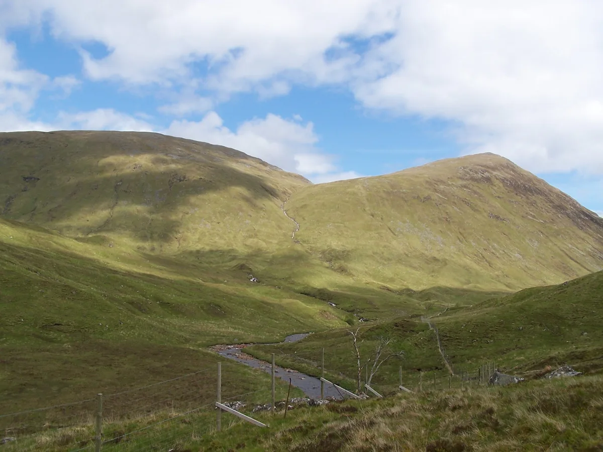
Meall na h-Eilde
Meall na h-Eilde — mountain in Highland, Scotland, UK.

Wikimedia Commons contributors — see linked file page for photographer and licence licence

Plan your visit
- Typical visit
- 1 h–2 h
- Free entry
- Dog-friendly
About
Meall na h-Eilde is a named natural landmark in the United Kingdom. Part of Northwest Highlands. Wikidata describes it as: "mountain in Highland, Scotland, UK". Coordinates: 57.0065°, -4.9899°.
Photo gallery
From the Wikipedia article
Meall na h-Eilde is a Scottish hill situated in the high ground between the Great Glen and Glen Garry, 23 km north of Fort William in the Highland Council Area.
Excerpt from Wikipedia under CC BY-SA 4.0. See the source article linked in Sources below.
Background
History
The hills outlying top Meall an Tagraidh which lies just over a kilometre south-east of the main summit has some historical interest. This summit was used as a hideout for several days and nights by the fugitive Charles Edward Stuart during his flight following the Battle of Culloden in mid April 1746. The fugitive prince was supplied with whisky, cheese and bread by Cameron of Clunes during his stay on the hill. The hills name translates from the Scottish Gaelic as Hill of the Hinds and is so called because the hills steep walled eastern corrie Coire an Tagraidh gave good shelter from the western gales and was a good place for hinds to protect and rear their young.
Description
Meall na h-Eilde reaches a height of 838 metres (2749 feet) making it the 110th highest Corbett and the 336th highest Marilyn. The hill has only been included on the list of Corbetts since 1981 when resurveying by the Ordnance Survey raised its height to 838 metres and above that of the nearby Meall Coire nan Saobhaidh which before that was regarded as the Corbett.
Sourced from Wikipedia under CC BY-SA 4.0.
- Coordinates
- 57.0065, -4.9899
- Address
- Highland, Scotland
Sources
- wikidata: Q6803544 (CC0)
- wikipedia: Meall na h-Eilde (CC BY-SA 4.0)
- commons: Meall na h-Eilde.JPG (CC BY-SA 4.0)
Other places nearby
Meall na h-Eilde
Mountains & hills · 0.3 km

Scotland
Islands · 0.9 km
COVID-19 pandemic in Scotland
Other places · 0.9 km

Meall an Tagraidh
Mountains & hills · 1.0 km

Meall Coire nan Saobhaidh
Mountains & hills · 1.2 km

Meall na h-Eilde - Meall Coire nan Saobhaidh
Mountains & hills · 1.2 km
Meall Tarsuinn
Mountains & hills · 2.2 km
Meall Tarsuinn
Mountains & hills · 2.5 km

Gleann Cia-aig
Gorges · 2.6 km

Geal Charn
Mountains & hills · 2.9 km
Geal Chàrn
Mountains & hills · 2.9 km

Glas Bheinn
Mountains & hills · 3.0 km
Nearby
📷 3Mountains & hills · Scottish Highlands
Meall na h-Eilde
Meall na h-Eilde — Named summit at 838 m.
📷 4Islands · Scottish Highlands
Scotland
Scotland in Scotland Islands, United Kingdom.
📷 4Other places · Scottish Highlands
COVID-19 pandemic in Scotland
COVID-19 pandemic in Scotland in Scotland Islands, United Kingdom.
📷 3Mountains & hills · Scottish Highlands
Meall an Tagraidh
Meall an Tagraidh — a mountain in scotland-highlands, United Kingdom.
📷 5Mountains & hills · Scottish Highlands
Meall Coire nan Saobhaidh
Meall Coire nan Saobhaidh — a hill or mountain in scotland highlands.
📷 3Mountains & hills · Scottish Highlands
Meall na h-Eilde - Meall Coire nan Saobhaidh
Meall na h-Eilde - Meall Coire nan Saobhaidh — a mountain in scotland-highlands, United Kingdom.
Where to eat & stay near Meall na h-Eilde
Places to stay
 📷 5
📷 5Campsites · Scottish Highlands
Glas-dhoire Trailblazer Rest
Glas-dhoire Trailblazer Rest — a campsite in scotland highlands.
 📷 5
📷 5Campsites · Scottish Highlands
Laggan Locks informal campsite
Laggan Locks informal campsite — a campsite in scotland highlands.
 📷 5
📷 5Campsites · Scottish Highlands
Gairlochy Locks informal campsite
Gairlochy Locks informal campsite — a campsite in scotland highlands.
 📷 5
📷 5Hostels · Scottish Highlands
Great Glen Hostel
Great Glen Hostel — a hostel in scotland highlands.
 📷 5
📷 5Campsites · Scottish Highlands
Moy Bridge informal campsite
Moy Bridge informal campsite — a campsite in scotland highlands.
 📷 5
📷 5Campsites · Scottish Highlands
Faichemard Farm Caravan & Camping
Faichemard Farm Caravan & Camping — a campsite in scotland highlands.
Places to eat & drink
 📷 5
📷 5Historic pubs · Scottish Highlands
The Lovat Hotel
The Lovat Hotel in Scotland Highlands, United Kingdom.
More natural landmarks in this region
 Flagship📷 3
Natural landmarks · Scottish Highlands
Dunalastair Water
Dunalastair Water — lake in Perth and Kinross, Scotland, UK, on the River Tummel.
 Flagship📷 3
Natural landmarks · Scottish Highlands
Loch Arkaig
Loch Arkaig — lake in Highland, Scotland, UK, outflows east to River Arkaig.
 Flagship📷 3
Natural landmarks · Scottish Highlands
Loch Assynt
Loch Assynt — lake in Highland, Scotland, UK, outflows to the River Inver and Loch na Garbh Uidhe.
 Flagship📷 5
Natural landmarks · Scottish Highlands
Loch Eilt
Loch Eilt — lake in Highland, Scotland, UK, outflows west to River Ailort.
Frequently asked questions
- Where is Meall na h-Eilde?
- Meall na h-Eilde is in the Scottish Highlands, United Kingdom.
- What is Meall na h-Eilde?
- Meall na h-Eilde — mountain in Highland, Scotland, UK.
- How do I get to Meall na h-Eilde?
- Its coordinates are 57.0065°, -4.9899°.
- Is Meall na h-Eilde free to visit?
- Yes, Meall na h-Eilde is free to enter.