Mountains & hills · Scottish Highlands
Meall an Daimh
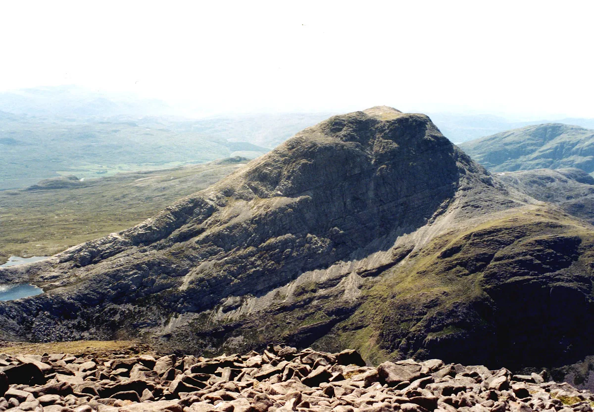
Meall an Daimh — mountain in scotland highlands. Elevation: 604 m.

db9 — CC BY-SA 2.0 via Wikimedia Commons licence
Plan your visit
- Typical visit
- 3 h–8 h
- Best time of year
- Late spring – early autumn (May–Oct)
About
Meall an Daimh is a mountain located in scotland highlands. Elevation: 604 m. A named British peak recorded in OpenStreetMap. Peaks are typically named on Ordnance Survey 1:50k mapping.
Photo gallery
Place summary
Meall an Daimh is a mountain located in the Scottish Highlands. It is known for its rugged terrain and scenic views typical of the region. The mountain offers various walking trails, attracting hikers and outdoor enthusiasts looking to explore the natural landscape. Its elevation and location provide opportunities for a range of outdoor activities.
AI-generated from the structured facts on this page (operator, designation, listing, era). Not a substitute for visiting.
- Coordinates
- 57.4655, -5.4624
Sources
- osm: n2412138038 (ODbL)
Other places nearby
Loading nearby places…
Nearby
 📷 5
📷 5Mountains & hills · Scottish Highlands
Ruadh Stac Bheag
Ruadh Stac Bheag — mountain in scotland highlands. Elevation: 758 m.
 📷 3
📷 3Mountains & hills · Scottish Highlands
An Ruadh-stac
An Ruadh-stac — Named summit at 892 m.
 📷 3
📷 3Natural landmarks · Scottish Highlands
An Ruadh-stac
An Ruadh-stac — mountain in Highland, Scotland, UK.
 📷 3
📷 3Mountains & hills · Scottish Highlands
Meall nan Ceapairean
Meall nan Ceapairean — a mountain in scotland-highlands, United Kingdom.
 📷 5
📷 5Mountains & hills · Scottish Highlands
Torr na h-Iolaire
Torr na h-Iolaire — mountain in scotland highlands. Elevation: 420 m.
 📷 5
📷 5Mountains & hills · Scottish Highlands
Cnoc Glas
Cnoc Glas — a hill or mountain in scotland highlands.
Where to eat & stay near Meall an Daimh
Places to stay
 📷 5
📷 5Campsites · Scottish Highlands
The Wee Campsite
The Wee Campsite — a campsite in scotland highlands.
📷 5Hotels · Scottish Highlands
Pathend Bed and Breakfast
Pathend Bed and Breakfast — a hotel in scotland highlands.
 📷 5
📷 5Campsites · Scottish Highlands
Torridon Camp Site
Torridon Camp Site — a campsite in scotland highlands.
 📷 5
📷 5Hostels · Scottish Highlands
Torridon Youth Hostel
Torridon Youth Hostel — a hostel in scotland highlands.
 📷 5
📷 5Hostels · Scottish Highlands
Sanachan Bunkhouse
Sanachan Bunkhouse — a hostel in scotland highlands.
 📷 5
📷 5Hostels · Scottish Highlands
Gerry's Hostel
Gerry's Hostel — a hostel in scotland highlands.
More mountains in this region
 📷 3
📷 3Mountains & hills · Scottish Highlands
A' Bhuidheanach Bheag
A' Bhuidheanach Bheag — Named summit at 936 m.
 📷 3
📷 3Mountains & hills · Scottish Highlands
A' Chailleach
A' Chailleach — Named summit at 997 m.
 📷 3
📷 3Mountains & hills · Scottish Highlands
A' Chailleach
A' Chailleach — Named summit at 930 m.
 📷 3
📷 3Mountains & hills · Scottish Highlands
A' Chaoirnich
A' Chaoirnich — Named summit at 875 m.
Frequently asked questions
- Where is Meall an Daimh?
- Meall an Daimh is in the Scottish Highlands, United Kingdom.
- What is Meall an Daimh?
- Meall an Daimh — mountain in scotland highlands. Elevation: 604 m.
- How do I get to Meall an Daimh?
- Its coordinates are 57.4655°, -5.4624°.