Mountains & hills · Scottish Highlands
Meall a' Mhaoil
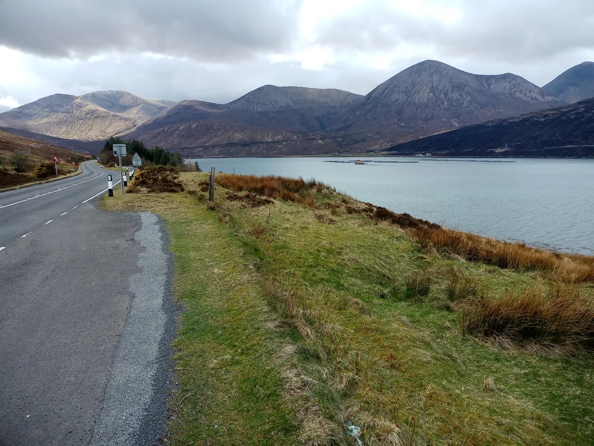
Meall a' Mhaoil — mountain in scotland highlands. Elevation: 284 m.

John Allan — CC BY-SA 2.0 via Wikimedia Commons licence
Plan your visit
- Typical visit
- 3 h–8 h
- Best time of year
- Late spring – early autumn (May–Oct)
About
Meall a' Mhaoil is a mountain located in scotland highlands. Elevation: 284 m. A named British peak recorded in OpenStreetMap. Peaks are typically named on Ordnance Survey 1:50k mapping.
Photo gallery
Place summary
Meall a' Mhaoil is a mountain located in the Scottish Highlands. It is known for its distinctive rounded summit and offers expansive views of the surrounding landscape. The area is popular with hikers and outdoor enthusiasts seeking to explore the rugged terrain and natural beauty of the Highlands. Various trails lead to the summit, providing options for different skill levels.
AI-generated from the structured facts on this page (operator, designation, listing, era). Not a substitute for visiting.
- Coordinates
- 57.3018, -6.0624
Sources
- osm: n559457672 (ODbL)
Other places nearby
Loading nearby places…
Nearby
📷 5Mountains & hills · Scottish Highlands
Meall a' Mhaoil
Meall a' Mhaoil — a hill or mountain in scotland highlands.
 📷 5
📷 5Mountains & hills · Scottish Highlands
Meall Buidhe
Meall Buidhe — mountain in scotland highlands. Elevation: 279 m.
 📷 3
📷 3Archaeological sites · Scottish Highlands
Maol na Gainmhich, dun site
Maol na Gainmhich, dun site — a archaeological in scotland-highlands, United Kingdom.
 📷 5
📷 5Mountains & hills · Scottish Highlands
Druim nan Cleochd
Druim nan Cleochd — a hill or mountain in scotland highlands.
 📷 5
📷 5Mountains & hills · Scottish Highlands
Leathad Chrithinn
Leathad Chrithinn — a hill or mountain in scotland highlands.
 📷 3
📷 3Mountains & hills · Scottish Highlands
Loch Ainort
Loch Ainort — bay on Skye, Highland, Scotland, UK.
Where to eat & stay near Meall a' Mhaoil
Places to stay
 📷 5
📷 5Hotels · Scottish Highlands
Raasay House
Raasay House — a hotel in scotland highlands.
 📷 5
📷 5Hostels · Scottish Highlands
Sligachan Bunkhouse
Sligachan Bunkhouse — a hostel in scotland highlands.
 📷 5
📷 5Campsites · Scottish Highlands
Sligachan Campsite
Sligachan Campsite — a campsite in scotland highlands.
 📷 5
📷 5Hostels · Scottish Highlands
Raasay Youth Hostel
Raasay Youth Hostel — a hostel in scotland highlands.
 📷 5
📷 5Campsites · Scottish Highlands
Camping Skye
Camping Skye — a campsite in scotland highlands.
 📷 5
📷 5Hostels · Scottish Highlands
Broadford Backpackers Hostel
Broadford Backpackers Hostel — a hostel in scotland highlands.
More mountains in this region
 📷 3
📷 3Mountains & hills · Scottish Highlands
A' Bhuidheanach Bheag
A' Bhuidheanach Bheag — Named summit at 936 m.
 📷 3
📷 3Mountains & hills · Scottish Highlands
A' Chailleach
A' Chailleach — Named summit at 997 m.
 📷 3
📷 3Mountains & hills · Scottish Highlands
A' Chailleach
A' Chailleach — Named summit at 930 m.
 📷 3
📷 3Mountains & hills · Scottish Highlands
A' Chaoirnich
A' Chaoirnich — Named summit at 875 m.
Frequently asked questions
- Where is Meall a' Mhaoil?
- Meall a' Mhaoil is in the Scottish Highlands, United Kingdom.
- What is Meall a' Mhaoil?
- Meall a' Mhaoil — mountain in scotland highlands. Elevation: 284 m.
- How do I get to Meall a' Mhaoil?
- Its coordinates are 57.3018°, -6.0624°.