Mountains & hills · Scottish Highlands
Meall a' Gharbhgair
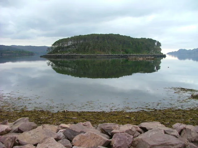
Meall a' Gharbhgair — a hill or mountain in scotland highlands.

Stuart Logan — CC BY-SA 2.0 via Wikimedia Commons licence
Plan your visit
- Typical visit
- 3 h–8 h
- Best time of year
- Late spring – early autumn (May–Oct)
About
A British hill or mountain, named on Ordnance Survey maps and walked by hill-baggers. Meall a' Gharbhgair is a named hill or mountain in scotland highlands, recorded in the GeoNames UK gazetteer. British landmarks of this type are typically marked on Ordnance Survey maps and recorded in the national gazetteer for cartographic and navigational reference. Coordinates and feature classification are sourced from the GeoNames open dataset.
Photo gallery
Place summary
Meall a' Gharbhgair is a mountain located in the Scottish Highlands. It is characterised by rugged terrain and offers panoramic views of the surrounding landscape. The area is popular with hikers and outdoor enthusiasts, providing opportunities for various levels of walking and climbing. The mountain contributes to the dramatic scenery typical of this region.
AI-generated from the structured facts on this page (operator, designation, listing, era). Not a substitute for visiting.
- Coordinates
- 57.5246, -5.7100
Sources
- manual: geonames-12612640 (CC BY 4.0)
Other places nearby
Loading nearby places…
Nearby
 📷 4
📷 4Mountains & hills · Scottish Islands
Ardheslaig
Ardheslaig in Scotland Islands, United Kingdom.
 📷 5
📷 5Mountains & hills · Scottish Highlands
A' Bhaintir
A' Bhaintir — mountain in scotland highlands. Elevation: 174 m.
 📷 5
📷 5Mountains & hills · Scottish Highlands
Meall Dearg
Meall Dearg — a hill or mountain in scotland highlands.
 📷 5
📷 5Mountains & hills · Scottish Highlands
Aird
Aird — a hill or mountain in scotland highlands.
 📷 5
📷 5Islands · Scottish Highlands
Shieldaig Island
Shieldaig Island — island in Highland, Scotland, UK.
 📷 5
📷 5Mountains & hills · Scottish Highlands
Croic-bheinn
Croic-bheinn — a hill or mountain in scotland highlands.
Where to eat & stay near Meall a' Gharbhgair
Places to stay
 📷 5
📷 5Campsites · Scottish Highlands
Shieldaig Camping and Cabins
Shieldaig Camping and Cabins — a campsite in scotland highlands.
 📷 5
📷 5Hostels · Scottish Highlands
Hartfield House
Hartfield House — a hostel in scotland highlands.
 📷 5
📷 5Campsites · Scottish Highlands
Applecross Campsite
Applecross Campsite — a campsite in scotland highlands.
 📷 5
📷 5Hostels · Scottish Highlands
Torridon Youth Hostel
Torridon Youth Hostel — a hostel in scotland highlands.
 📷 5
📷 5Campsites · Scottish Highlands
Torridon Camp Site
Torridon Camp Site — a campsite in scotland highlands.
 📷 5
📷 5Hostels · Scottish Highlands
Sanachan Bunkhouse
Sanachan Bunkhouse — a hostel in scotland highlands.
More mountains in this region
 📷 3
📷 3Mountains & hills · Scottish Highlands
A' Bhuidheanach Bheag
A' Bhuidheanach Bheag — Named summit at 936 m.
 📷 3
📷 3Mountains & hills · Scottish Highlands
A' Chailleach
A' Chailleach — Named summit at 997 m.
 📷 3
📷 3Mountains & hills · Scottish Highlands
A' Chailleach
A' Chailleach — Named summit at 930 m.
 📷 3
📷 3Mountains & hills · Scottish Highlands
A' Chaoirnich
A' Chaoirnich — Named summit at 875 m.
Frequently asked questions
- Where is Meall a' Gharbhgair?
- Meall a' Gharbhgair is in the Scottish Highlands, United Kingdom.
- What is Meall a' Gharbhgair?
- Meall a' Gharbhgair — a hill or mountain in scotland highlands.
- How do I get to Meall a' Gharbhgair?
- Its coordinates are 57.5246°, -5.7100°.