Mountains & hills · Scottish Highlands
Meall a' Chreamha East Top
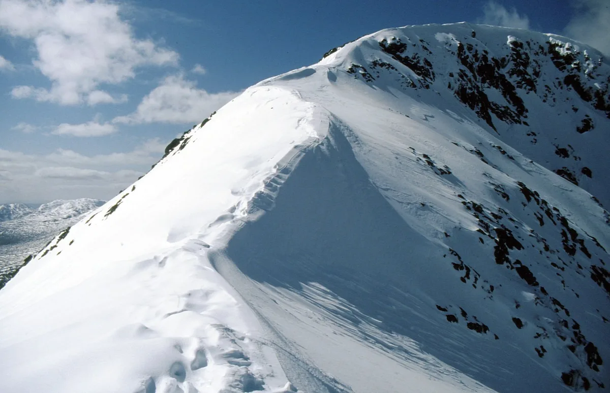
Meall a' Chreamha East Top — a hill or mountain in scotland highlands.

Russel Wills — CC BY-SA 2.0 via Wikimedia Commons licence
Plan your visit
- Typical visit
- 3 h–8 h
- Best time of year
- Late spring – early autumn (May–Oct)
About
A British hill or mountain, named on Ordnance Survey maps and walked by hill-baggers. Meall a' Chreamha East Top is a named hill or mountain in scotland highlands, recorded in the GeoNames UK gazetteer. British landmarks of this type are typically marked on Ordnance Survey maps and recorded in the national gazetteer for cartographic and navigational reference. Coordinates and feature classification are sourced from the GeoNames open dataset.
Photo gallery
Place summary
Meall a' Chreamha East Top is a mountain located in the Scottish Highlands. This peak is part of the larger Meall a' Chreamha range, offering typical Highland scenery. It attracts walkers and climbers looking for remote and rugged terrain. The area is characterised by its natural beauty and challenging routes.
AI-generated from the structured facts on this page (operator, designation, listing, era). Not a substitute for visiting.
- Coordinates
- 56.5881, -5.0908
Sources
- manual: geonames-12616711 (CC BY 4.0)
Other places nearby
Loading nearby places…
Nearby
 📷 3
📷 3Mountains & hills · Scottish Highlands
Beinn Fhionnlaidh East Top
Beinn Fhionnlaidh East Top — a mountain in scotland-highlands, United Kingdom.
 📷 5
📷 5Mountains & hills · Scottish Highlands
Beinn Fhionnlaidh
Beinn Fhionnlaidh — Named summit at 959 m.
 📷 5
📷 5Mountains & hills · Scottish Highlands
Creag Dhubh
Creag Dhubh — a hill or mountain in scotland highlands.
 📷 5
📷 5Mountains & hills · Scottish Highlands
Meall nan Gobhar
Meall nan Gobhar — mountain in scotland highlands. Elevation: 590 m.
 📷 5
📷 5Mountains & hills · Scottish Highlands
An Grianan
An Grianan — mountain in scotland highlands. Elevation: 549 m.
📷 5Mountains & hills · Scottish Highlands
An Grianan
An Grianan — a hill or mountain in scotland highlands.
Where to eat & stay near Meall a' Chreamha East Top
Places to stay
 📷 5
📷 5Campsites · Scottish Highlands
Red Squirrel Campsite
Red Squirrel Campsite — a campsite in scotland highlands.
 📷 5
📷 5Hostels · Scottish Highlands
Glencoe Independent Hostel
Glencoe Independent Hostel — a hostel in scotland highlands.
📷 5Hostels · Scottish Highlands
Glencoe Youth Hostel
Glencoe Youth Hostel — a hostel in scotland highlands.
 📷 5
📷 5Campsites · Scottish Highlands
Glencoe Camping & Caravanning Club
Glencoe Camping & Caravanning Club — a campsite in scotland highlands.
 📷 5
📷 5Campsites · Scottish Highlands
Invercoe Caravan & Camping Park
Invercoe Caravan & Camping Park — a campsite in scotland highlands.
 📷 5
📷 5Campsites · Scottish Highlands
Achindarroch Touring Park
Achindarroch Touring Park — a campsite in scotland highlands.

More mountains in this region
 📷 3
📷 3Mountains & hills · Scottish Highlands
A' Bhuidheanach Bheag
A' Bhuidheanach Bheag — Named summit at 936 m.
 📷 3
📷 3Mountains & hills · Scottish Highlands
A' Chailleach
A' Chailleach — Named summit at 997 m.
 📷 3
📷 3Mountains & hills · Scottish Highlands
A' Chailleach
A' Chailleach — Named summit at 930 m.
 📷 3
📷 3Mountains & hills · Scottish Highlands
A' Chaoirnich
A' Chaoirnich — Named summit at 875 m.
Frequently asked questions
- Where is Meall a' Chreamha East Top?
- Meall a' Chreamha East Top is in the Scottish Highlands, United Kingdom.
- What is Meall a' Chreamha East Top?
- Meall a' Chreamha East Top — a hill or mountain in scotland highlands.
- How do I get to Meall a' Chreamha East Top?
- Its coordinates are 56.5881°, -5.0908°.