
Historic churches · South East England
Matfield
In or near Pembury.
Matfield — a church in england-south-east, United Kingdom.

N Chadwick — CC BY-SA 2.0 via Wikimedia Commons licence

Plan your visit
- Typical visit
- 30 min–1 h
- Nearest railway station
- Paddock Wood · 4.1 km
- Free entry
About
Matfield is a church in england-south-east, United Kingdom, listed in the Wikipedia register of British heritage and tourism sites. See the linked Wikipedia article for full details.
Photo gallery
Protected designations
- Area of Outstanding Natural Beauty: High Weald
- Area of Outstanding Natural Beauty: Kent Downs
Designations sourced from Natural England open data under OGL v3.
Place summary
Matfield is a church located in South-East England. It is notable for its architectural features and serves as a focal point in the local community. The church reflects the historical significance of the area.
AI-generated from the structured facts on this page (operator, designation, listing, era). Not a substitute for visiting.
Background
Architecture
St Luke's Church is a Grade II listed building. Matfield currently has a butcher's and grocery store. Following the closure of The Wheel Wright's Arms in 2017, the village now only has two pubs, The Star and a gastropub, The Poet at Matfield, which was formerly known as the Standing's Cross. This unusual name lasted for over 150 years from the earliest days of the pub. It was so named as, in the 1840s, John Standing ran an alehouse in his cottage and served his customers homebrew from barrels in his front room. However, he had problems with his cellar which flooded whenever it rained. So, he sold his house and moved across the road into a bakery – converting it into Matfield’s new alehouse.…
Sourced from Wikipedia under CC BY-SA 4.0.
- Coordinates
- 51.1488, 0.3648
- County
- Kent
- District
- Tunbridge Wells
- Parish
- Brenchley and Matfield
- Postcode
- TN12 7LF
- Parliamentary constituency
- Tunbridge Wells
- Nearest railway station
- Paddock Wood — 4.1 km
Sources
- wikipedia: Matfield (CC BY-SA 4.0)
Other places nearby

Matfield House
Gardens · 0.5 km

Stable Block Immediately North East Of Matfield House
Historic houses · 0.6 km

Matfield
Villages · 0.6 km

Matfield War Memorial
Memorials & monuments · 0.6 km
St Luke's Church, Matfield
Historic churches · 0.7 km
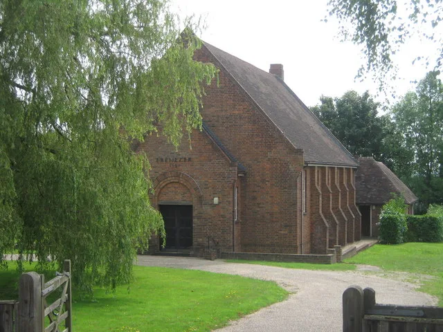
Ebenezer Church (Matfield)
Historic churches · 0.7 km

Kippings Cross
Villages · 1.8 km

Brenchley
Castles · 2.0 km

Brenchley Manor
Manor houses · 2.2 km

Brenchley War Memorial
Memorials & monuments · 2.3 km

The Bull at Brenchley
B&Bs · 2.4 km
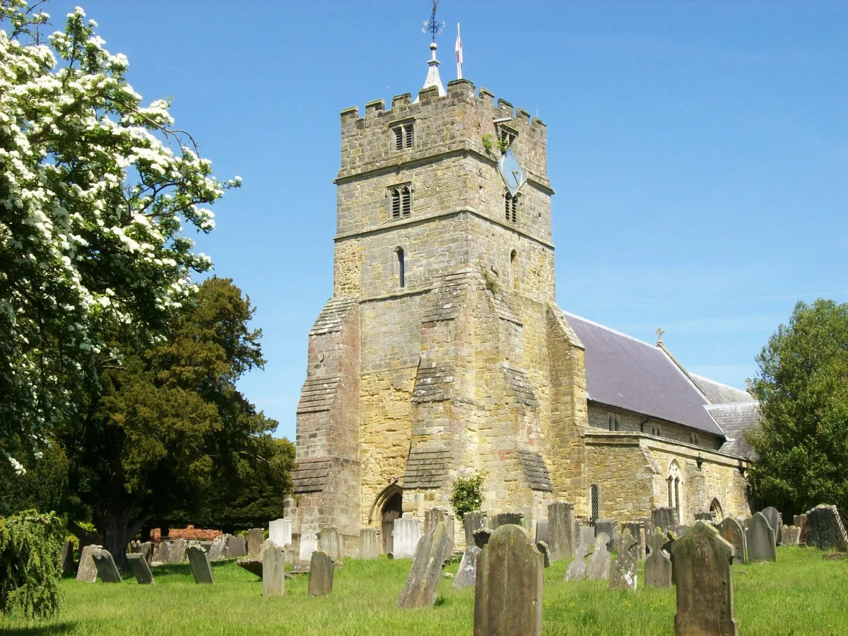
Parish Church of All Saints
Historic churches · 2.5 km
Nearby
📷 5Gardens · South East England
Matfield House
Matfield House — a garden in england-south-east, United Kingdom.
📷 5Historic houses · South East England
Stable Block Immediately North East Of Matfield House
Stable Block Immediately North East Of Matfield House — a Grade I-listed historic house in england-south-east, United Kingdom.
📷 5📷 5Memorials & monuments · South East England
Matfield War Memorial
Matfield War Memorial — Grade II listed building-listed memorial in england-south-east, United Kingdom.
📷 5Historic churches · South East England
St Luke's Church, Matfield
St Luke's Church is a parish church in the village of Matfield, Kent, England. It is a Grade II listed building. The church is dedicated to Luke the Evangelist.
📷 5Historic churches · South East England
Ebenezer Church (Matfield)
Ebenezer Church (Matfield) — church in United Kingdom.
Where to eat & stay near Matfield
Places to stay
📷 7B&Bs · South East England
The Bull at Brenchley
The Bull at Brenchley — a bed-and-breakfast in england south east.
 📷 5
📷 5Hotels · South East England
The Camden Arms Hotel
The Camden Arms Hotel — a hotel in england south east.
 📷 5
📷 5Caravan parks · South East England
Lamb's Caravan Park
Lamb's Caravan Park — a caravan park in england south east.
 📷 5
📷 5Hotels · South East England
The Royal Wells Hotel
The Royal Wells Hotel — a hotel in england south east.
 📷 5
📷 5 📷 5
📷 5Places to eat & drink
 📷 5
📷 5Historic pubs · South East England
John Brunt V.C.
John Brunt V.C. in England South East, United Kingdom.
 📷 7
📷 7Historic pubs · South East England
The Gun And Spitroast Public House And Rear Courtyard
The Gun And Spitroast Public House And Rear Courtyard in England South East, United Kingdom.
 📷 5
📷 5Historic pubs · South East England
Elephants Head Public House
Elephants Head Public House in England South East, United Kingdom.
 📷 7
📷 7Historic pubs · South East England
The Man Of Kent Public House
The Man Of Kent Public House in England South East, United Kingdom.
 📷 5
📷 5Historic pubs · South East England
Ye Olde Vauxhall Inn
Ye Olde Vauxhall Inn in England South East, United Kingdom.
 📷 6
📷 6Historic pubs · South East England
Opera House, Royal Tunbridge Wells
Opera House, Royal Tunbridge Wells in England South East, United Kingdom.
More places in this region
 📷 5
📷 5Historic churches · South East England
All Saints Church, Frindsbury
All Saints Church, Frindsbury — church in Medway, UK.
 📷 5
📷 5Historic churches · South East England
All Saints Church, Maidstone
All Saints Church, Maidstone — parish church associated with the Archbishop's Palace, Maidstone, Kent, England, UK.
 📷 5
📷 5Historic churches · South East England
All Saints Church, West Farleigh
All Saints Church, West Farleigh — Grade I listed church in West Farleigh, Maidstone, Kent, England, UK.
 📷 5
📷 5Historic churches · South East England
All Souls' Church, Sutton Green
All Souls' Church, Sutton Green — church in Guildford, England.
Frequently asked questions
- Where is Matfield?
- Matfield is in Kent, South-East England, United Kingdom (postcode TN12 7LF), in the parish of Brenchley and Matfield.
- What is Matfield?
- Matfield — a church in england-south-east, United Kingdom.
- How do I get to Matfield?
- The nearest railway station is Paddock Wood, about 4.1 km away. Drivers can use postcode TN12 7LF.
- Is Matfield a protected site?
- Yes — Matfield is part of the High Weald National Landscape (AONB) and the Kent Downs National Landscape (AONB).
- Is Matfield free to visit?
- Yes, Matfield is free to enter.
- How do I get to Matfield?
- The nearest railway station is Paddock Wood, about 4.1 km away. Drivers can navigate to postcode TN12 7LF.