Natural landmarks · Scottish Lowlands
Maryport Bay
Maryport Bay — a natural feature in scotland lowlands.

Ann Cook — CC BY-SA 2.0 via Wikimedia Commons licence
Plan your visit
- Typical visit
- 1 h–2 h
About
Maryport Bay is a named natural feature in scotland lowlands, recorded in the GeoNames UK gazetteer. British landmarks of this type are typically marked on Ordnance Survey maps and recorded in the national gazetteer for cartographic and navigational reference. Coordinates and feature classification are sourced from the GeoNames open dataset.
Photo gallery
Place summary
Maryport Bay is a natural landmark located in the Scottish Lowlands. It features a scenic coastal landscape characterised by its rugged cliffs and sandy beaches. The bay is part of the Solway Firth, offering views across to the Cumbrian hills. This area is known for its wildlife, including various seabirds and marine life, making it an appealing destination for nature enthusiasts.
AI-generated from the structured facts on this page (operator, designation, listing, era). Not a substitute for visiting.
- Coordinates
- 54.6706, -4.8782
Sources
- manual: geonames-11103594 (CC BY 4.0)
Other places nearby
Loading nearby places…
Nearby
📷 5Campsites · Scottish Lowlands
Maryport Holiday Park
Maryport Holiday Park — a campsite in scotland lowlands.
 📷 5
📷 5Natural landmarks · Scottish Lowlands
Crawar Bay
Crawar Bay — a natural feature in scotland lowlands.
 📷 5
📷 5Natural landmarks · Scottish Lowlands
Back Bay
Back Bay — a natural feature in scotland lowlands.
 📷 5
📷 5Natural landmarks · Scottish Lowlands
Cairngarroch Bay
Cairngarroch Bay — a natural feature in scotland lowlands.
 📷 5
📷 5Historic churches · Scottish Lowlands
Kirkmaiden Church,church & churchyard 500m N of Mull of Galloway Farm
Kirkmaiden Church,church & churchyard 500m N of Mull of Galloway Farm — scheduled monument-listed church in scotland-lowlands, United Kingdom.
 📷 3
📷 3Archaeological sites · Scottish Lowlands
High Drummore Motte
High Drummore Motte — a archaeological in scotland-lowlands, United Kingdom.
Where to eat & stay near Maryport Bay
Places to stay
📷 5Campsites · Scottish Lowlands
Maryport Holiday Park
Maryport Holiday Park — a campsite in scotland lowlands.
 📷 5
📷 5Campsites · Scottish Lowlands
Clashwhannon Holiday Park
Clashwhannon Holiday Park — a campsite in scotland lowlands.
 📷 5
📷 5Caravan parks · Scottish Lowlands
Muldaddie
Muldaddie — a caravan park in scotland lowlands.
 📷 5
📷 5Caravan parks · Scottish Lowlands
New England Bay
New England Bay — a caravan park in scotland lowlands.
 📷 5
📷 5Caravan parks · Scottish Lowlands
Ardwell Caravan Park
Ardwell Caravan Park — a caravan park in scotland lowlands.
 📷 5
📷 5Campsites · Scottish Lowlands
Ardwell Chalets
Ardwell Chalets — a campsite in scotland lowlands.
More natural landmarks in this region
 Flagship📷 3
Natural landmarks · Scottish Lowlands
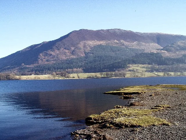
Bassenthwaite Lake
Bassenthwaite Lake — lake in Cumbria, England, UK.
 Flagship📷 3
Natural landmarks · Scottish Lowlands
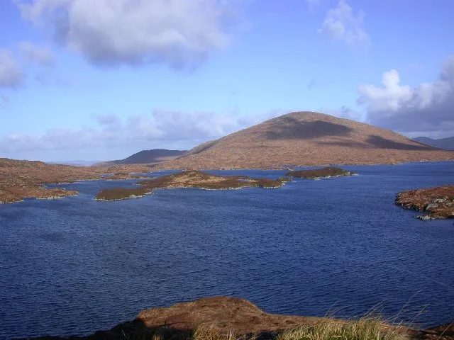
Loch Enoch
Loch Enoch — lake in Dumfries and Galloway, Scotland, UK.
 📷 5
📷 5Natural landmarks · Scottish Lowlands
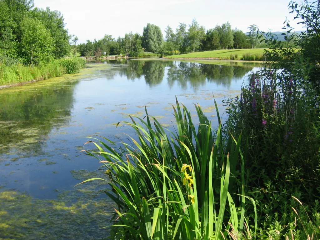
Annandale Water
Annandale Water — lake in Dumfries and Galloway, Scotland, UK.
 📷 3
📷 3Natural landmarks · Scottish Lowlands
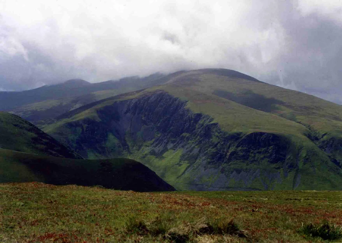
Bakestall
Bakestall — mountain in United Kingdom.
Frequently asked questions
- Where is Maryport Bay?
- Maryport Bay is in the Scottish Lowlands, United Kingdom.
- What is Maryport Bay?
- Maryport Bay — a natural feature in scotland lowlands.
- How do I get to Maryport Bay?
- Its coordinates are 54.6706°, -4.8782°.