
Public art & sculpture · East of England
Mary Read
In or near Wood Dalling.
Mary Read — a public art in england-east-midlands, United Kingdom.

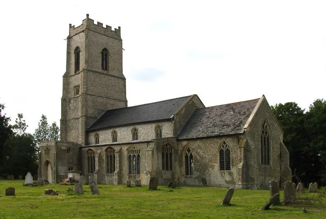
John Salmon — CC BY-SA 2.0 via Wikimedia Commons licence

Plan your visit
- Typical visit
- 1 h–2 h
- Nearest railway station
- Aylsham · 8.3 km
- Free entry
- Dog-friendly
Getting there & planning your visit
To visit the public art piece Mary Read, the nearest railway station is Aylsham, located 8.3 km away. The postcode for navigation is NR11 6AD, and entry is free.
About
Mary Read is a public art located in england-east-midlands, United Kingdom. Sourced from OpenStreetMap (ODbL licence); see local listings for visitor information, opening hours and admission details.
Photo gallery
Protected designations
- Site of Special Scientific Interest: River Wensum SSSI
- Area of Outstanding Natural Beauty: Norfolk Coast
Designations sourced from Natural England open data under OGL v3.
From the Wikipedia article
Mary Read (died April 1721), was an English pirate who served under John Rackham. She and Anne Bonny were among the few female pirates during the "Golden Age of Piracy". Much of Read's background is unknown. The first biography of Read comes from Captain Charles Johnson's 1724 book, A General History of the Pyrates. According to Johnson, Read was born in England, dressed as a boy much of her childhood, eventually joined the military and later moved to the West Indies. Although Johnson's version of events has become popular over the centuries, there is little evidence to support it. At an unknown date, Read traveled to the Bahamas where she became acquainted with the pirate John Rackham. In August 1720, Read joined Rackham's crew, alongside another female pirate, Anne Bonny. Together they stole the sloop William owned by John Ham from Nassau on 22 August 1720. Rackham and his crew carried out a number of attacks on merchant ships in the West Indies until they were captured by former privateer Jonathan Barnet following a brief naval engagement in October 1720 near Jamaica. Rackham, along with all the male crew members, were tried, sentenced, and executed, but Read and Bonny both claimed to be pregnant during their trials and received a stay of execution. While Anne Bonny’s fate is unknown, Mary Read died while imprisoned in Spanish Town around April 1721 of an unknown cause.
Excerpt from Wikipedia under CC BY-SA 4.0. See the source article linked in Sources below.
- Coordinates
- 52.8025, 1.1337
- County
- Norfolk
- District
- Broadland
- Parish
- Heydon
- Postcode
- NR11 6AD
- Parliamentary constituency
- Broadland and Fakenham
- Nearest railway station
- Aylsham — 8.3 km
Sources
- osm: node/6897997549 (ODbL)
- wikipedia: Mary Read (CC BY-SA 4.0)
Other places nearby

The Earle Arms
Historic pubs · 0.0 km

Sall
Villages · 0.3 km
Heydon
Villages · 0.3 km

Heydon Hall
Historic houses · 0.5 km

Cropton Hall
Historic houses · 1.1 km

Wood Dalling Village Sign
Public art & sculpture · 2.4 km
Wood Dalling
Towns & cities · 2.5 km

Salle Village Sign
Public art & sculpture · 2.5 km

Oulton
Villages · 2.7 km

Thurning
Villages · 2.8 km

Corpusty & Saxthorpe Village Sign
Public art & sculpture · 2.8 km

Corpusty
Villages · 2.8 km
Nearby
📷 5📷 5📷 5📷 4Historic houses · East of England
Heydon Hall
Heydon Hall — a Grade I-listed historic house in england-east-midlands, United Kingdom.
📷 3Historic houses · East of England
Cropton Hall
Cropton Hall — house in Heydon, Broadland, England, UK.
📷 3Public art & sculpture · East of England
Wood Dalling Village Sign
Wood Dalling Village Sign — a public art in england-east-midlands, United Kingdom.
Where to eat & stay near Mary Read
Places to stay
 📷 5
📷 5 📷 5
📷 5Caravan parks · East of England
Martintole Farm
Martintole Farm — a caravan park in england east midlands.
 📷 5
📷 5Caravan parks · East of England
Mannington Hall
Mannington Hall — a caravan park in england east midlands.
 📷 5
📷 5Campsites · East of England
Whitwell and Reepham Railway Camping
Whitwell and Reepham Railway Camping — a campsite in england east midlands.
 📷 5
📷 5 📷 5
📷 5Campsites · East of England
Moat Island Glamping
Moat Island Glamping — a campsite in england east midlands.
Places to eat & drink
📷 5 📷 5
📷 5Historic pubs · East of England
Buckinghamshire Arms Public House
Buckinghamshire Arms Public House in England East, United Kingdom.
 📷 5
📷 5Historic pubs · East of England
Saracen's Head
Saracen's Head in England East, United Kingdom.
 📷 5
📷 5Historic pubs · East of England
Black Boys Public House
Black Boys Public House in England East, United Kingdom.
 📷 5
📷 5 📷 7
📷 7Historic pubs · East of England
Recruiting Sergeant Inn
Recruiting Sergeant Inn in England East, United Kingdom.
More places in this region
 📷 5
📷 5Public art & sculpture · East of England
Bird In Flight
Bird In Flight — Public artwork (sculpture) by Bob Dawson.
 📷 5
📷 5Public art & sculpture · East of England
bust of Jagadish Chandra Bose
bust of Jagadish Chandra Bose — Public artwork (sculpture).
 📷 5
📷 5Public art & sculpture · East of England
Calvery's Ode To Tobacco
Calvery's Ode To Tobacco — Public artwork (mural).
 📷 5
📷 5Public art & sculpture · East of England
Cambridge Gateway from India
Cambridge Gateway from India — Public artwork (installation).
Frequently asked questions
- Where is Mary Read?
- Mary Read is in Norfolk, the East Midlands, United Kingdom (postcode NR11 6AD), in the parish of Heydon.
- What is Mary Read?
- Mary Read — a public art in england-east-midlands, United Kingdom.
- How do I get to Mary Read?
- The nearest railway station is Aylsham, about 8.3 km away. Drivers can use postcode NR11 6AD.
- Is Mary Read a protected site?
- Yes — Mary Read is part of the River Wensum SSSI Site of Special Scientific Interest and the Norfolk Coast National Landscape (AONB).
- Is Mary Read free to visit?
- Yes, Mary Read is free to enter.
- How do I get to Mary Read?
- Drivers can navigate to postcode NR11 6AD. It sits within the Broadland and Fakenham parliamentary constituency.