
Manor houses · South East England
Marringdean Manor
In or near Marehill.
Marringdean Manor — Grade II listed building-listed manor in england-south-east, United Kingdom.

Dave Spicer — CC BY-SA 2.0 via Wikimedia Commons licence

Plan your visit
- Typical visit
- 1 h–2 h
- Nearest railway station
- Billingshurst · 1.6 km
- Limited wheelchair access
Getting there & planning your visit
To visit Marringdean Manor, the nearest railway station is Billingshurst, located 1.6 km away. The postcode for sat-nav is RH14 9HF. Accessibility is limited for wheelchair users.
About
Marringdean Manor is a Grade II listed building-listed manor in england-south-east, United Kingdom, registered on the National Heritage List for England (NHLE entry 1354278). Listed status protects buildings and structures of special architectural or historic interest. See the linked Wikipedia article for further details.
Photo gallery
Heritage listing
Details The following building shall be added to the list: TQ 02 SE BILLINGSHURST MARRINGDEAN ROAD 14/455 Marringdean Manor - II House. C15 south wing with C16 cross wing to north west and possibly early C19 addition to north east. Timber framed building mainly tile hung except for part of south front and later additions of north front. Roof mainly of clay tiles except for east facing roof of C16 wing which is of Horsham stone slabs. 2 brick chimney stacks. 2 storeys and attic, irregular fenestration. Main entrance is in C16 wing on north front. This has half-hipped roof with flat roofed dormer with casement and 2 iron casements to lower floors. Doorcase has flat wooden hood on brackets and C20 wooden door with 15 panels. South front has flat roofed 3 light dormer, 2 mullioned windows with leaded lights to 1st floor and large late C19 3 light canted bay to right hand side with iron casements and French window to ground floor. Late C19 canted bay to left hand side. The south west part of the C15 wing retains crown posts arched tie beams collars and collar. purlins. The western bay has 2 most unusual inward facing straight braces underneath the tie beam. The centre bay has a curved brace between the jowled up-right post and tie beam. All except about 3 feet of the collar purlin facing eastwards has been sawn away and is supported by a head brace from the crown post. The 1st floor bedroom at the junction of the C15 wing and C16 cross wing has a fine late C16 stone fireplace with moulded top, 4 centred arch with decorated spandrels and high stops. Listing NGR: TQ0908723581 Legacy The contents of this record have been generated from a legacy data system. Legacy System number: 299755 Legacy System: LBS
From the Historic England List Entry under OGL v3.
Place summary
Marringdean Manor is a Grade II listed building located in South-East England. This manor is notable for its architectural significance and historical value within the region.
AI-generated from the structured facts on this page (operator, designation, listing, era). Not a substitute for visiting.
- Coordinates
- 51.0013, -0.4467
- County
- West Sussex
- District
- Horsham
- Parish
- Billingshurst
- Postcode
- RH14 9HF
- Parliamentary constituency
- Horsham
- Nearest railway station
- Billingshurst — 1.6 km
Sources
- wikidata: Q26637146 (CC0)
Other places nearby
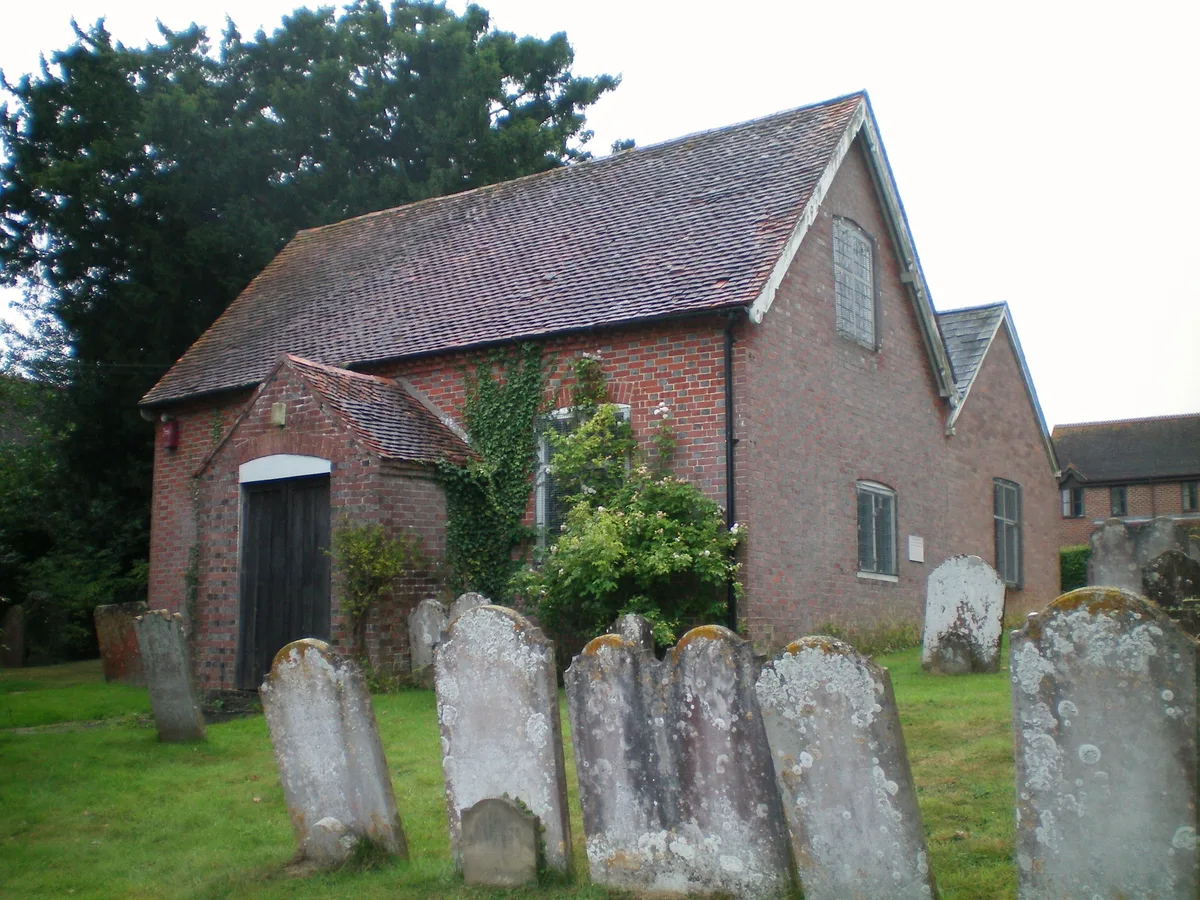
Billingshurst Unitarian Chapel
Historic churches · 2.3 km

Hammonds Mill (Ruin)
Archaeological sites · 2.4 km

Limeburners Campsite
Campsites · 2.6 km

Jubliee Oaks Memorial
Memorials & monuments · 2.8 km

Coolham Advance Landing Ground
Memorials & monuments · 3.0 km
Kenny's Spitfire
Natural landmarks · 3.1 km

Coolham
Villages · 3.1 km
The Selsey Arms Public House
Historic pubs · 3.1 km

Cattlestone
Campsites · 3.7 km

Broomershill
Mountains & hills · 4.1 km

Bluebell Park
Caravan parks · 4.4 km

The Parish Church of St Peter Ad Vincula
Historic churches · 4.5 km
Nearby
📷 5Historic churches · South East England
Billingshurst Unitarian Chapel
Billingshurst Unitarian Chapel — church in Billingshurst, UK.
📷 5Archaeological sites · South East England
Hammonds Mill (Ruin)
Hammonds Mill (Ruin) — a archaeological in england-south-east, United Kingdom.
📷 5Campsites · South East England
Limeburners Campsite
Limeburners Campsite — a campsite in england south east.
📷 5Memorials & monuments · South East England
Jubliee Oaks Memorial
Jubliee Oaks Memorial is a memorial in the United Kingdom.
📷 5Memorials & monuments · South East England
Coolham Advance Landing Ground
Coolham Advance Landing Ground — a memorial in england-south-east, United Kingdom.
📷 5Natural landmarks · South East England
Kenny's Spitfire
Kenny's Spitfire — a other in england-south-east, United Kingdom.
Where to eat & stay near Marringdean Manor
Places to stay
📷 5Campsites · South East England
Limeburners Campsite
Limeburners Campsite — a campsite in england south east.
📷 5📷 4Caravan parks · South East England
Bluebell Park
Bluebell Park — a caravan park in england south east.
 📷 5
📷 5Campsites · South East England
Sumners Ponds
Sumners Ponds — a campsite in england south east.
 📷 6
📷 6 📷 5
📷 5Campsites · South East England
Knepp Wildland Campsite
Knepp Wildland Campsite — a campsite in england south east.
Places to eat & drink
📷 7Historic pubs · South East England
The Selsey Arms Public House
The Selsey Arms Public House in England South East, United Kingdom.
 📷 5
📷 5Historic pubs · South East England
The Rising Sun Inn
The Rising Sun Inn in England South East, United Kingdom.
 📷 7
📷 7Historic pubs · South East England
The Blue Ship Public House
The Blue Ship Public House in England South East, United Kingdom.
 📷 5
📷 5Historic pubs · South East England
The White Hart
The White Hart — Historic pub — listed building or notable heritage status.
 📷 7
📷 7Restaurants · South East England
Chak de India
Chak de India — a restaurant in england south east.
 📷 7
📷 7More places in this region
 📷 5
📷 5Manor houses · South East England
Albury Manor
Albury Manor — a manor in england-london, United Kingdom.
 📷 5
📷 5Manor houses · South East England
Weardale Manor
Weardale Manor — a manor in england-london, United Kingdom.
 📷 5
📷 5Manor houses · South East England
Rowbarns Manor
Rowbarns Manor — a manor in england-london, United Kingdom.
 📷 5
📷 5Manor houses · South East England
Sutton Place
Sutton Place — a manor in england-london, United Kingdom.
Frequently asked questions
- Where is Marringdean Manor?
- Marringdean Manor is in West Sussex, South-East England, United Kingdom (postcode RH14 9HF), in the parish of Billingshurst.
- What is Marringdean Manor?
- Marringdean Manor — Grade II listed building-listed manor in england-south-east, United Kingdom.
- How do I get to Marringdean Manor?
- The nearest railway station is Billingshurst, about 1.6 km away. Drivers can use postcode RH14 9HF.
- Is Marringdean Manor a listed building?
- Marringdean Manor is officially recognised as Grade II listed building listed.
- How do I get to Marringdean Manor?
- The nearest railway station is Billingshurst, about 1.6 km away. Drivers can navigate to postcode RH14 9HF.