
Museums · London
Mardyke (river)
In or near Swanscombe.
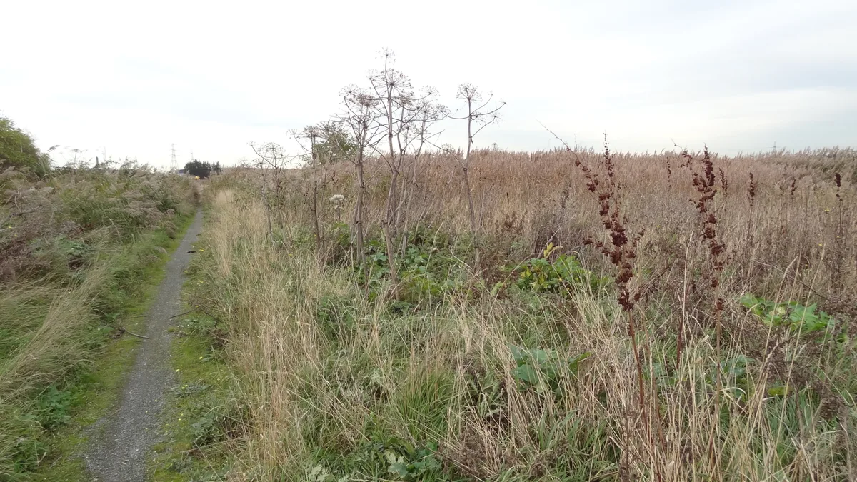
The Mardyke (sometimes, but less frequently, Mar Dyke, occasionally Mardike) is a small river, mainly in Thurrock, that flows into the River Thames at Purfleet, close to the Queen Elizabeth II Bridge.

David Anstiss — CC BY-SA 2.0 via Wikimedia Commons licence

Plan your visit
- Typical visit
- 1.5 h–3 h
- Best time of year
- Year-round
- Nearest railway station
- Purfleet · 0.8 km
- Free entry
- Family-friendly
- Limited wheelchair access
Getting there & planning your visit
To visit the Mardyke river, the nearest railway station is Purfleet, which is 0.8 km away. The postcode for navigation is RM19 1ZZ. Accessibility is limited for wheelchair users.
About
The Mardyke (sometimes, but less frequently, Mar Dyke, occasionally Mardike) is a small river, mainly in Thurrock, that flows into the River Thames at Purfleet, close to the Queen Elizabeth II Bridge. In part, it forms the boundary between the Essex hundreds of Barstable and Chafford. The river gives its name to the Mardyke Valley—a project aimed at increasing appreciation and usage of recreational land around the Mardyke.
Photo gallery
See it from the streetimagery from 2024
Imagery © Mapillary contributors, CC BY-SA 4.0
Summary from the official site
The Purfleet Heritage and Military Centre is located in a historic Grade 1 listed building that once served as a Royal Gunpowder Magazine. Visitors can explore military artifacts, learn about local history, and participate in guided tours and special events that celebrate Purfleet's rich heritage.
Read more on the official property page.
Protected designations
- Site of Special Scientific Interest: Inner Thames Marshes SSSI
Designations sourced from Natural England open data under OGL v3.
From the Wikipedia article
The Mardyke (sometimes, but less frequently, Mar Dyke, occasionally Mardike) is a small river, mainly in Thurrock, that flows into the River Thames at Purfleet, close to the Queen Elizabeth II Bridge. In part, it forms the boundary between the Essex hundreds of Barstable and Chafford. The river gives its name to the Mardyke Valley—a project aimed at increasing appreciation and usage of recreational land around the Mardyke.
Excerpt from Wikipedia under CC BY-SA 4.0. See the source article linked in Sources below.
Background
History
Between Stifford and the Rainham marshes where the Mardyke enters the Thames, the river flows through a relatively steep sided valley formed by an earlier position of the Thames. There is ancient woodland on the valley slopes and the land close to the river was used for grazing. Pollen evidence from the Mardyke valley shows that there was woodland regeneration at the end of the Roman period and into the early Anglo-Saxon period. There is a substantial bridge over the Mardyke at Stifford. A medieval stone bridge was built in 1487, although this has subsequently been replaced more than once. Various archaeological objects have been found in the Mardyke close to Stifford Bridge. These include…
Sourced from Wikipedia under CC BY-SA 4.0.
- Coordinates
- 51.4859, 0.2281
- District
- Thurrock
- Parish
- Thurrock, unparished area
- Postcode
- RM19 1ZZ
- Parliamentary constituency
- Thurrock
- Phone
- +44 1708890874
- Nearest railway station
- Purfleet — 0.8 km
- Official site
- purfleet-hmc.org
Sources
- wikipedia: Mardyke (river) (CC BY-SA 4.0)
Other places nearby
A million years in Purfleet
Public art & sculpture · 0.0 km

Purfleet Heritage Centre
Museums · 0.2 km
Government Powder Magazine
Historic houses · 0.2 km

The Royal Hotel
Hotels · 0.4 km
Rainham Marshes Nature Reserve
Wildlife reserves · 0.5 km

Purfleet-on-Thames
Villages · 1.0 km

Cherrywood Campsite
Campsites · 1.4 km

Purfleet
Museums · 1.7 km

High House, Purfleet
Historic houses · 2.0 km

Dovecote at High House, Purfleet
Historic houses · 2.0 km

Erith Marshes Heavy Anti-Aircraft Battery
Historic houses · 2.2 km

Erith Marshes Heavy Anti-Aircraft Battery
Archaeological sites · 2.2 km
Nearby
📷 5Public art & sculpture · London
A million years in Purfleet
A million years in Purfleet — a public art in england-london, United Kingdom.
📷 5Museums · London
Purfleet Heritage Centre
Purfleet Heritage Centre — a museum in england-london, United Kingdom.
📷 5Historic houses · London
Government Powder Magazine
Government Powder Magazine — a Grade I-listed historic house in england-london, United Kingdom.
📷 7📷 5Wildlife reserves · London
Rainham Marshes Nature Reserve
Rainham Marshes Nature Reserve — marshland nature reserve in Greater London and Essex, England, UK.
📷 5Where to eat & stay near Mardyke (river)
Places to stay
📷 7📷 5Campsites · London
Cherrywood Campsite
Cherrywood Campsite — a campsite in england london.
 📷 5
📷 5Hotels · London
DoubleTree by Hilton Hotel Dartford Bridge
DoubleTree by Hilton Hotel Dartford Bridge — a hotel in england london.
 📷 5
📷 5Hotels · London
The Royal Victoria & Bull Hotel
The Royal Victoria & Bull Hotel — a hotel in england london.
 📷 5
📷 5 📷 6
📷 6Places to eat & drink
 📷 7
📷 7 📷 7
📷 7 📷 5
📷 5 📷 5
📷 5Restaurants · London
The Adaalat Lounge
The Adaalat Lounge — a restaurant in england london.
.jpg?width=1200) 📷 7
📷 7Historic pubs · London
The Royal Oak
The Royal Oak — Historic pub — listed building or notable heritage status.
 📷 5
📷 5Historic pubs · London
The Coach And Horses Public House
The Coach And Horses Public House in England London, United Kingdom.
More museums in this region
 Flagship📷 10
Museums · London
Kenwood House
Kenwood House — art museum and historic house in Hampstead, London.
 📷 5
📷 5Museums · London
Amora London
Amora London — European touring exhibition dedicated to love, relationships and sexual wellbeing.
 📷 5
📷 5Museums · London
Antique Breadboard Museum
Antique Breadboard Museum — small museum in Putney, London, England, UK.
 📷 5
📷 5Museums · London
Arsenal Football Club Museum
Arsenal Football Club Museum — sports museum in London.
Frequently asked questions
- Where is Mardyke (river)?
- Mardyke (river) is in London, United Kingdom (postcode RM19 1ZZ), in the parish of Thurrock, unparished area.
- What is Mardyke (river)?
- The Mardyke (sometimes, but less frequently, Mar Dyke, occasionally Mardike) is a small river, mainly in Thurrock, that flows into the River Thames at Purfleet, close to the Queen Elizabeth II Bridge.
- How do I get to Mardyke (river)?
- The nearest railway station is Purfleet, about 0.8 km away. Drivers can use postcode RM19 1ZZ.
- Is Mardyke (river) a protected site?
- Yes — Mardyke (river) is part of the Inner Thames Marshes SSSI Site of Special Scientific Interest.
- How do I get to Mardyke (river)?
- The nearest railway station is Purfleet, about 0.8 km away. Drivers can navigate to postcode RM19 1ZZ.